About Vernal Fall
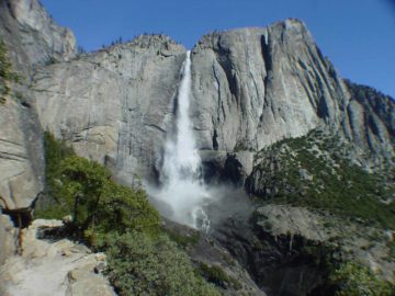
Vernal Fall is a spectacular, classically-shaped waterfall plunging over a reported height of 317ft.
This waterfall makes up the lower step of the Giant Stairway, which can be thought of as a pair of giant steps with Nevada Falls making up the upper step.
And since it’s on the Merced River drainage system, it has year-round flow though its flow is strongest in the mid- to late Spring.
We know this firsthand because the greater the volume of the waterfall, the more it sprays the appropriately-named Mist Trail (i.e. the trail that went directly to the top of the falls).
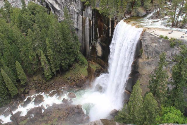
Experience has told us that this blasting mist tended to be the most intense during that peak snowmelt period.
Although we’ve noticed that this waterfall was immensely popular, it wasn’t quite as easy to access as the other famous waterfalls throughout Yosemite Valley.
That was because we either had to do a somewhat moderate hike to get close to this waterfall, or we had to drive towards the end of Glacier Point Road in order to access the overlooks that allowed us to see this waterfall from afar.
Because there are at least a handful of very different ways of experiencing this waterfall, I’ve decided to describe each excursion (and its directions) separately. That way we can paint a clearer picture for you about the experience and the logistics of a visit to Vernal Fall.
Mist Trail to Vernal Fall
This trail begins at the Happy Isles trailhead (signpost V24, adjacent to the far southeast end of the Upper Pines Campground).
Usually, no vehicles are allowed to this point, but whenever we weren’t camping at the Upper Pines, we were able to take one of the frequent shuttles from the large car park at Curry Village (signpost V22), which sat at the far eastern end of Yosemite Valley.
We also could’ve walked that distance (which I believe would be about a mile each way).
Of course if we were lucky enough to score a spot in the Upper Pines Campground, it was quite literally just a quick hop, skip, and a jump to the Happy Isles trailhead.
This hike to the top of the falls was about 2 miles each way.
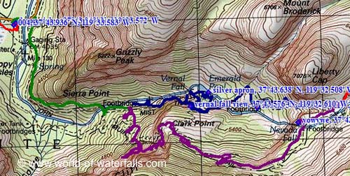
For the first mile, we followed a very busy and well-established trail that followed the raging Merced River before going uphill (this is the green line on the map shown above).
After the ascent peaked near the 3/4-mile point (where we were also able to view part of Illilouette Fall), the trail then quickly descended to the footbridge spanning the Merced River with our first glimpse at part of Vernal Fall.
Continuing beyond the footbridge, we had a choice of whether to take the Mist Trail or the John Muir Trail.
Since we were interested in only going directly to Vernal Fall, we took the Mist Trail (the blue line on the map shown above), which followed the turbulent (especially in the Spring) Merced River from here right up to the top of Vernal Fall.
A short distance before we’d get to the granite steps and the misty part of the Mist Trail, there was a short spur (easy to miss) with a plaque.
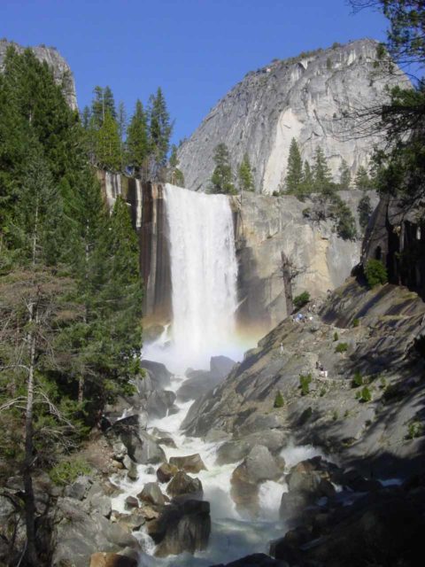
It turned out that this detour led to a protruding rock jutting out onto the Merced River, and this was where we were able to get that classic view of the front of the waterfall with the Liberty Cap behind it (see the first photo at the top of this post).
This vantage point was called the Lady Franklin Rock, and I recalled seeing quite a few vending machines showing photos of Vernal Fall from this exact vantage point (or at least that was the case during my visits throughout the mid-2000s)!
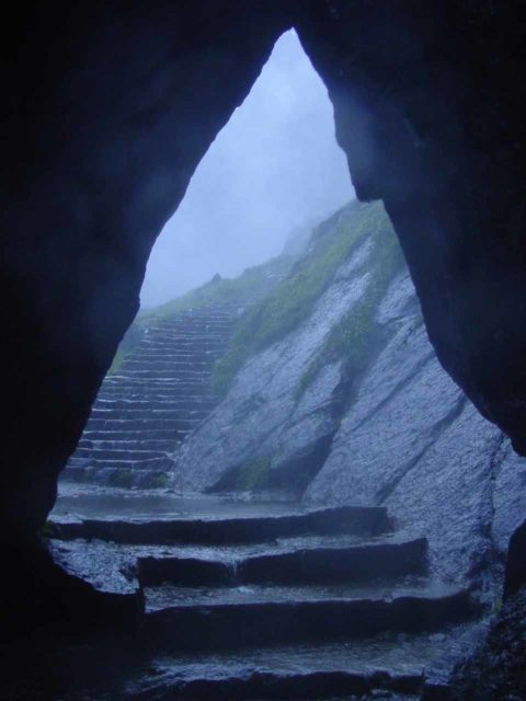
Continuing to make the ascent along the Mist Trail, it wasn’t long before we rounded a bend and we had to face the mist coming from the waterfall.
It was in this spot where we needed to wear our wet weather gear to protect our clothing, our core body temperature (since the spray can be quite cold), and our electronics (especially our cameras).
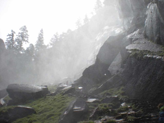
The thing to watch out for here was the potentially slippery granite steps given that they were wet. Since the Mist Trail was so popular, we had to squeeze our way through the bi-directional traffic while trying not to fall into the Merced River!
Just beyond the drenching part, the trail continued to climb up more granite steps (with some handrails and fences to keep us from being exposed to the dropoffs).
Once at the top, there was a sloping granite plateau that descended right towards the brink of the falls as well as the raging river.
From this point, we had the option of going back down the Mist Trail to the trailhead, continue hiking upstream towards the continuation of the Mist Trail to Nevada Fall’s north side, or take an uphill connecting trail up to the John Muir Trail, where we could continue towards Nevada Fall’s south side or head back down the trail to the Vernal Fall footbridge and complete a loop.
View from near Clark Point
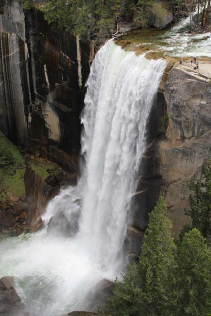
Beyond the top of Vernal Fall, we continued on the trail as it followed the raging Merced River past the Emerald Pool and the Silver Apron.
By the way, the Silver Apron apparently used to be popular spots for Summertime swimming until recent deaths in this area caused the park service to prohibit going into the river there.
Just as the trail reached another junction near some porta-potty restrooms and a footbridge going over the Merced River, we turned right (going away from the bridge) and went uphill.
That uphill trail was a linking trail that would eventually join up with the the John Muir Trail at Clark Point (about a mile downhill from the Panorama Cliffs; look for the thin black dotted line between Clark Point and the blue line on the map above).
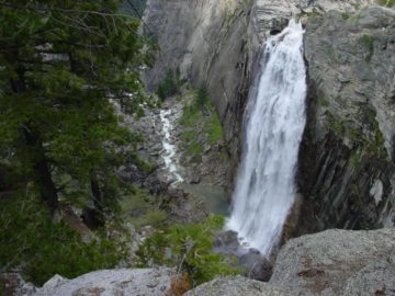
Near the top of this ascent was a short spur trail leading to a lookout where we were able to get a dramatic top-down view of the entire waterfall.
Usually, there were people near the brink of the waterfall to give us a sense of the immense scale of the falls as the people looked puny compared to Vernal Fall itself.
Once at the John Muir Trail, there was the option of continuing uphill along the Panorama Cliffs towards Nevada Fall or descending down switchbacks to rejoin the Mist Trail near the Vernal Fall footbridge and complete the short loop.
View from Washburn Point or Glacier Point
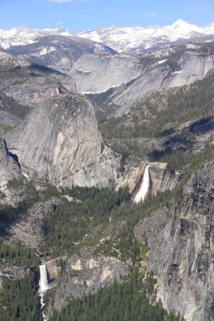
If you don’t want to hike but still see Vernal Fall, then driving to the end of Glacier Point Road (G11) or one stop before that at Washburn Point (G10) would be the way to go.
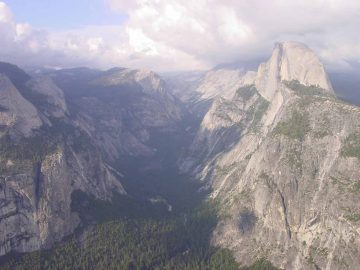
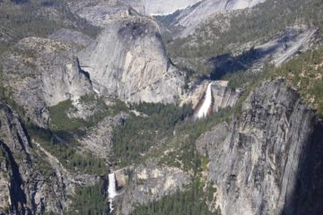
At Washburn Point, we could see both Vernal Fall and Nevada Fall together, and we could gain a better appreciation for why the combination of the pair of major waterfalls was also referred to as the Giant Stairway.
Of course, panoramic views of the Clark Range as well as Half Dome and Mt Starr King were also possible from this lookout.
At the famous Glacier Point stop, we were able to get slightly less optimal views of the Giant Stairway, but we were also able to peer right down at Yosemite Valley, Tenaya Canyon, and see Half Dome appear so close it played some perspective tricks with our minds (i.e. it almost felt as if we could reach out and touch it).
Glacier Point was also the starting (or ending) point for a hike on the Panorama Trail, which yielded additional top-down views of Vernal Fall as well as Nevada Fall and Illilouette Fall.
Authorities
Vernal Fall resides in Yosemite National Park. For information or inquiries about the park as well as current conditions, visit the National Park Service website.
Related Top 10 Lists
Trip Planning Resources
Nearby Accommodations
This content is for members only. See Membership Options.Featured Images and Nearby Attractions
This content is for members only. See Membership Options.Visitor Comments:
Got something you'd like to share or say to keep the conversation going? Feel free to leave a comment below... Beautiful Vernal Falls February 17, 2016 9:33 pm - Thank you so much for all the pictures of Vernal Falls and the commentary. We walked up the trail the first of February, 1959 when we were on our honeymoon. A couple days later the snow fell so it was good we went there when we did. I purchased a poster of the Falls, had… ...Read More
 Take a raincoat! May 30, 2011 2:34 am - The Mist Trail remains our most memorable hike in Yosemite, Summer of 2010. Two families with four kids 11-14 years old arrived at the Park in the afternoon and we wanted to do one hike that day. One of the adults had heard of the Mist Trail to Vernal Falls and we took the shuttle… ...Read More
 Please help identify waterfall April 11, 2011 4:57 pm - Please help my family identify this waterfall! My Great Uncle Jerry was a fighter pilot in WWII and he loved to take photos. This is one of his photographs. I have always been drawn to this photo and have not been able to identify the location. My Great Uncle Jerry was shot down in Northern… ...Read More
 My Hike to Vernal Falls September 28, 2008 3:05 am - I had alot of fun in Yosemite. I hiked to the top of Nevada and Vernal Falls (just to tell you; I am 10 so it was alot [of hiking] lol). I got soaked on the mist trail because Vernal Falls was raging. While my family was walking up to Nevada Falls, we had a… ...Read More
Visitor Reviews of this Waterfall:
If you have a waterfall story or write-up that you'd like to share, feel free to click the button below and fill out the form...No users have submitted a write-up/review of this waterfall


Only logged in users can post a comment Please login or sign up to comment