About Hengifoss
Hengifoss was the star waterfall attraction of the Eastfjords area around Lagarfljót and the town of Egilsstaðir. While this waterfall was said to be the third tallest waterfall at 118m (at least when we were there in 2007), we thought the red strata patterns on the cliff giving rise to the falls was also very interesting as it was something we didn’t typically see in other waterfalls.
According to a sign that we noticed while hiking, it explained that there was a four-step process giving rise to the red stripes. The first step was the deposition of volcanic ash and basaltic lava. Then, the mineral rich ash sitting atop the hardened basalt became soil. Clay compounds were formed from this soil as a result of the damp climate of the Tertiary Period. Then, lava would flow over the soil, which was rich in iron, causing it to oxidate and turn red thereby resulting in the reddish clay trapped between the thicker basalt layers. This process would repeat, which was how there were multiple stripes.
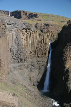
On the way up, I noticed smaller waterfalls deep in the gorge adjacent to the trail. Most of those were not easy to see (and the morning shadows didn’t help matters either). However, at about 1.2km on the trail, Julie and I noticed the intriguing Litlanesfoss (also known as Stuðlabergsfoss), which was surrounded by basalt columns, which was flanked by obvious basalt columns in much the same way as Aldeyjarfoss and Svartifoss. Depending on the viewing angle and where we were along the cliffs, we were able to see both Litlanesfoss and part of Hengifoss further upstream together.
During much of the hike up, there were frequent spur trails taking us towards a parallel trail skirting the edge of the gorge containing the waters from Hengifoss. Much of this “edge trail” were worn and slippery due to the loose pebbles atop packed hard dirt. Thus, we not only had to mind the butterflies in our stomachs whenever we found ourselves close to the cliff edges, but we also had to be very cognizant of the dropoff hazard (which the signs here also warned about).
Eventually, we climbed up to a point where the parallel trails converged and it continued until we were essentially at the apex of the climb with still another 0.5 kilometer left to go to reach the base of the falls. We actually stopped where we got a fairly distant but total view of Hengifoss because there were more worn sections of trail where it looked very easy to fall into the gorge in many spots. But I’m still kicking myself for not doing that last section of trail. I even witnessed a handful of people continuing on past us, but for some reason I opted to be content with the view from here.
At least with the long climb up, the rest of the hike was all downhill back to the car park. We got to enjoy the views throughout the hike while also enjoying once again Litlanesfoss and some other unnamed falls in the gorge as well.
Related Top 10 Lists
Trip Planning Resources
Nearby Accommodations
This content is for members only. See Membership Options.Featured Images and Nearby Attractions
This content is for members only. See Membership Options.Visitor Comments:
Got something you'd like to share or say to keep the conversation going? Feel free to leave a comment below...No users have replied to the content on this page
Visitor Reviews of this Waterfall:
If you have a waterfall story or write-up that you'd like to share, feel free to click the button below and fill out the form...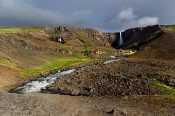 Hengifoss June 23, 2014 1:02 pm - An amazing place to visit. Easy walk to the waterfall with stunning views of the lake and mountains you as you walk off - you will not be disappointed ...Read More
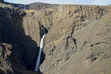 Nice waterfalls (Hengifoss) February 12, 2014 11:20 am - I liked both waterfalls. They're quite different but both pretty and special: One is surrounded by very even basalt columns and the other is showing the red & black stone layers as clearly it's possible. The hike on the south-west side of the water is nice, in the upper part at times a little bit… ...Read More


Only logged in users can post a comment Please login or sign up to comment