About Escondido Falls
Escondido Falls is said to be the tallest waterfall in the Santa Monica Mountains. Well, this claim can be realized depending on how the waterfall is experienced.
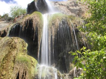
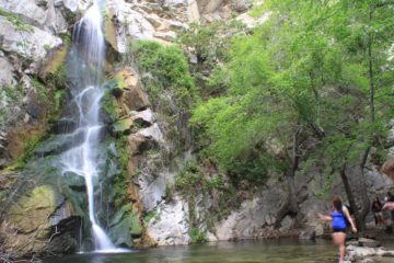
Unfortunately, on our first visit to this waterfall, we managed to see only the last 40 or 50ft of it in its lowest drop through a mossy green wall. It wasn’t until our second visit three years later did we finally get to experience the taller, more scenic upper tier, which is said to be 100ft or so (see photo at the top of this page). Cumulatively, all the drops together (including some hidden middle tiers) might make this waterfall have an overall 200ft or so drop.
The lower Escondido Falls seemed to be typical of coastal waterfalls in Southern and Central California in that it was a column of water surrounded by mossy walls. While this waterfall alone might be worthwhile as a destination for a hike, the upper Escondido Falls was definitely prettier and had more character as far as we were concerned. That was because its stream spilled over a series of grottos fronted by overhanging moss dripping with water. We think it was the drooping moss that really gave this waterfall character (as Julie likes to say).
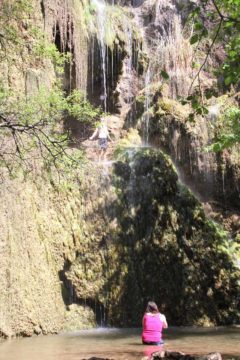
Although this waterfall has plenty of moss and lush vegetation surrounding its stream, it seems to have surprisingly fickle flow. Perhaps the lower tier has more predictable flow than the upper one, but that upper tier seems to be at its best shortly after rain (at least as far as our experience was concerned). I’d guess that you would be out of luck seeing any water flowing appreciably by mid- to late Spring (and I’m sure it would be gone by the Summertime) though all that depends on how much precipitation has fallen in the Winter and how soon you visit the falls after a significant storm.
The word “escondido” is Spanish for “hidden,” and it seemed to be quite an appropriate name for this waterfall. That was because hiking the first mile involved walking through a particularly well-off residential area with super big homes and gorgeous ocean views that typify the prime real estate of the Malibu area. Yet it belies the wilderness concealed behind these homes. Moreover, the upper waterfall is elusive to the uninitiated and will require a bit of an adventure to reach.
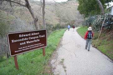
After a stream crossing at the bottom of the ravine, the dirt footpath turned left and followed (and crossed) the creek running through Escondido Canyon up to the falls. We counted five stream crossings, and most of them were doable without getting our feet wet though Gore-tex boots certainly helped.
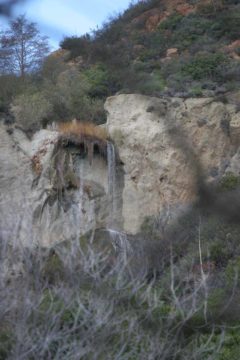
Roughly 3/4-mile from the start of the official trail, we keenly noticed the upper waterfall almost hiding itself behind foliage blocking the field of view. However, when the trail officially ended, we were right at the base of the lower falls. On our first visit, the entire lower Escondido Falls was completely visible, but on our second visit three years later, there was a lot more overgrowth that made seeing the entire waterfall more of a challenge (especially its uppermost sections).
This is where most people would turn back and head back towards the trailhead. However, it’s at this point that we have to caution you if you want to continue towards the prettier upper waterfall. While plenty of people have done it, it’s not for everyone and it does have some hazards that could seriously hurt you if you don’t respect them with preparation and plenty of caution. Know your limits and make sure you know what you are doing.
Anyways, Julie and I followed the “path” to the upper waterfall, which began up a steep gully to the right shortly before the base of the lower waterfall. Given the popularity of the trail, the start of this scramble seemed pretty obvious to us. Nonetheless, the trail got progressively steeper as we ascended the gully until we got to a point where we had to use all of our limbs to climb up rocks while trying not to lose our footing (which was real easy to do, especially when muddy).
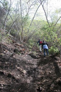
One of these hairy sections involved a rope (which may or may not be there on your visit), which helped us traverse a particularly slippery and steeply exposed gully. Immediately after this section was another steep (close to vertical) climb up another series of rocks. Once we were past these obstacles, the “path” went around a bend with a nice view of the canyon below us before hugging a narrow ledge towards another stream crossing with a small middle-tier cascade fronting it.
After the middle cascade, there was another steep climb with a particularly tricky section up some more rocks with particular large spaces between “footholds.” Caution was definitely necessary here on this hairy spot given how easy it was to slide back down and possible take a nasty fall.
Once this nearly rock-wall obstacle was traversed, Julie and I were able to follow the path along the stream until we made it to the base of the upper waterfall, which some would say is the REAL Escondido Falls.
Given the adventure it took to get here, we definitely lingered here for as long as possible before facing the same obstacles on the way back down (again, we had to take our time and respect the hazards). To sum it all up, we probably hiked about 4.25 miles round trip including the walk on the residential Winding Way Road.
Related Top 10 Lists
Trip Planning Resources
Nearby Accommodations
This content is for members only. See Membership Options.Featured Images and Nearby Attractions
This content is for members only. See Membership Options.Visitor Comments:
Got something you'd like to share or say to keep the conversation going? Feel free to leave a comment below...No users have replied to the content on this page
Visitor Reviews of this Waterfall:
If you have a waterfall story or write-up that you'd like to share, feel free to click the button below and fill out the form...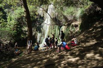 Escondido Falls April 24, 2011 7:39 pm - This was an incredible hike! it was very crowded the day I went but it was well worth seeing the falls!! Whenever I saw pictures of the upper falls, i did not believe the true size, it looks much smaller in photos!! When we got to the lower falls, it was very fanned out with… ...Read More
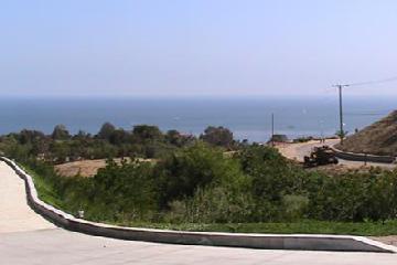 CMarie (Escondido Falls) November 14, 2010 6:27 am - This hike is AMAZING! I was happy going through this trail with a few friends as it was quite pretty. The road up is a long one and there were a few small stream crossings. It is dog friendly so that was nice because we had a small dog with us. We mainly hike trails… ...Read More
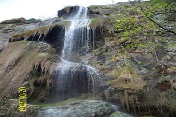 Escondido Falls- The Elusive Upper Falls February 16, 2009 8:23 pm - This hike is in Malibu and is on the website but the pictures don't exactly show the REAL [Escondido Falls]. From the lower falls you start on a rough trail that requires some moderate climbing or scurrying up the path of steep rocks and dirt. It's nothing to dangerous though, even borderline easy. Shortly you… ...Read More
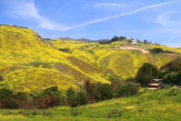
Only logged in users can post a comment Please login or sign up to comment