About Stigfossen and Tverrdalsfossen (Trollstigen)

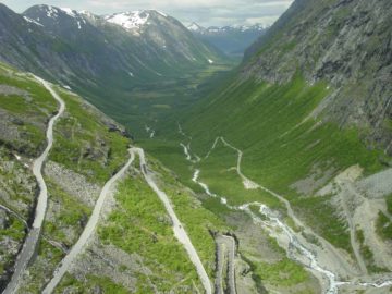
Stigfossen and Tverrdalsfossen were the pair of main waterfalls surrounding the famous 11-turn serpentine road Trollstigen (“the troll ladder”). This memorable scene of steep switchbacking roads where we kept seeing one waterfall or the other at each switchback very much reminded us of another famous serpentine road with a pair of waterfalls flanking it that we encountered earlier on our June-July 2005 trip – Stalheimskleiva. Having gone through that other serpentine road, we knew what to expect in terms of taking it slow while also looking for opportunities to pull over and relish in the glorious scene around us. We also noticed some people on mountain bikes as well as a handful of people even walking parts of the old packhorse road called Kløvstien that was once the main means of travel between Sunnmøre and Romsdal Counties before modern changes were made to accommodate automobiles. Prior to these developments, the 800m wall was impassable.
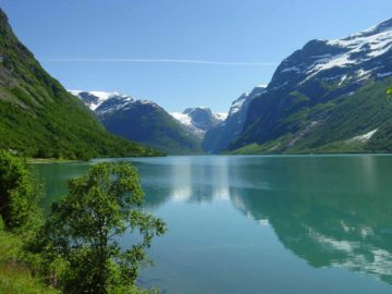
The larger waterfall that we noticed as we approached Trollstigen was Stigfossen, which we thought was the main feature waterfall of the two. We were able to see this 180m waterfall from various angles. The progression for us started with a full frontal view near the bottom of the road before Trollstigen’s first switchback. More than two-thirds the way up the road we then approached the bridge Stigfossbrua where we got a little sprayed by the mist of Stigfossen’s uppermost sections of its cascade. Ultimately, when we reached to very top of Trollstigen at Stigrøra, we then took a short and well-developed walking path down to an overlook of the switchbacks along with a partial view of Stigfossen and the valley Isterdalen beyond the bottom of the serpentine road (as shown at the top of this page).
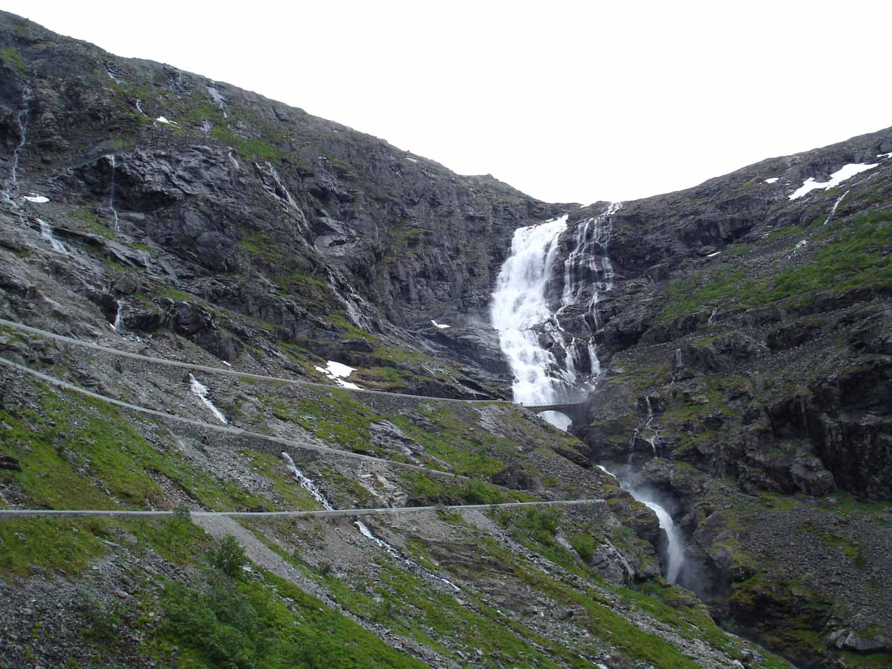
Both waterfalls had good volume though Stigfossen’s volume was much more significant and probably most likely to be year-round. That was probably due to the fact that it was draining at least two major lakes (Bispevatnet and Alnesvatnet) as well as the melting of some receding glaciers. Meanwhile, Tverrdalsfossen drained only the lake Stigbotnvatnet and we can’t say for sure if it does or does not flow year-round. That said, it was certainly voluminous and significant during our visit in early July 2005. To not get confused about which waterfall is which, as you face Trollstigen on the ascent, Stigfossen is the waterfall on the right while Tverrdalsfossen is the waterfall next to the switchbacks on the left.
During our visit, there was quite a bit of construction work going on, especially near the bottom of the road. Julie and I had read a sign there talking about how a 600m stretch of road covering a pair of switchbacks were being re-routed because of its vulnerability to rockfalls. From looking at the top down photo shown on the sign, a combination of the steep walls of Trollstigen combined with the water from Tverrdalsfossen seemed to present an engineering challenge. In any case, I’m sure by the time you get to ascend or descend Trollstigen, the driving experience will be quite different from what Julie and I were able to do.
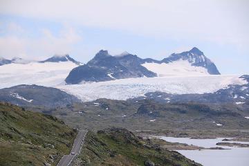
As Julie and I read more about Trollstigen, we learned that it opened in July 1936 after eight years of construction under the reign of King Haakon VII. Given its dramatic ascent (or descent) between the two giant waterfalls, beneath several majestic mountains (many of which were named like Kongen [the King] and Dronninga [the Queen]), and capping it off with an incredible panorama looking back down the valley Isterdalen, it was said that Trollstigen was the most traveled tourist road in Norway. We can probably corroborate this claim given how many people we had to share the narrow serpentine road with on our visit. Supposedly, the Norwegian road authority, Statens Vegvesen, was said to have big plans for the stretch of Road 63 that included Geiranger and Trollstigen. They wanted to make the so-called Atlantic Road as part of the National Tourist Road system to further establish Norway as a self-driving destination. We’re not sure if these big plans have been completely executed or not, but it seemed to make a lot of sense given the concentration of seemingly iconic sights along this route.
Related Trip Reports
Related Top 10 Lists
No Posts Found
Related Itineraries
Trip Planning Resources

Nearby Accommodations
This content is for members only. See Membership Options.Featured Images and Nearby Attractions
This content is for members only. See Membership Options.Visitor Comments:
Got something you'd like to share or say to keep the conversation going? Feel free to leave a comment below...No users have replied to the content on this page
Visitor Reviews of this Waterfall:
If you have a waterfall story or write-up that you'd like to share, feel free to click the button below and fill out the form...No users have submitted a write-up/review of this waterfall
Only logged in users can post a comment Please login or sign up to comment