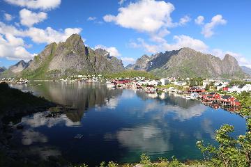
About The Seven Sisters and the Geirangerfjorden Waterfalls

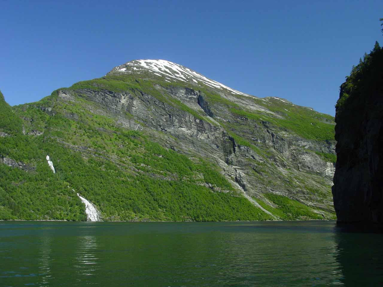
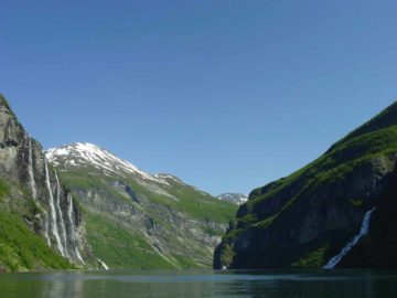
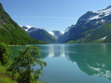
The Seven Sisters Waterfall were certainly the most famous of the waterfalls in the Geiranger Fjord (Geirangerfjorden). Julie and I did the cruise on the world famous Geirangerfjord largely in anticipation of seeing this waterfall. However, we ended up getting more than just the waterfall. Indeed, we got a very memorable experience that also allowed us to better appreciate the steep walls and cliff-hanging farms as well as other major and minor waterfalls draping both sides of the fjord. Couple with the beautiful weather that we happened to be experiencing during our time on the tour, we simply couldn’t have asked for a better visual experience. In fact, the Geirangerfjord was gazetted as a UNESCO World Heritage Site during the year of our visit in 2005.
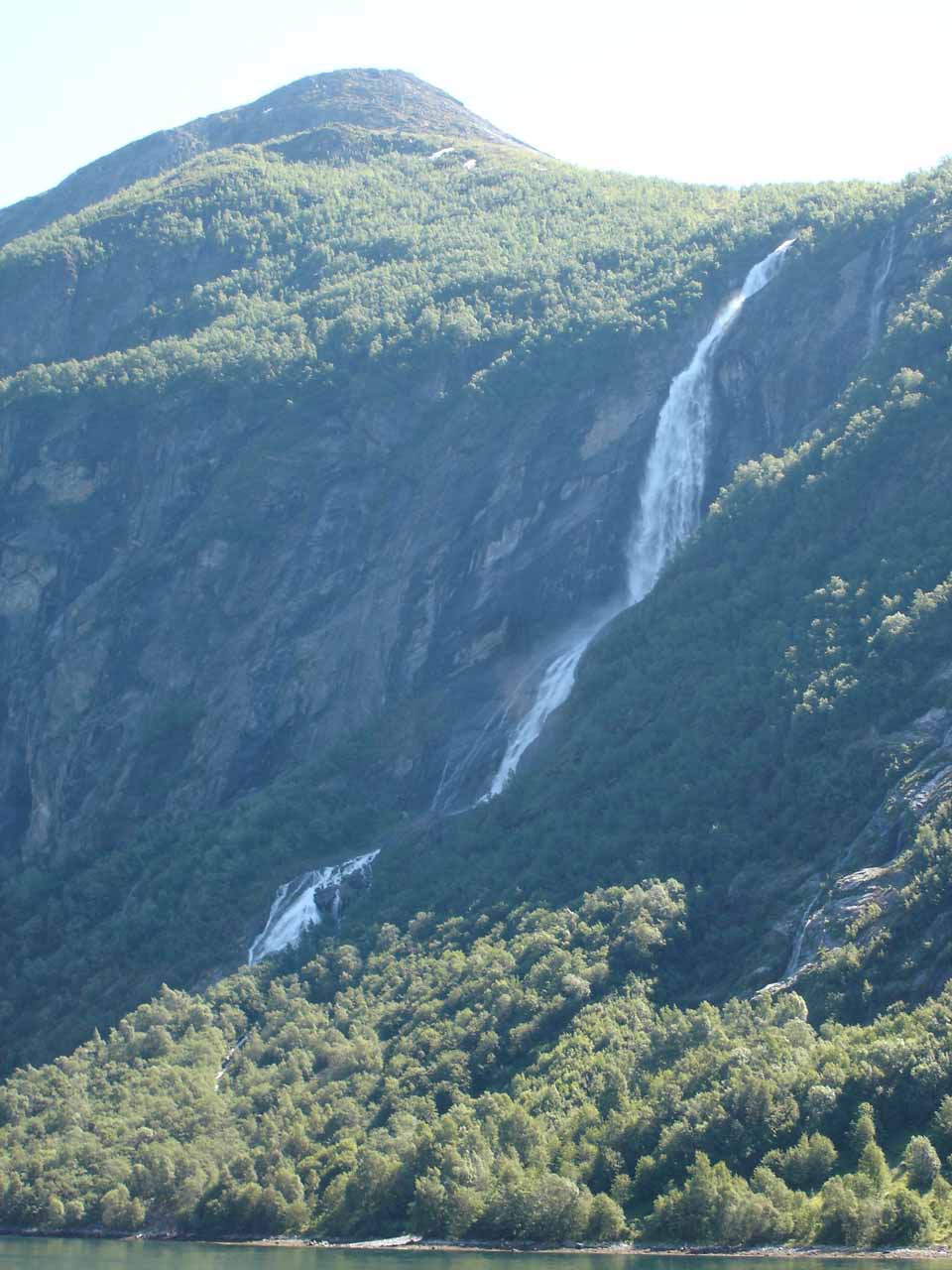
As for the Seven Sisters, it consisted of a series of several columns of water with the tallest drop said to be 220m. I’d imagine that someone must have envisioned there were seven of these columns, which was how it got its name. As you can see from our photos on this page, I don’t think we were able to count seven of them, but perhaps that all depended on the amount of snowmelt or rain. Besides, I had read from the literature that it was rare to actually see the stream segment into seven waterfalls.

We mentioned earlier that our visit to the Seven Sisters Waterfall involved many other waterfalls. So we’ll continue this writeup with the progression of the waterfalls that we managed to see during our visit in July 2005.
First, as we left the port at Geiranger at the east end of the fjord, we started to see the serpentine road Ørneveien (or Ørnevegen; meaning “the Eagle Road”) on the north side. Just a short distance west of the road was the waterfall Gjerdefossen. It was a tall but light-flowing 200m waterfall during our visit, but from looking at the map, it appeared to have a trail that left the Eagle’s Road towards a profile view of the falls overlooking the scenic fjord. Julie and I had completely forgotten about this possibility when the cruise was over and we’re keen to come back to try it on our next trip here…
Indeed, after Bringefossen, we then went into the middle of the fjord where we saw the Seven Sisters Waterfall to the north as well as another waterfall called Friaren right across the fjord to the south. Given that this large and voluminous 250m tall waterfall was all alone with the Seven Sisters in sight, Julie and I heard a story perpetuated by the tourist boat cruise we were on explaining how the falls got to where they were. Legend had it that the Friar was trying to woo the sisters across the fjord so he could have them to himself. He only managed to make it as far as the fjord but wasn’t able to get any closer. Yet there he was still plotting his next move…
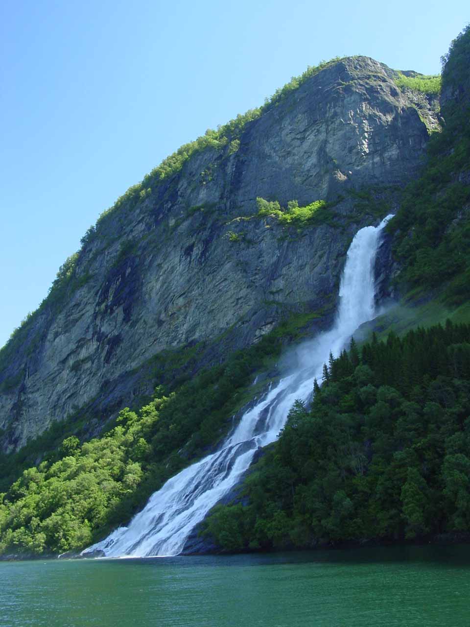
Further to the west of the famous Seven Sisters and Friaren, was the thin but very tall plunge of Brudesløret (the Bridal Veil). It was said to be the tallest singular freefalling waterfall in the fjord (I recalled the boat might have said something to the effect it was 1000ft tall). We particularly remembered this falls because there was an attractive rainbow in its mist at its base.
The cruise ultimately made it all the way out to the junction of the Geirangerfjord with Sunnylyvsfjord (Sunnylyvsfjorden). Then the cruise turned back at headed east to Geiranger allowing us to re-visit all of the waterfalls once again before ending back at Geiranger. As the boat was turning around, we got to see a distant waterfall called Hellesyltfossen within the town of Hellesylt way in the distance. We also glimpsed other other tall waterfalls along the Sunnylyvsfjord. Meanwhile, as we headed back to Geiranger, we started paying attention to other unnamed (and possibly named) waterfalls within Geirangerfjorden itself. Indeed, there were simply way too many waterfalls to single out in addition to the more major ones we’ve singled out on this page.
Anyways, just as we were about to return to Geiranger, Julie and I noticed there was still another tall sloping cascade right behind the town. To our knowledge, this waterfall didn’t have a formal name, but since it was coming from Grinddalen (according to the maps), we decided to call it “Grinddalsfossen”. When we did the Storsæterfossen hike after the cruise, we’d find out that we would get to see more of Grinddalsfossen as well.
Finally, in terms of time commitment, our tour took about 2- to 2.5 hours. Given the popularity of the cruise, it got quite crowded and getting the choicest viewing positions wasn’t easy. I’d imagine that the higher the seat, the better the viewing experience as fewer heads would be in the way. I didn’t recall how much the cruise costed, but I did recall it seemed to be pretty reasonable. There were other motorboat-hire options available, but I think to truly see the whole fjord like we did, a more powerful boat would be necessary given how much there was to see along the way and the distances that needed to be covered in a short amount of time. At least that was our thought process that ultimately resulted in us going with the common tour option.
Related Trip Reports
Related Top 10 Lists
Related Itineraries
Trip Planning Resources

Nearby Accommodations
This content is for members only. See Membership Options.Featured Images and Nearby Attractions
This content is for members only. See Membership Options.Visitor Comments:
Got something you'd like to share or say to keep the conversation going? Feel free to leave a comment below...No users have replied to the content on this page
Visitor Reviews of this Waterfall:
If you have a waterfall story or write-up that you'd like to share, feel free to click the button below and fill out the form...No users have submitted a write-up/review of this waterfall
Only logged in users can post a comment Please login or sign up to comment