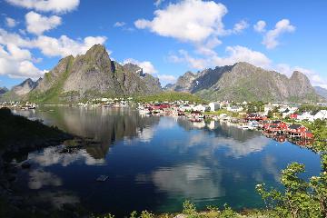
About Grongstadfossen

Grongstadfossen (I’ve also seen it spelled Grungstadfossen) was said to be the tallest waterfall in the Høylandet municipality at 75m. From the picnic area where we parked the car and got the view that you see at the top of this page, it was clear that the falls was very impressive. Unfortunately, the view was very limited from where we were standing. This was further complicated by the swarms of wasps that were also sharing the lookout and picnic area with us. As Julie stayed in the car, I was fortunate that none of them stung me (it actually took me a while to figure out that these were indeed wasps), but it was nerve-wracking to say the least. Speaking of which, even though this was a very beautiful and peaceful place to have a picnic, there was no way we were going to use it at the time.
I did notice that there was a trail leading further down the hill and further downstream from the waterfall on the Nordåa River. I wasn’t sure if this path would yield a better view, but I was told after our trip that there was indeed a path to improve the view of Grongstadfossen, and it could very well be on that trail. With hindsight being 20/20, I’ll have to make it a point to come back here next time to see the waterfall as it ought to be seen…
Related Trip Reports
Related Top 10 Lists
No Posts Found
Related Itineraries
Trip Planning Resources

Nearby Accommodations
This content is for members only. See Membership Options.Featured Images and Nearby Attractions
This content is for members only. See Membership Options.Visitor Comments:
Got something you'd like to share or say to keep the conversation going? Feel free to leave a comment below... More on Grongstadfossen September 22, 2008 10:09 am - I live in Høylandet and find it interesting that you added Grongstadfossen on your website. I'm sorry that you didn't know this when you visited the place, but there's a better lookout place where you can see the whole waterfall from a much closer place. The waterfall was also important during the industrialization because it… ...Read More
Visitor Reviews of this Waterfall:
If you have a waterfall story or write-up that you'd like to share, feel free to click the button below and fill out the form...No users have submitted a write-up/review of this waterfall
Only logged in users can post a comment Please login or sign up to comment