About Elgafossen (Algafallet)
Elgafossen (or more accurately Elgåfossen in Norwegian and Älgafallet in Swedish) was a shared waterfall between Norway and Sweden.
In fact, its watercourse on a tributary of the Enningdalsälven called Elja actually defined parts of the Swedish-Norwegian border.
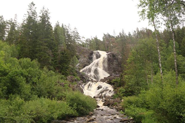
As you can tell from the pictures on this page, this 46m waterfall definitely held its own in the scenic department.
The height of the falls made it the highest such unregulated waterfall in the general Østfold (Norway) and Bohuslän (Sweden) counties.
When we made our visit, it featured a gushing flow with a tinge of brown as it might have either been in flood from recent rains, or it might drain tannin-laced peatlands further upstream.
The Border History at Elgafossen
In the 14th century, Denmark, Norway, and Sweden were united as the Kalmar Union, but Sweden pulled out in 1523.
This left a Denmark-Norway rule with Norway taking a lesser position as Danish rule was more powerful at the time.
According to the signs here, after a series of conflicts between Sweden and Denmark-Norway, the losing Danish side wound up ceded some of Norway’s border provinces to Sweden.
This included Bohuslän in 1658, which caused the Elja and the Elgåfossen to sit right at the international boundary.
To the people living here, this meant that neighbors once under common rule suddenly became cross-border enemies.
The signs here even told of a farmer named Anders Jensen Gribsrød, who was killed as punishment for transporting oak timber across the border in 1743.
Although relations were tense between the 17th and 19th centuries, in the WWII years of 1940-1945 (during the German occupation of Norway), Norwegian and Swedish locals had been more supportive of each other.
Again, according to the signs here, the inter-border mixing of populations was best indicated in a cross-border marriage between a Norwegian girl and a Swedish man right above Elgåfossen.
In our visit to the falls in 2019, it seemed like the cultural blurring of international boundaries appears to persist to this day.
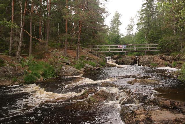
Further upstream of the falls, we crossed a bridge over the Elja with both Norwegian and Swedish flag symbols on display side-by-side.
The Pilgrim’s Way
Technically, the Pilgrim’s Way of St Olav (St Olavsleden) was an east-west route that started from Sundsvall, Sweden by the Baltic Sea to Trondheim, Norway in the west via Östersund, Sweden.
It covered a 580km stretch that essentially acted as the Scandinavian version of El Camino de Santiago de Compostela across Northern Spain.
That said, Julie and I noticed many of the same pilgrim icons and trail signage around Elgåfossen.
Apparently, there also existed pilgrims who took the so-called Borg Path from the national border around this waterfall to Oslo and ultimately to Trondheim’s Nidaros Cathedral.
Thus, they considered this somewhat obscure route (if not for the waterfall) as part of the Pilgrim Way.
Experiencing Elgafossen
From a well-signed and modestly-sized car park area (see directions, we followed an obvious footpath leading past some picnic tables and lawn area towards some signs as well as a restroom facility.
Given that it had been drizzling during our visit, we didn’t linger around too much for the picnicking.
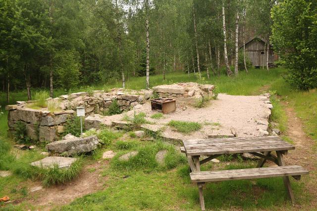
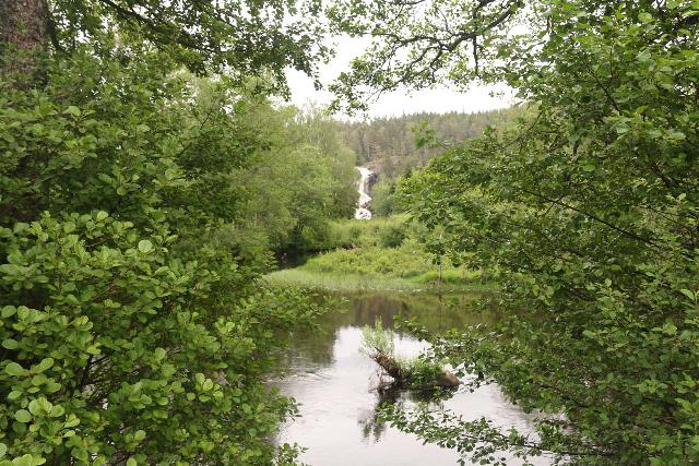
However, we did notice the gushing Elgåfossen in the distance after peering through some of the foliage openings.
We then crossed a sturdy bridge over the Enningdalselva before following a well-defined footpath flanked by lush green vegetation with lots of wildflowers.
After we followed the trail along the Elja River (a tributary of Enningdalselva), we encountered a trail junction flanked by signs and some historical relics.
Among these relics included the foundations of some mills as well as at least one mill stone.
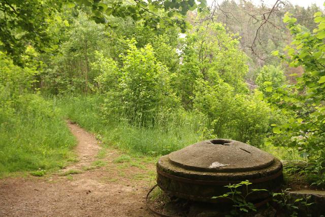
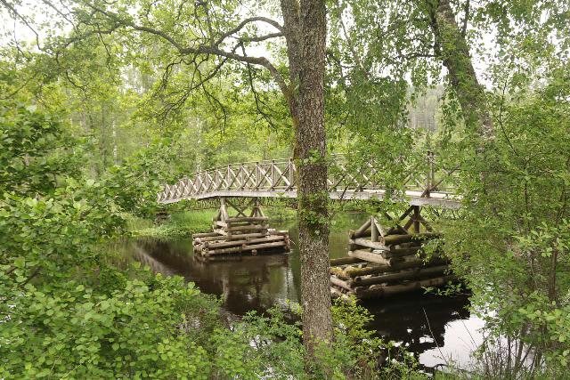
In addition, we spotted an old cow house as well as some picnic tables as well as a long bridge over the Elja with a frontal view of Elgafossen.
Going to the Top of Elgafossen
While we could have contented ourselves with the frontal views and be done with it, I did do some additional exploring as the footpath continued to climb alongside the waterfall.
As the footpath became increasingly steep, I did manage to find some outcrops providing downstream views as well as intriguing close-up profile views of the impressive waterfall.
I even noticed some floodlight poles, which suggested to me that they might light up this waterfall at night.
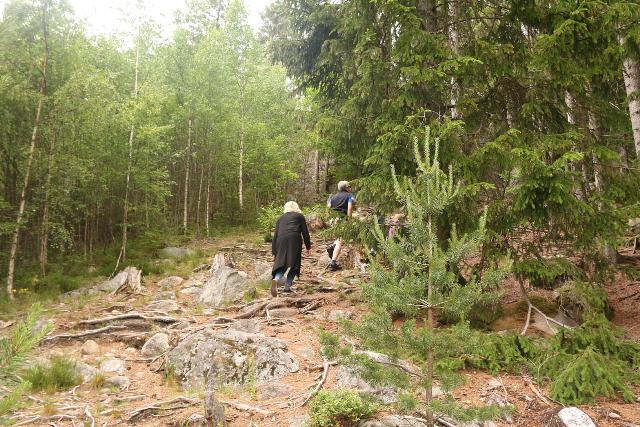
The footpath continued climbing steeply as it skirted the foot of a vertical cliff before going up more steps to get right up to the brink of Elgafossen at perhaps about 100m beyond the historical relics below.
The footpath continued further upstream towards the friendship bridge, where I then crossed over and went to the brink of Elgafossen on the Swedish side.
From the brinks of either side of the waterfall, I enjoyed commanding views of the Enningdal Valley below.
However, I didn’t proceed any further as this was my turnaround point.
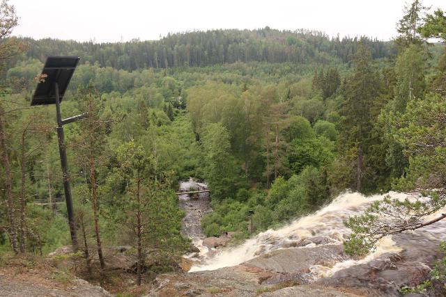
Overall, we had spent a little over an hour away from the car, which included my excursion to the top of the falls.
That said, I could easily envision a visit here could take as little as a half-hour or much longer if one wished to explore further upstream along the Elja.
Authorities
Elgåfossen is shared between the municipalities of Halden in Norway’s Østfold County and Tanum in Sweden’s Västra Götaland County (where Bohuslän County was incorporated). For information or inquiries about the area as well as current conditions, visit their respective local government websites here (Norway) and here (Sweden).
Related Top 10 Lists
No Posts Found
Trip Planning Resources
Nearby Accommodations
This content is for members only. See Membership Options.Featured Images and Nearby Attractions
This content is for members only. See Membership Options.Visitor Comments:
Got something you'd like to share or say to keep the conversation going? Feel free to leave a comment below...No users have replied to the content on this page
Visitor Reviews of this Waterfall:
If you have a waterfall story or write-up that you'd like to share, feel free to click the button below and fill out the form...No users have submitted a write-up/review of this waterfall



Only logged in users can post a comment Please login or sign up to comment