About Paradise Falls (Wildwood Falls)
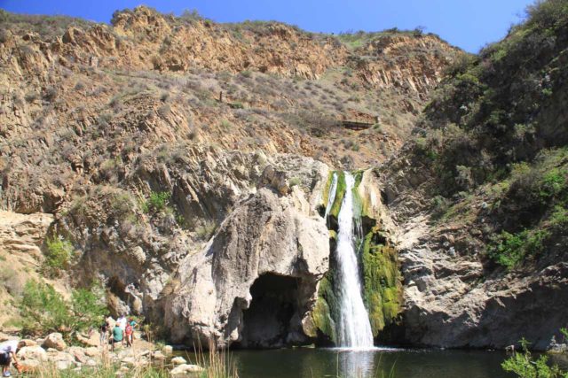
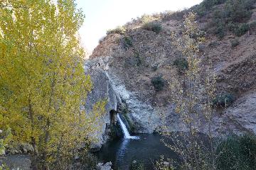
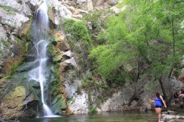
Paradise Falls (also referred to as Wildwood Falls) was a lovely 40ft waterfall in the canyons of Wildwood Park.
It was also the first waterfall that Julie and I visited together.
We had such a positive experience that we wound up seeing others in the greater Los Angeles area!
Years later, we brought our daughter when she was only a year old.
In all of our subsequent visits, we’ve brought her along as well as my parents.
So visiting Paradise Falls was definitely a family-friendly affair.
Sitting in the Thousand Oaks area well west of the Los Angeles basin, this waterfall also tended to reside in an area with a bit of a hot and dry climate.
However, this seemed like one of the rare waterfalls that somehow managed to thrive in this climate.
Each time we’ve visited this waterfall (at least a half-dozen times or more), the waterfall has performed nicely.
Given all these factors, I guess we found it fitting to put this falls on our list of Top 10 Southern California Waterfalls.
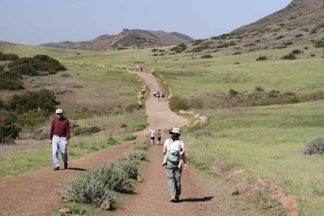
Over the years we’ve that hiked to this waterfall, we’ve gravitated towards two different approaches. Each one yielded a different experience.
We’ll describe each of these trail options in the subsequent sections on this page.
The Mesa Trail and North Teepee Trail to Paradise Falls
In my mind, this was the most direct approach, and it required only a 2.4-mile round-trip hike from the main parking lot.
It started from the main entrance (see directions below), then followed the Mesa Trail and North Teepee Trail before arriving at Paradise Falls.
This route basically formed an upside-down L shape. Most of its net 250ft drop in elevation came at the end right before the waterfall.
From the main parking lot, we followed the obvious trail to the right, which briefly climbed a short hill, then descended towards a wide unpaved road about 0.2 miles from the start.
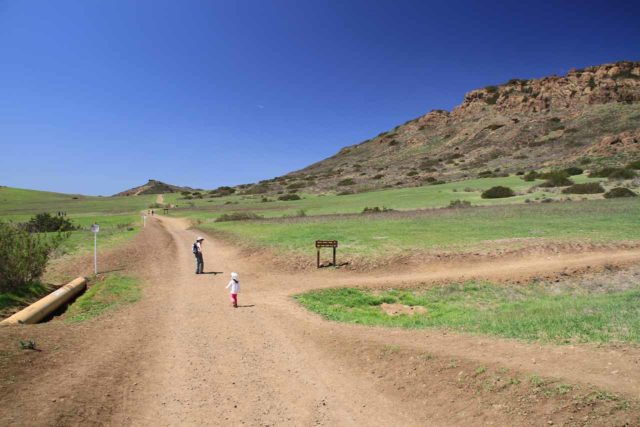
That road turned out to be part of the Public Access Road to the other parking lot.
But for the intent of this hike, it was about 0.1-mile of the Mesa Trail.
The Mesa Trail continued straight past a vehicle barricade while the Public Access Road veered to the left at nearly a right angle to it. We kept right to keep on the Mesa Trail.
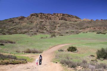
For the next 0.2 miles, the Mesa Trail continued to follow along a flat and open area.
To our right were the namesake mesas towering over us. Depending on the conditions, wildflowers could color the foothills yellow and purple.
To our left were some natural gas pipelines as well as prickly bush. The elevation gain had been pretty minimal to this point.
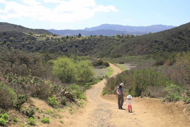
Then, the Mesa Trail made a junction with the North Teepee Trail.
We left the Mesa Trail and took the North Teepee Trail, which passed by a junction with the Stagecoach Bluff Trail before passing by another junction with the Moon Ridge Trail.
The trail then descended steeply at roughly 80-120ft elevation loss to the namesake Teepee.
This sturdy Teepee was not a genuine Native American shelter as it acted more like a resting area. It sat at a three-way junction roughly a half-mile from where we left the Mesa Trail.
Next, we’d keep right at the Teepee to follow the Teepee Trail for the next 0.2 miles as the trail continued descending.
We noticed the contours of Wildwood Canyon on our left during this stretch, where we often see wildflowers in bloom here in the Spring.
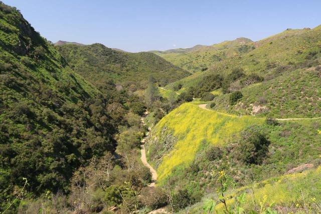
The trail then reached another signed junction, where we left the Teepee Trail and descended on the direct downhill trail.
After a couple of switchbacks, this downhill trail would intersect with the Wildwood Canyon Trail, then continue down steps before reaching the banks of Indian Creek and the plunge pool of Paradise Falls.
The edge of this plunge pool marked the official end of the waterfall trail.
We noticed other trails continuing further downstream into the canyon to attractions like Lizard Rock. But since we didn’t venture further downstream, we can’t say more about that.
A craggy protruding rock blocked the view of the all but the very bottom of Paradise Falls.
So that compelled us to cross the creek while trying to keep the feet dry (Gore-tex boots helps).
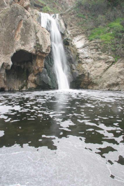
Once we got to the other side, we enjoyed full frontal views of Paradise Falls (as you can see at the top of this page).
I’d imagine that depending on Indian Creek’s flow, this stream crossing can be shallower or deeper than what we’ve described.
Thus, you may want to assess your situation before you decide to cross.
After having our fill of this falls, we had the option of extending our hike or just going back the way we came.
This out-and-back hike was by far the most popular way to experience Paradise Falls as evidenced by the increasing volume of people doing it this way over the years.
It normally would take us about 30-40 minutes each way so I’d budget at least about 90 minutes.
Paradise Falls via the Wildwood Canyon Trail and Moonridge Trail
This second option started from a spillover parking lot though we also happened to have done it from the main parking lot as well.
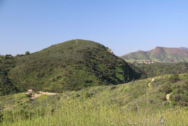
The route followed the Wildwood Canyon Trail before arriving at Paradise Falls. Then, it returned via the Moonridge Trail to complete the loop.
While this option seemed longer than the first (especially if we started from the main parking lot), it could have easily been about the same distance (possibly shorter) starting from the spillover parking lot.
Indeed, each time we’ve done Paradise Falls using this approach, we’ve started from that spillover parking lot, which was once signed “Parking Lot No.1”.
At this parking lot, we could peer down in the distance at the Teepee. We could also look in the opposite direction at the mesas in the distance.
Just downhill from the spillover parking lot, we descended a couple of gentle curves about 0.3 miles to a spur trail just before a footbridge over Indian Creek.
That spur trail led about 0.1-mile to the foot of the Indian Cave, which was basically more like a natural alcove or shelter.
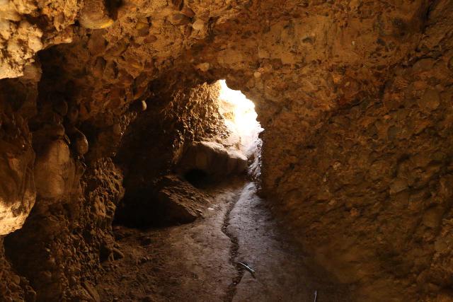
However, there was a small crawl-space opening at its longest end. A use-trail continued back uphill from the other end of this opening.
However, after having our fill of this cave, we went back down and returned to the footbridge.
On the other side of the footbridge, there were other trails like the Indian Creek Trail to the left as well as the Meadows Picnic Area.
There also seemed to be some informal connectors to the Lynnmere Trail.
Just uphill and around a bend was the Meadows Center, which was an amphitheater that would typically host ranger talks or programs under the stars.
There was also a toilet facility with flush toilets.
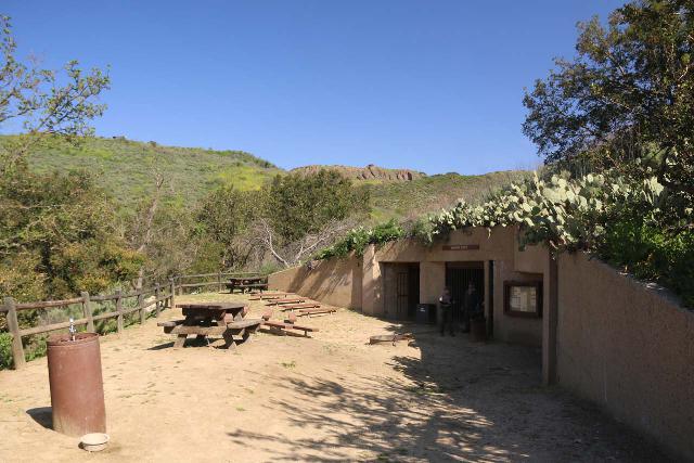
Back across the bridge, we then followed Indian Creek downstream along the Wildwood Canyon Trail. This trail would continue flanking the creek.
After about 0.2 miles from the footbridge, there was a spur trail climbing uphill on the Teepee Trail eventually leading 0.2 miles up to the Teepee itself.
We continued on the Wildwood Canyon Trail where there was a picnic area right at a bend in the trail and Indian Creek.
The park map indicated that there was a Little Falls here, but I honestly didn’t see much in the way of a notable waterfall here.
Next, the Wildwood Canyon Trail continued into its narrowest section where it followed a ledge flanked by cacti on one side and fences with dropoffs on the other.
Down below us remained Indian Creek but we started to see some small upper cascades of Paradise Falls.
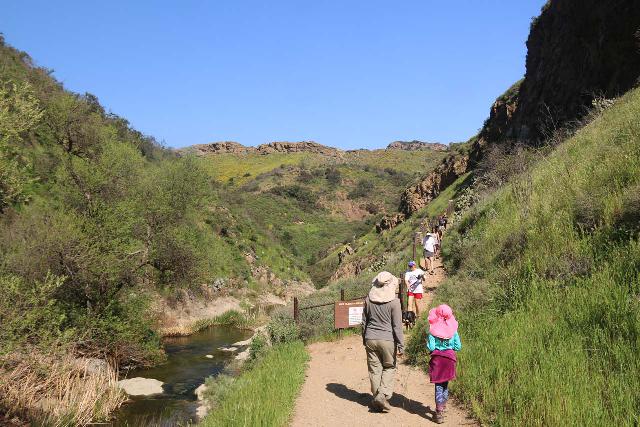
Eventually, the trail would join up with a trail junction connecting the spur trail from the Teepee Trail and the descent to the Paradise Falls.
After having our fill of the falls, we then went all the way up to the Teepee Trail instead of taking the Wildwood Canyon Trail back.
After about 0.2 miles east on the Teepee Trail, we reached the namesake Teepee. Then, we hiked uphill on the North Teepee Trail for about 0.1-mile before veering onto the Moonridge Trail.
The Moonridge Trail was about a half-mile in distance, and it ultimately took us back to the spillover parking lot. This trail was much quieter than the other wider trails we had walked on to this point.
Thus, we were able to observe more wildflowers, cacti, and the odd views back towards the mesas since we were hiking on an undulating ridge.
Overall, the distance we covered was probably on the order of a little over 2 miles to cover this entire loop.
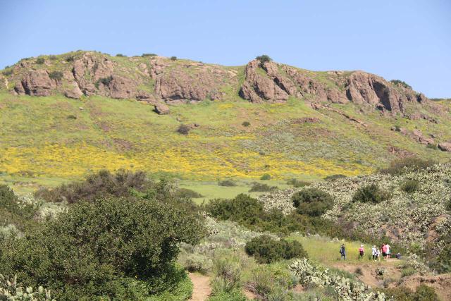
Had we started from the main parking lot, then this hike would have been at least over three miles round trip.
Like with the primary option, we spent between 90 minutes and two hours at a leisurely pace.
Authorities
Paradise Falls resides in Wildwood Park, which is part of the Conejo Recreation and Park District. For information or inquiries about this park as well as current conditions, visit the Conejo Recreation and Park District website.
Related Top 10 Lists
Trip Planning Resources
Nearby Accommodations
This content is for members only. See Membership Options.Featured Images and Nearby Attractions
This content is for members only. See Membership Options.Visitor Comments:
Got something you'd like to share or say to keep the conversation going? Feel free to leave a comment below... Paradise Falls – Looking forward to heading here for the first time July 24, 2010 8:52 pm - Hey, great review, and great pictures/video! I'm headed there for the first time today and my neighbor mentioned that the water there smells due to runoff water from the local area. You're the only review site that mentioned it. And your before and after pictures of the fall really helped out to verify that and… ...Read More
Visitor Reviews of this Waterfall:
If you have a waterfall story or write-up that you'd like to share, feel free to click the button below and fill out the form... Paradise Falls April 2013 April 15, 2013 5:24 pm - Went for a hike this weekend at Paradise Falls. Perfect weather. Great time. Going to Rose Valley in 2 weeks ...Read More




Only logged in users can post a comment Please login or sign up to comment