About Carlon Falls

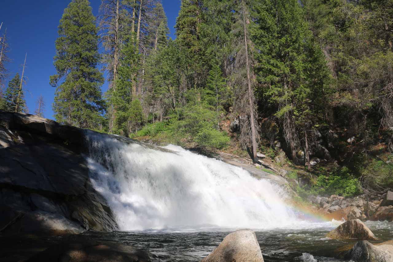
Carlon Falls was a strangely-shaped waterfall that had that rare characteristic of flowing year-round, which was quite a statement to make since most waterfalls within Yosemite National Park couldn’t make that claim.
It had modest height (say around 35ft or so) but it was wider than it was tall with a sloping shape that tapers off to the far side of the South Fork Tuolumne River.
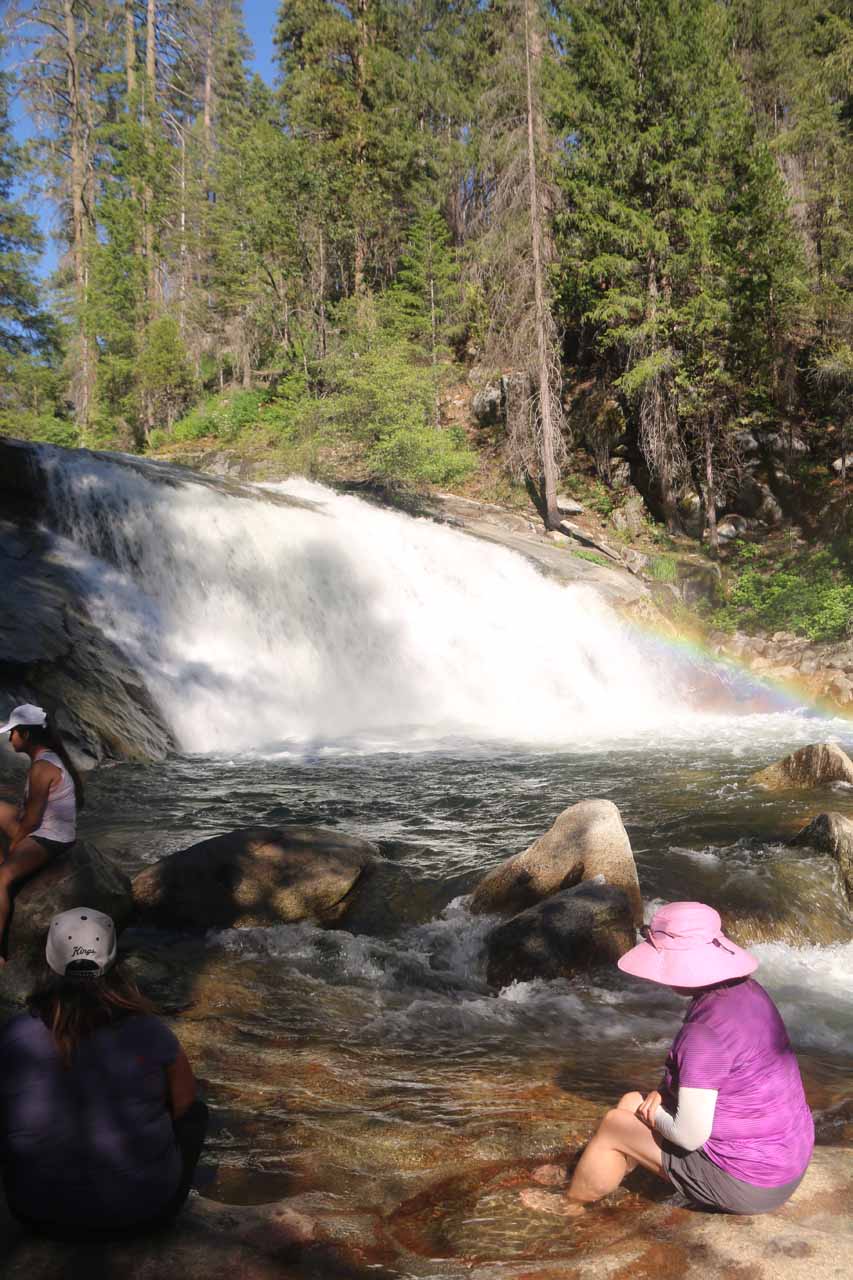
In addition to its unusual shape, the potholed granite bench near its plunge pool created little pools and a calm section where the river wasn’t raging.
So it provided an opportunity for us to take a dip (or at least cool off our feet) and cool off from the heat of a hot Summer’s day. That definitely came in handy when most of Yosemite’s other waterfalls wouldn’t be flowing late in the Summer and into the Fall.
As for timing for photos, the best lighting appears to happen in the early to mid afternoon as we were looking against the sun in the morning and the shadows would grow too long too late in the afternoon.
A real quirky thing about the hike to get here was that its trailhead was situated outside the National Park boundary (in Stanislaus National Forest), and I suspect it’s this strange attribute that makes this falls pretty unknown to most visitors to Yosemite National Park.
In fact, we only became aware of this hike while doing the drive to Hetch Hetchy one day and noticed a trailhead with a sign for “Carlon Day Use Area” along the way. We made it a point to come here on a subsequent visit.
Hiking to Carlon Falls
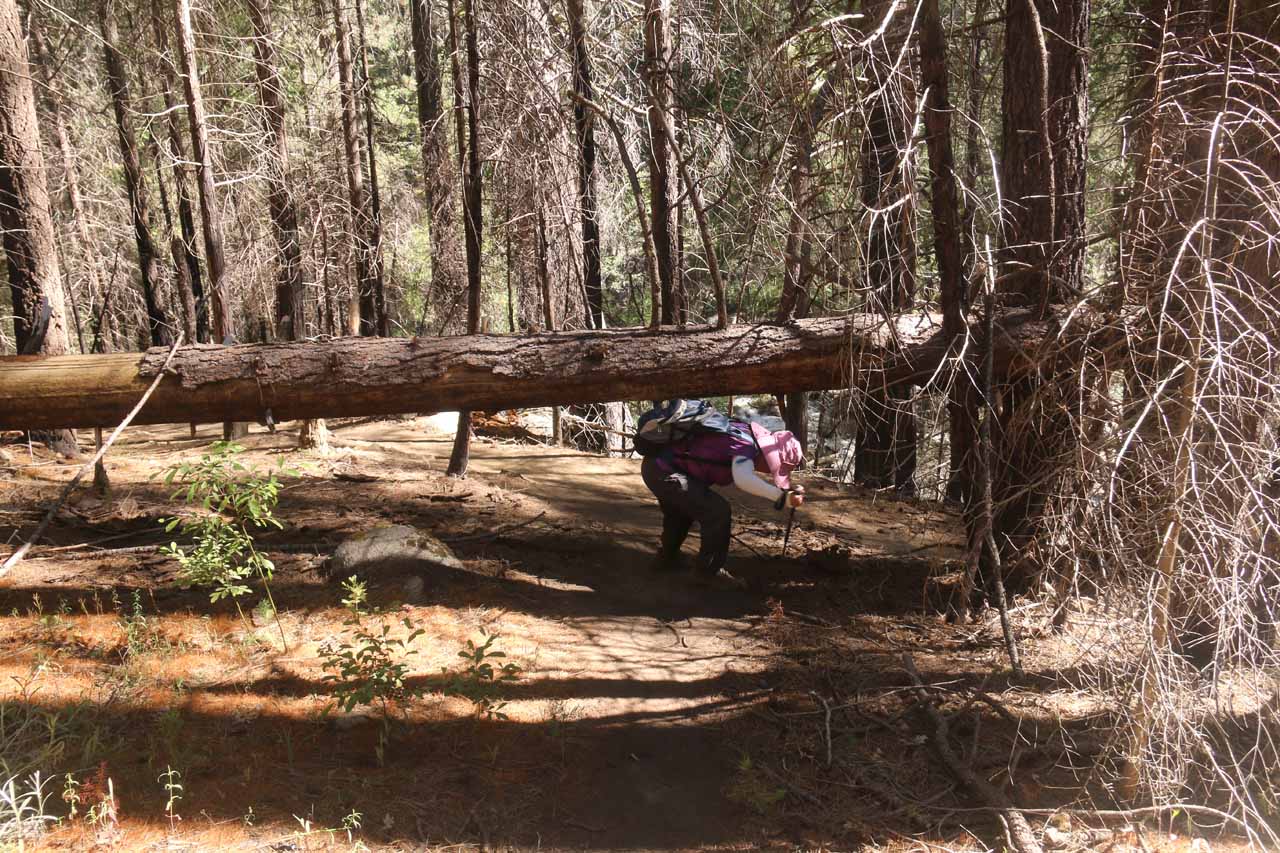
Speaking of which, we’ve done this hike a couple of times – once in 2004 and another time in 2017. And between these visits, there appeared to be quite a change in the experience as much of the terrain was affected by a fire that swept through the area in 2013.
So we had to deal with more deadfalls as well as a couple of pretty badly eroded sections that made this trail a little harder than it was on our first time around.
From the signposted Carlon Falls Trailhead (see directions below), we followed a pretty obvious trail along the north bank of the South Fork of the Tuolumne River.
My Mom and I saw many people on the opposite side of the river playing in the calmer parts of the river as there was an Upper Carlon Day Use Area and campground over there.
However, if you’re starting from there, it’s best to backtrack to the Evergreen Road and then swing back around to the north side of the river, which was where the well-maintained trail to the falls was.

And as there didn’t seem to be such “play” areas on our side of the river, we pretty much continued amongst the well-shaded forested trail as it proceeded through a trail maze marking our re-entry into Yosemite National Park wilderness barely 0.1 mile from the trailhead.
Beyond the maze, we saw even more evidence of fire damage from black-barked trees and deadfalls that we had to go over or around.
There were also some building remnants that the trail went right through. Yet even with the fire damage, the trail remained serene and well-shaded as it would proceed this way for about the next mile or so.
The pace went pretty quickly because this stretch was pretty much flat and it followed along the South Fork Tuolumne River for almost the entire way.
With the scenery pretty much staying like this for this stretch, we also noticed little things like a hole in the ground by the trail at around 0.6 miles from the Yosemite boundary as well as one short stretch where the trail went up a steep eroded embankment before descending back down along the main trail again.
At the end of the long, flat forested stretch that dominated the majority of the Carlon Falls hike to this point, the trail then made a fairly steep and persistent climb of around 500ft or so.
During this climb, we were now able to look down at a bend in the South Fork Tuolumne River before the trail gingerly traversed a fairly badly eroded section of trail as a slippery dirt slope was angled right into a few dead-felled trees.
There were a couple of trail forks in this section, and it was advised to keep left at the fork (which we did) instead of going straight down at the right and then try to scramble back up to the main trail again.
Avoiding False Paths
Afterwards, the rest of the trail was a bit narrower. It involved trying to avoid false paths leading to our right towards the South Fork Tuolumne River while also climbing up and down undulating steep and rugged spots that we never recalled seeing before on our first experience in 2004.
Each of the “false paths” leading to the South Fork Tuolumne River actually resulted in spots where it was possible to play in the river. Had we chosen to go on one of these paths, we still would have had to exercise caution due to the high runoff conditions we encountered as the river rushed with whitewater.
Trying to boulder scramble directly to the end of the trail from these false paths was too rugged and rough. So after scouting out some of these false paths, we backtracked to regain the main trail before proceeding further to the falls.
Thus, we kept left at each of the remaining false path forks for the remainder of the hike until we eventually made a final steep descent leading right down to the base of Carlon Falls.
Note that I didn’t recall having this steep descent the first time here in 2004, which kind of tells you how much things can change over the years.
It took us about an hour to get to this point, which was said to be around 2 to 2.25 miles.
So the inviting water was a welcome relief before making the return hike, which ended up taking us around 30 minutes on a quick pace without stops.
Authorities
Carlon Falls resides in Yosemite National Park, but its trailhead resides in Stanislaus National Forest. For information or inquiries about the park as well as current conditions, visit the National Park Service website. You can also check out the National Forest website or Facebook page.
Related Trip Reports
Related Top 10 Lists
No Posts Found
Related Itineraries
Trip Planning Resources


Nearby Accommodations
This content is for members only. See Membership Options.Featured Images and Nearby Attractions
This content is for members only. See Membership Options.Visitor Comments:
Got something you'd like to share or say to keep the conversation going? Feel free to leave a comment below...No users have replied to the content on this page
Visitor Reviews of this Waterfall:
If you have a waterfall story or write-up that you'd like to share, feel free to click the button below and fill out the form...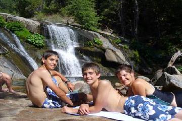 Carlon Falls found! August 18, 2009 3:14 pm - Carlon Falls was a great find because it was a hot Saturday. We needed a place to swim near our camp (5 miles outside the west gate), but didn't want to fight the crowds inside Yosemite National Park. We almost had the place to ourselves! ...Read More
Only logged in users can post a comment Please login or sign up to comment