Asafossen ("Vassbakkfossen"), "Liingafossen", and the Waterfalls of Skjolden and Fortunsdalen

Skjolden, Sogn og Fjordane County, Norway

About Asafossen (“Vassbakkfossen”), “Liingafossen”, and the Waterfalls of Skjolden and Fortunsdalen


Hiking Distance: roadside
Suggested Time:

Date first visited: 2005-06-28
Date last visited: 2019-07-21

Waterfall Latitude: 61.47895
Waterfall Longitude: 7.66227

Waterfall Safety and Common Sense

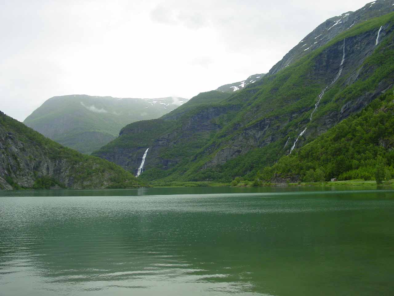
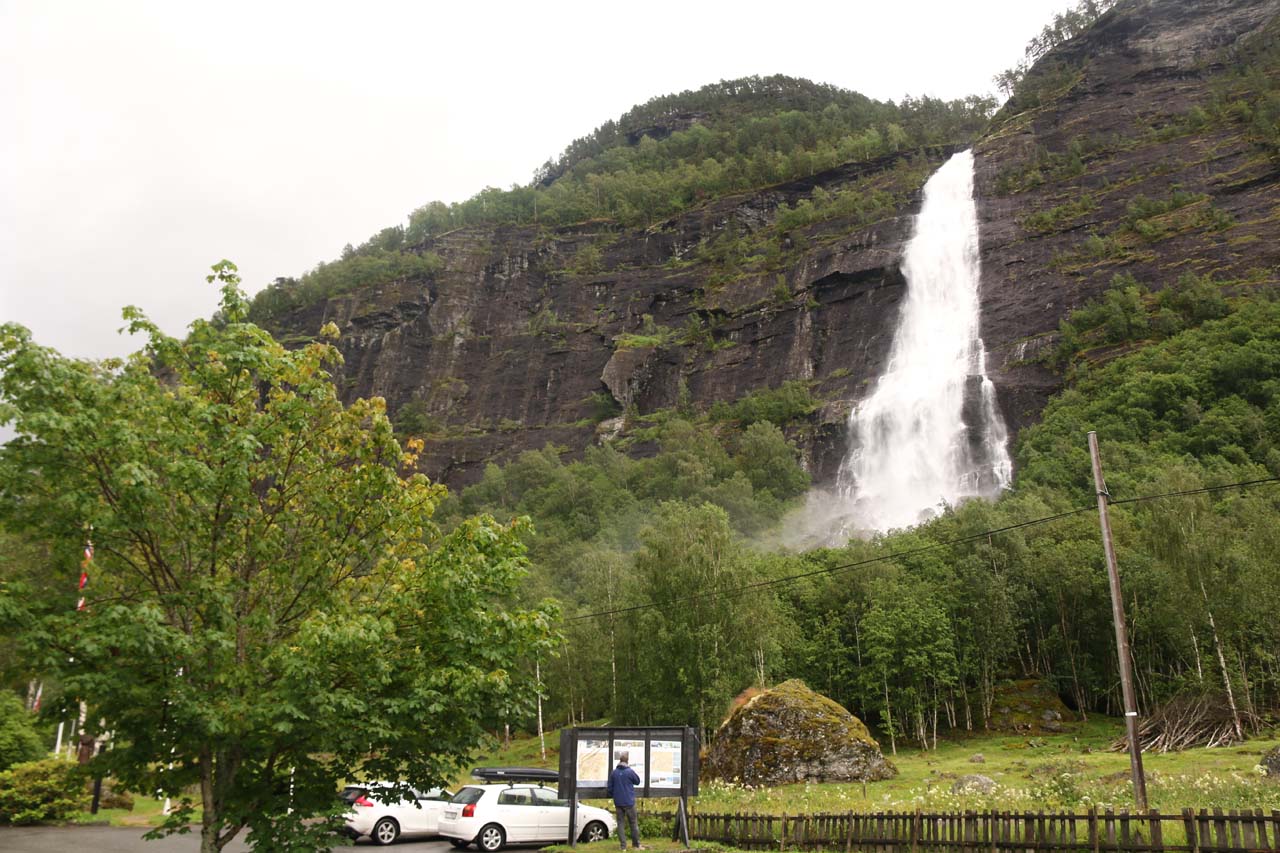
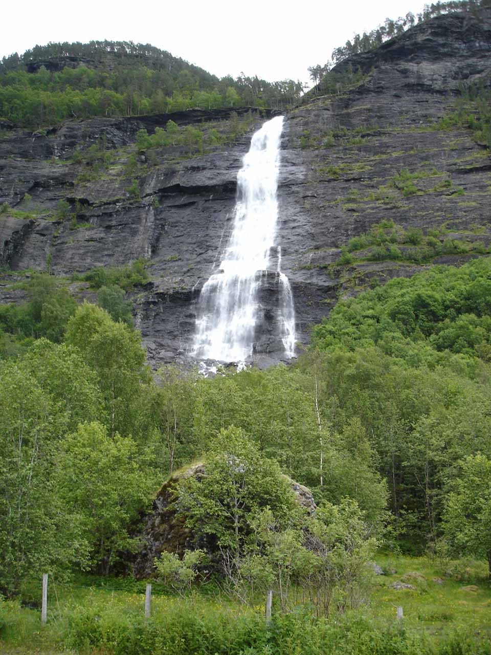
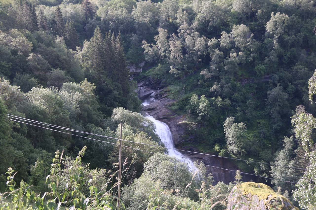
Asafossen (more correctly called Åsafossen) was the conspicuous waterfall spilling into Fortundalen easily seen from the scenic town of Skjolden.

I used to call this waterfall “Vassbakkfossen” since our first trip to Norway in 2005 because I had trouble finding its formal name, and it happened to be situated right across from the Vassbakken Camping and Kro.

Lustrafjorden_001_06282005
Åsafossen (‘Vassbakkfossen’) with ‘Liingafossen’ seen over Eidsvatnet as of our first trip to Norway in 2005

It was only when I returned to Norway in 2019 did I finally start to see local tourism literature refer to this waterfall as Åsafossen, which fittingly flowed on the Åselvi Stream.

The falls dropped from perhaps about 180m (based on my Norgeskart measurements) over its steepest section on the Vassbakken cliffs.

By the way, I believe vassbakken means “the watery hill” so if that’s true, then I guess the cliffs were aptly-named.

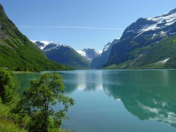
Even though I got the closest views of the falls from the Vassbakken Camping area, I found the most atmospheric views of this waterfall came from the mouth of Eidsvatnet (closer to Skjolden).

Vassbakken_005_07212019
Context of Åsafossen as seen from the Vassbakken Camping and Kro

That was where I could see this waterfall as well as a taller thinner waterfall on the Liingaelvi (so we informally called it “Liingafossen”).

Anyways, since I easily saw the Åsafossen from the roadside along the Fv55, I never saw a need to go on a hike to see it in a different manner.

That was unfortunate because apparently there was such a trail that started by a bridge over its stream and was said to take only 15 minutes on a sherpa-made path.

I’ll have to come back here and do that if fortune smiles upon us and lets us have another chance at experience this place.

Other Waterfalls in Fortundalen

Lustrafjorden_020_jx_06282005
Åsafossen when we first saw it back in late June 2005 from the Vassbakken Camping area

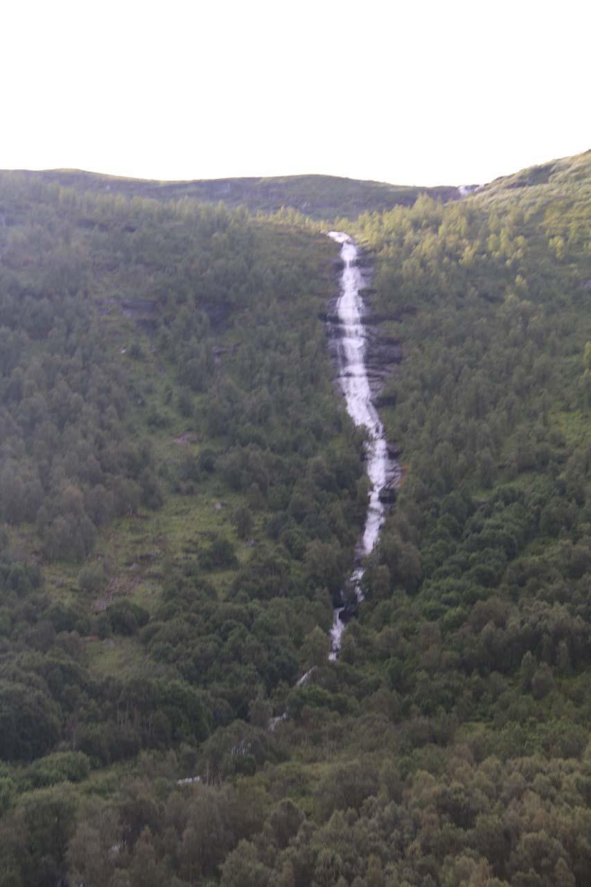
Technically, Åsafossen and “Liingafossen” were merely a couple of waterfalls tumbling into the scenic Fortundalen.

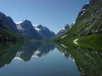
This valley rose sharply towards the town of Turtagrø, and throughout the drive along the narrow Fv55, we encountered many unnamed waterfalls en route.

I can’t single specific waterfalls along this drive, but I thought they would be worth a mention since we inevitably noticed them (though had trouble finding any infrastructure to appreciate them better).

Perhaps the most noticeable of these waterfalls leading up to Turtagrø was on the Farningselvi, which was 2.8km before reaching the town of Turtagrø.

Rv55_050_07212019
The waterfall that I believe is on the Farningselvi as I was driving uphill on the Fv55 towards Turtagrø

There was a very slight informal space to pullover to get a somewhat clean direct view of the waterfall here.

Julie and I have also noticed another gushing waterfall within the Bergselvi.

However, we couldn’t find a place to properly appreciate it, and all we have is a partial view of it taken from Julie as the shotgun photographer.

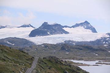
When we made it up to Turtagrø, we then turned right to go onto the Fardalen/Tindevegen Mountain Road, which required a toll.

Rv55_042_07212019
Fleeting and partial view of a waterfall on the Bergselvi while driving uphill on the Fv55 towards Turtagrø

In case you’re wondering, the Fv55 continued climbing beyond Turtagrø, but we have a separate write-up covering the famed Sognefjellet Road through the heart of the Jotunheimen Mountains.

Other Waterfalls on the Fardalen/Tindevegen Mountain Road

The Fardalen/Tindevegen Mountain Road covered the high mountain pass between the towns of Turtagrø and Øvre Årdal.

Like with the Fortundalen Drive, I couldn’t pick out any particular named waterfall to specifically stop for, but we noticed many cascades tumbling into both the Berdalen on the north side of the pass and the Fardalen on the south side of the pass.

If there had to be one waterfall to single out as the most interesting of the bunch, I’d say it was the unnamed one somewhere near what the Norgeskart calls Nedregjerdet or Muregjerde.

Fardalen_002_jx_06282005
This gushing waterfall beneath the power lines might be what Norgesglasset called Brekkefossen or just an unnamed waterfall by Muregjerde or Nedregjerdet. This picture was taken in 2005

Other than that, the waterfalls pretty much act like scenic backdrops to this otherwise surreal stretch of road, which I’d imagine would be only open in the Summer when it’s mostly snow free.

Authorities

Åsafossen resides in the Luster Municipality. For information or inquiries about the area as well as current conditions, visit their website or Facebook page.

Rv55_002_07212019
Rv55_006_07212019
Rv55_008_07212019
Rv55_025_07212019
Turtagro-Over_Ardal_mtn_pass_rd_005_07212019
Turtagro-Over_Ardal_mtn_pass_rd_009_07212019
Turtagro-Over_Ardal_mtn_pass_rd_011_07212019
Turtagro-Over_Ardal_mtn_pass_rd_014_07212019
Turtagro-Over_Ardal_mtn_pass_rd_027_07212019
Turtagro-Over_Ardal_mtn_pass_rd_029_07212019
Turtagro-Over_Ardal_mtn_pass_rd_031_07212019
Turtagro-Over_Ardal_mtn_pass_rd_032_07212019
Turtagro-Over_Ardal_mtn_pass_rd_035_07212019
Turtagro-Over_Ardal_mtn_pass_rd_040_07212019
Vassbakken_007_07212019
Turtagro-Ovre_Ardal_mtn_rd_046_07212019
Turtagro-Ovre_Ardal_mtn_rd_047_07212019
Turtagro-Ovre_Ardal_mtn_rd_049_07212019
Fardalen_001_06282005
Fardalen_003_jx_06282005
Fardalen_004_jx_06282005
Fardalen_006_jx_06282005
Fardalen_010_jx_06282005
Fardalen_011_jx_06282005
Lustrafjorden_001_jx_06282005
Lustrafjorden_003_jx_06282005
Lustrafjorden_007_jx_06282005
Lustrafjorden_011_jx_06282005
Lustrafjorden_015_jx_06282005
Lustrafjorden_018_jx_06282005
Lustrafjorden_041_jx_06282005
Lustrafjorden_044_jx_06282005

join-booking-970x240-1.jpg


In 2005, the route that Julie and I took pertaining to this write-up began from the town of Øvre Årdal (Upper Årdal).

In 2019, on multiple occasions, I did this drive from Skjolden as well as back in the other direction from Øvre Årdal.

You can use any available routing apps to get to either endpoint.

Rv55_039_07212019
Driving on the single-lane, cliff-hugging road along the busy Fv55 towards Turtagrø

We’ll pick up the driving route starting from Skjolden.

So heading east on the Fv55 for 15.6km towards the town of Turtagrø, we then took the toll road starting as the Fv331 towards Årdal.

Along this initial stretch of road, the Vassbakken Camping and Kro (and trail access to Åsafossen) was about 3km from its junction with the Fv333 turnoff for Mørkrid.

We then followed this road for 30.6km eventually descending (as Fardalsvegen or Fv302) into the town of Øvre Årdal.

The road ultimately joins up with Storevegen in the town of Øvre Årdal.

Turtagro-Ovre_Ardal_mtn_rd_048_07212019
The automatic toll boom on the mountain pass road through both Bergdalen and Fardalen

By the way, the automatic toll boom, where I had to use my credit card to make a payment and pass through, was at about 12.4km south of the turnoff at Turtagrø or 18.1km north of the start of the Fardalsvegen Road at Øvre Årdal.

Overall, this driving route would take at least an hour, but given the slow rate of speed (especially with slower drivers on the single-lane roads), I’d say this drive would be more like 90 minutes at a comfortable pace.

For geographical context, Skjolden was about 30km (over 30 minutes drive) northeast of Ornes, 27km (30 minutes drive) northeast of Gaupne, about 43km (under an hour drive without a ferry) or 34km (over an hour drive with a ferry) northeast of Solvorn, 55km (about an hour drive) northeast of Sogndal, 47km (over an hour drive via the mountain pass on Fardalvegen/Tindevegen) north of Øvre Årdal, 124km (or 2.5 hours drive with a ferry crossing) north of Flåm, and 288km (over 4.5 hours drive with a ferry crossing) northeast of Bergen.

Find A Place To Stay

Checking out the Asafossen waterfall from the parking lot of the Vassbakken Kro


Sweep from one of the vistas over the valley deep below along the Rv55 showing some of the waterfalls spilling across the way

Related Top 10 Lists

No Posts Found

Tagged with: skjolden, fardalen, luster, sogn og fjordane, lustrafjorden, vassbakken, fureasfossen, liingafossen, ardal, turtagro, sognefjorden, aselvi, eidsvatnet, norway, waterfall


Visitor Comments:

Got something you'd like to share or say to keep the conversation going? Feel free to leave a comment below...

No users have replied to the content on this page


Share your thoughts about what you've read on this page

You must be logged in to submit content. Refresh this page after you have logged in.

Visitor Reviews of this Waterfall:

If you have a waterfall story or write-up that you'd like to share, feel free to click the button below and fill out the form...

No users have submitted a write-up/review of this waterfall


Have you been to a waterfall? Submit a write-up/review and share your experiences or impressions

Review A Waterfall

Nearest Waterfalls

The Waterfaller Newsletter

The Waterfaller Newsletter is where we curate the wealth of information on the World of Waterfalls website and deliver it to you in bite-sized chunks in your email inbox. You'll also get exclusive content like...

  • Waterfall Wednesdays
  • Insider Tips
  • User-submitted Waterfall Write-up of the Month
  • and the latest news and updates both within the website as well as around the wonderful world of waterfalls


How To Build A Profitable Travel Blog In 4 Steps