About Sorvagen Waterfall
The Sorvagen Waterfall (or more accurately Sørvågen Waterfall) was our lone waterfalling attraction that we experienced in the magical Lofoten Islands.
This waterfall actually didn’t have a formal name, and I only named it as such because it sat behind the fishing village of Sørvågen.
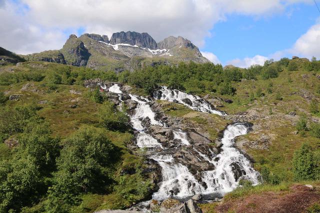
In fact, you could argue that the waterfall itself didn’t possess anything special other than it was one of the few reliable ones on Norway’s signature island chain.
It was merely a cascade that just so happened to be along the way for longer hikes (such as a popular one to Munkebu Hut).
That said, I felt the surroundings were what made this rather simple waterfalling experience so memorable.
Indeed, the Sorvagen Waterfall was surrounded by attractive lakes, backed by sharp mountain peaks, and even had an ocean view to boot.
Such scenery merely hinted at the landscapes that would be typical of the longer Lofoten peak hikes for mindblowing top down views (provided you’re up for the physical demands and time commitment of such excursions).
My Sørvågen Waterfall Experience
I started off from a somewhat limited car park that filled up quickly (see directions below).
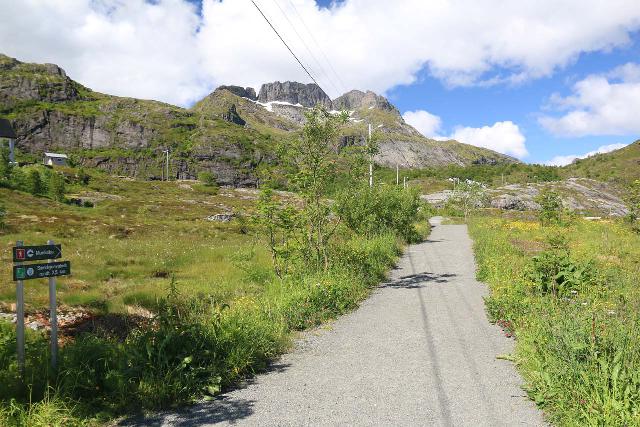
From there, I followed the signs onto an obvious granite path where I could already start to see the waterfall.
After walking about 250m, the trail reached a signposted junction.
The path on the right went around the neighboring lake Sørvågvatnet for 2.5km, but I only needed to go about 250m to reach a waterfall on Olaelva.
Olaelva branched off from the main stream, which I believe is called Studalselva so this waterfall could technically be considered a segment of the Sørvågen Waterfall that we’re focusing on in this page.
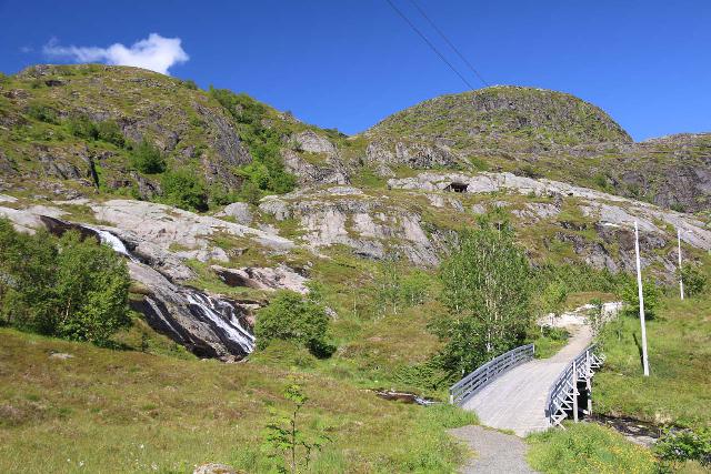
Anyways, continuing towards the larger waterfall (and not doing the Sørvågvatnet loop), I then had to climb up a semi-steep granite friction pitch that went alongside the cascade.
Once I got to the top of the climb (roughly 175m beyond the first trail junction), I was able to look down at the Studalselva and the waterfall backed by the peaks of Vestertinden and Støvla.
Since the maps called this stream Studalselva, perhaps the Sørvågen Waterfall could very well be called Studalsfossen.
In addition to enjoying the views of the waterfall, I also looked back past some wiry star of David towards both the Sørvågvatnet, the town of Sørvågen, and the Atlantic Ocean beyond.

As far as the Sorvagen Waterfall was concerned, this could be the turnaround point for a very short and easy experience.
However, I did manage to go up beyond the waterfall to see what else there was that could be reasonably done on a time constraint.
Beyond the Sørvågen Waterfall
So after having my fill of the views over the Studalsfossen and in the other direction, I then continued to follow the trail, which descended towards a tiny footbridge over the branch of Studalselva that became Olaelva.
Once across the bridge, the trail started to become less defined as I kept left and climbed up alongside the Studalsfossen.
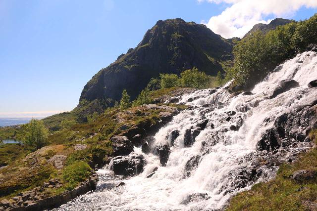
Eventually, when I made it to the top of the cascade, I noticed a dam and some kind of small-scale facility across the stream, which made me think that perhaps this waterfall had some degree of regulation.
The path continued further upstream for another 200m before I encountered a bridge spanning the start of the Studalselva as it drained the fairly large Stuvdalsvatnet.
By the way, I wondered if Studalselva could also be called Stuvdalselva given the name of the lake, and thus could the waterfall also be called Stuvdalsfossen?
In any case, this bridge and view over the lake was my turnaround point, but I did spend some time enjoying the views across the lake towards more cascades in the background.
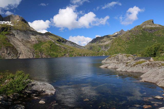
Even though I turned around from this bridge to return to the car park, the trails didn’t end here.
Indeed, had I crossed the bridge and followed the steep uphill path on the left side beyond it, I would have wound up summiting the Tindstinden peak, which would have yielded a top down view over both Sørvågen and Å.
Had I followed the trail skirting the east side of Sørvågvatnet and closer to the distant cascades at the head of the lake, I would have continued on the much longer hike to Munkebu.
Nevertheless, in summary, I wound up hiking about 2.5km or so, and it took me on the order of a leisurely hour or so to do it.
Authorities
The Sorvagen Waterfall resides in the Moskenes Municipality. For information or inquiries about the area as well as current conditions, visit their website.
Related Top 10 Lists
No Posts Found
Trip Planning Resources
Nearby Accommodations
This content is for members only. See Membership Options.Featured Images and Nearby Attractions
This content is for members only. See Membership Options.Visitor Comments:
Got something you'd like to share or say to keep the conversation going? Feel free to leave a comment below...No users have replied to the content on this page
Visitor Reviews of this Waterfall:
If you have a waterfall story or write-up that you'd like to share, feel free to click the button below and fill out the form...No users have submitted a write-up/review of this waterfall


Only logged in users can post a comment Please login or sign up to comment