About Preikestolen Waterfalls
This Preikestolen Waterfalls page was kind of my waterfalling excuse to talk about the famous and impressive Preikestolen formation.
That said, I did spot some noteworthy waterfalls on both the hike to get to Preikestolen as well as the cruise into the Lysefjorden to experience the Hengjanefossen.
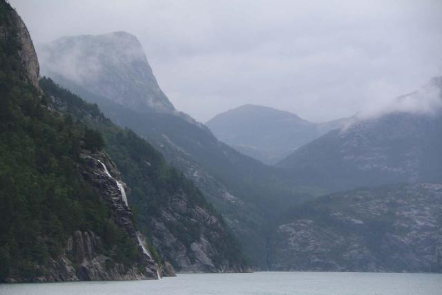
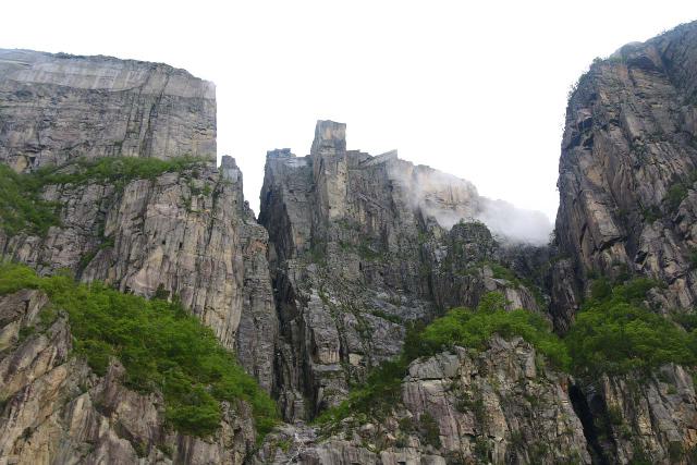
Preikestolen (translated as “pulpit rock” or literally “the priest’s chair”) was a curious plateau surrounded on three sides by vertical cliffs dropping almost right into the waters of the Lysefjorden.
While no one comes here just to witness the waterfalls, they do provide interesting “background” attractions to further add to the overall experience of Preikestolen.
So we describe the waterfalls on this page with that in mind.
That said, we managed to experience Preikestolen from above via a moderate hike as well as from below from a cruise that started and ended in Stavanger.
The Lysefjord Cruise
The selling point of doing the Lysefjord Cruise was to experience the scenic Lysefjorden itself from within the waters of the fjord.
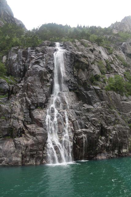
A major draw for us was to get right in front of the Hengjane Waterfall, which was one of the few named waterfalls spilling onto the fjord itself.
To my knowledge, the fjord cruise was the most common way to experience that waterfall. I’m not aware of any other sanctioned means of experiencing it from land.
From the city center in Stavanger, we managed to book and hop on to one of the popular scheduled cruises that leaves from the guest harbor and returns there.
For the most part, the cruise went through fairly featureless stretch of entering the Høgsfjorden then veering into Lysefjorden while avoiding Frafjorden.
Of the three-hour cruise, perhaps 90 minutes or so was spent in the Lysefjorden itself.
The cruise went as far as the Hengjane Waterfall before turning back, but it also spent time beneath the Preikestolen (looking small from below) as well as the Fantahola (basically a deep chasm).
As far as I know, the Hengjane Waterfall as the only waterfall of note that we noticed during the cruise.
Insofar as scenic attractions were concerned, this cruise was a bit on the light side.
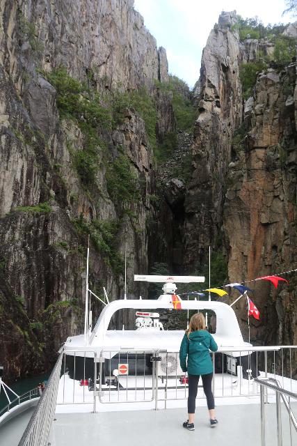
However, we found the experience to be more about relaxing and experiencing Norway in relative comfort.
The Hike to Preikestolen
For a more interactive and immersive experience, I had to hike to the Preikestolen itself.
To make a long story short, hiking to Preikestolen and back required about 4 hours to cover the 8km round trip distance, plus perhaps another 2km of scrambling around looking for alternate overlooks.
During the hike, I didn’t see any significant waterfalls until about 3.8km from the trailhead.
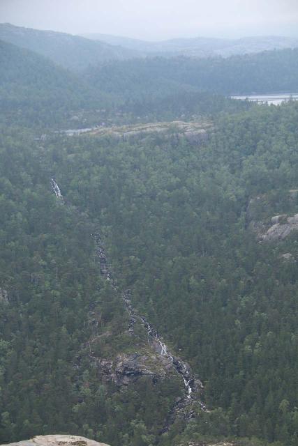
This was where the trail was mostly on sloping granite, and I managed to witness a long cascade on an unnamed creek at the head of Neverdalen.
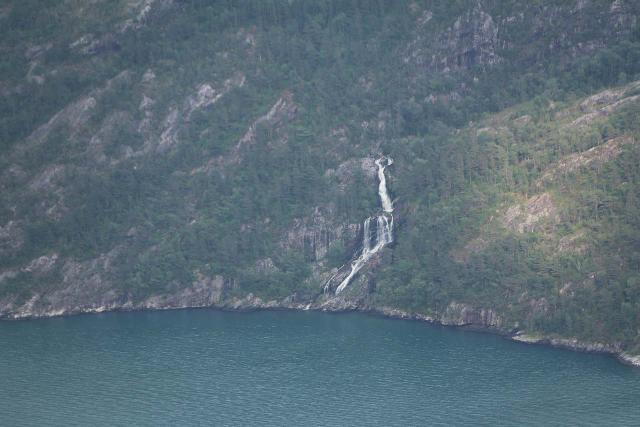
When I finally reached the Preikestolen in another 200m or so, I was able to look across the Lysefjorden towards a waterfall tumbling right into the fjord.
According to the maps, I believe this waterfall belonged to the Fossåna stream, which seemed to drain some lakes and tarns.
But as far as waterfalling experiences went, those two waterfalls were pretty much it.
However, as far as the Preikestolen hike was concerned, the key things to keep in mind were the following:
- This was a very busy trail full of tour bus passengers from all over the world
- The trail relentlessly climbed 334m with most of the elevation gain in the first 2km
- The trail surface was hard granite, which was killer on the knees, especially on the return hike
- Parking wasn’t cheap (I paid about 250 NOK)
Below, I’ll give you a more detailed account of what my hike to Preikestolen was like.
The Hike to Preikestolen: Relentless Climbing
From the spacious car park, I followed some pretty easy signage to get onto the wide and immediately ascending trail.
Given the heavy traffic on this trail, it’s hard to miss.
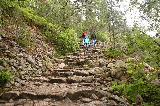
In any case, the initial ascent went for about 500m.
I could tell straight away that the trail consisted mostly of hard granite or granite rocks that the trail makers used to make steps.
I noticed many people brought trekking poles, and while it may be a nuissance to carry them for the whole hike, I can see the wisdom in having them.
After all, if they’re used properly, they can absorb some of the shock on the knees when descending (especially on the return hike).
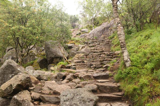
Once the initial ascent ended, the trail flattened out momentarily for the next 300m or so.
The trail switched from an open plateau with brief views over a lake (Revsvatnet) before passing through some forested terrain.
After another mild ascent, the trail flattened out once again. However, this time, it passed through some marshy areas.
Authorities had set up boardwalks to keep hikers from sinking into the muck as well as to protect the soil.
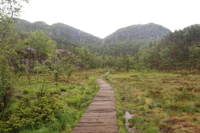
This persisted until about 1.5km from the car park.
Then, the steepest part of the ascent began, which also happened to be the most difficult part of the hike.
Indeed, this next section gained at least over 200-300m in a half-kilometer.
The surface remained unrelenting as it was pretty much all granite and hard rocks so with every step, the joints were met with bone jarring shocks from the impact.
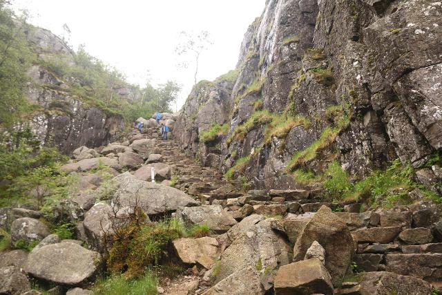
Eventually, after making it to the summit of this part of the hike, I started to see signs again, which indicated that I still had another 2km (maybe a little under that) to go to reach Preikestolen.
While I took my breath, I managed to look back in the direction of the car park where I could see almost all the way out to the sea (or at least the wider fjords that Lysefjorden joined up with).
The Hike to Preikestolen: The Latter Half
The next 2km of the hike pretty much undulated over mostly granite terrain.
For the most part, it hugged some minor cliffs as well as skirted around tarns and small lakes.
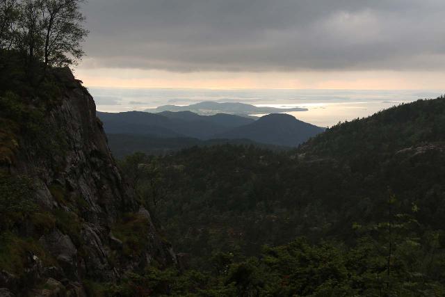
After another 750m from the signs at the top of the brutal climb (or about 3km from the trailhead), I reached a trail junction where the other path had signage telling would-be hikers that it didn’t go to Preikestolen.
So continuing on with the main trail, it traversed more granite plateaus before resuming another round of climbing along a combination of steps and cliffhugging ledges.
As the trail continued to climb a sloping granite incline (roughly 3.75km from the trailhead or 750m from the last trail junction), I managed to get views into the depths of the adjacent side valley called Neverdalen.
And that was where I noticed a thin but long cascade draining unnamed lake or tarn.
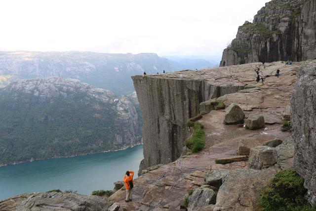
Not much longer beyond the views over Neverdalen, the trail continued hugging cliff ledges, but this time it started to approach the dropoffs facing Lysefjorden.
The trail then veered to the right and followed more wide ledges before finally arriving right on top of Preikestolen.
While I found the experience here to be thrilling (and for many this was the turnaround point of the hike), it left me wanting more in terms of having good views as well as photos of the Preikestolen in context with the Lysefjord itself.
The Hike to Preikestolen: Alternate Views
While the scramble I am about to describe don’t count towards the 8km round trip distance of the official trail, I found it worth the additional effort.
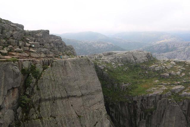
I managed to find red Ts marking the way as soon as I turned around and faced away from Preikestolen.
At that point, I saw faint scrambling paths bringing me up above the immediate granite wall.
Next, I had to scramble around and follow more red Ts along with trails of use, which actually led me further away from Preikestolen.
Eventually, the trail curved to the left and went up another steep incline or wall to get up to the next plateau.
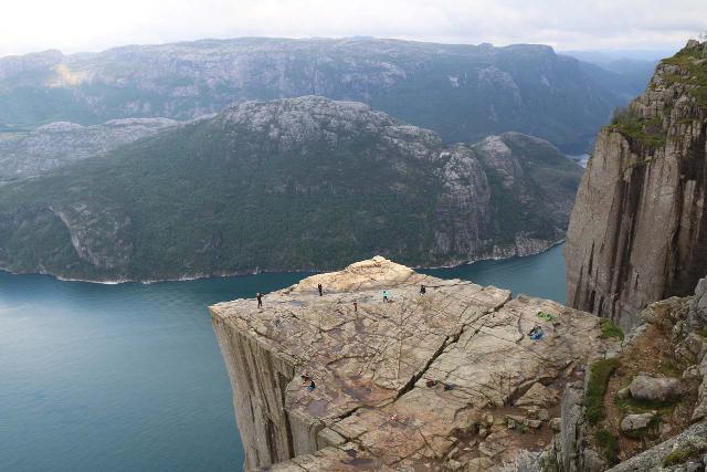
Once above that climb, the trail curved left some more before yielding an interesting top down view of Preikestolen from almost right above it.
At this point, I had scrambled about 250m from the top of Preikestolen to get to this unsigned lookout.
After getting my fill of this unusual view of the famous pulpit rock, the trail continued further inland as it seemed to go even further away from Preikestolen.
In another 200m beyond the unusual view of Preikestolen, I found a trail of use veering back towards Lysefjord on my left.
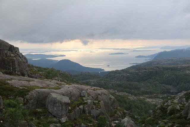
At this point, I had to do a little route finding because there were lots of false trails so I definitely had to exercise caution here.
After descending then ascending a bouldery gully, I then found a trail that took me a fair bit even higher on a cliff-hugging trail.
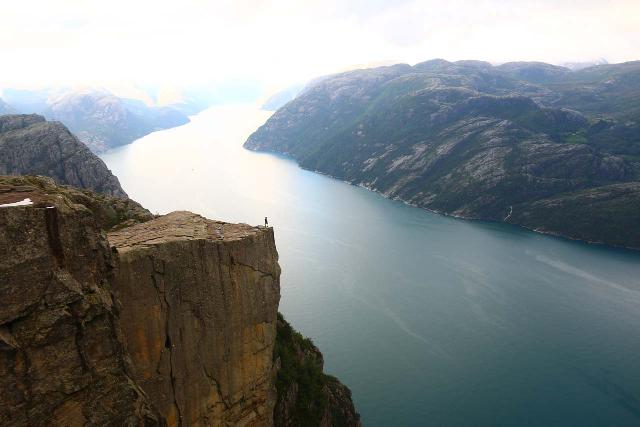
Eventually after 400m from the last view of Preikestolen, I reached a protrusion on a ledge overlooking the Preikestolen backed by Lysefjorden.
This was my turnaround point as I was very happy with this commanding view.
While I’m sure I could have extended my exploration, it was getting late at night so I had to start heading back to ensure I’d be back in time to catch one of the last ferries back to Lauvvik from Oanes.
That said, I did find some mild difficulty trying to backtrack the way I came as it wasn’t obvious where my original trail had disappeared to.
These were the times where a bit of hiking experience and staying calm paid off to regain the main trail and be well on my way to the bone jarring descent back to the trailhead.
Overall, this additional scrambling to the alternate views of Preikestolen took me about a little under an hour covering around 1.3km round trip.
Authorities
The Preikestolen Waterfalls (as well as the Preikestolen itself) sat in the Forsand Municipality in Rogaland County. For information or inquiries about the area as well as current conditions, visit the local government website.
Related Top 10 Lists
No Posts Found
Trip Planning Resources
Nearby Accommodations
This content is for members only. See Membership Options.Featured Images and Nearby Attractions
This content is for members only. See Membership Options.Visitor Comments:
Got something you'd like to share or say to keep the conversation going? Feel free to leave a comment below...No users have replied to the content on this page
Visitor Reviews of this Waterfall:
If you have a waterfall story or write-up that you'd like to share, feel free to click the button below and fill out the form...No users have submitted a write-up/review of this waterfall


Only logged in users can post a comment Please login or sign up to comment