About Gloppefossen
Gloppefossen was one of the highest permanent waterfalls (Reiårsfossen could be taller) in the Setesdal Valley with a cumulative drop of around 120m (or up to 140m if I include some of the cascades above and below the steepest part).
This waterfall actually haunted me ever since the first time we visited the Setesdal Valley back in late June 2005, but completely missed on it.
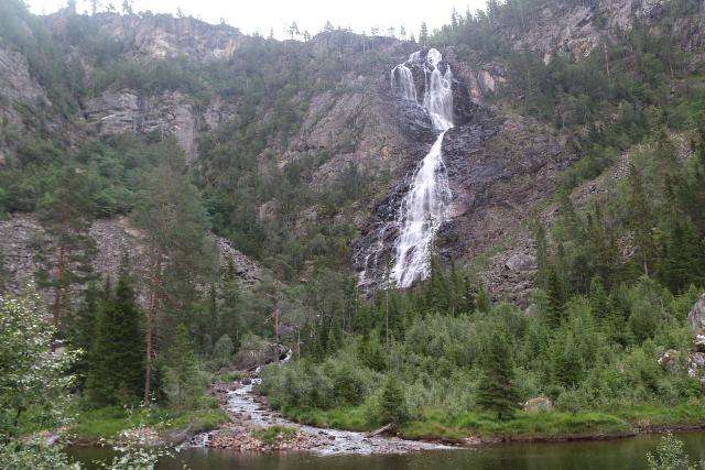
Since then, I had been itching to finally get to see this waterfall, and I had to wait 14 years and towards the end of our 2019 trip when the weather was good enough to finally do it.
The waterfall flowed on the Veiåne River, which was sourced by highland lakes and plateaus including Husebøvatnet as well as Torvikvatnet just to name a few.
So with this permanent flow, it carved a deep and wide canyon called Veiåjuvet through which the hiking trail traversed through while crossing the river about three or four times.
The hike itself was about 3km each way (6km round trip), and didn’t have any severe climbs.
However, all but two of the river crossings were unbridged so I didn’t think it was a good idea to do this hike when the rivers would be swollen during heavy rains (which was the case when we first stayed in Setesdalen in late June 2019).
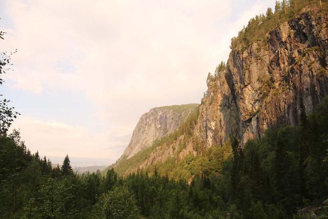
When I came back a month later, the river levels were low enough that I didn’t get my feet wet though there was a good deal of balancing (hiking sticks would help) to get through the unbridged crossings.
Nevertheless, it was a pretty simple hike though I did have to race the morning sun since it was a west-facing waterfall.
In other words, if it’s sunny, then afternoon would be a good time to take photos.
Hiking to Gloppefossen
The hike began right off the Rv7 road at the start of what appeared to be an old gravel road (see directions below).
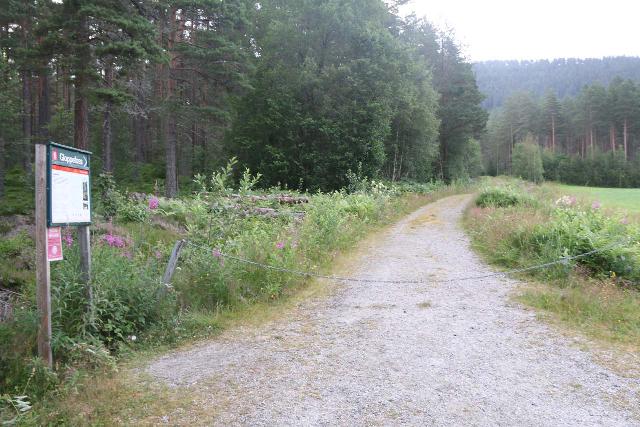
A barricade blocked further vehicular traffic from the turnoff so I had to walk the gravel road.
For the first 1.2km , the gently ascending trail left the open valley and went into a forested area as the trail made a hook bend to the left.
Eventually, the trail arrived at a small loop where the old trailhead used to be, and this confirmed my suspicion that they used to let you drive this gravel road.
In any case, beyond this loop, the trail continued on an old and narrow tractor road as it started to follow the Veiåne (or Veiåni as labeled on Norgeskart) and would do so for the remainder of the hike.
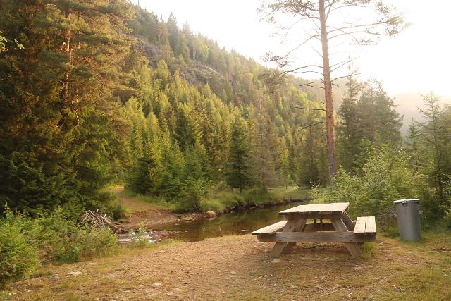
At a little over 400m from the old trailhead (or 1.6km from the current trailhead), I reached a crossing of the river.
Although I could have gone right through this crossing unbridged, I did notice a pretty sturdy footbridge nearby, so I took that to avoid getting wet.
Beyond the bridge, the trail resumed its gentle riverside meander for the next 900m or so.
Towards the end of this stretch, the trail probably reached its highest point where there was some kind of box as well as my first glimpses of the Gloppefossen up ahead.
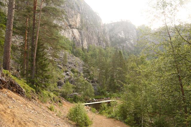
After a brief descent back down to the river level, the trail made another river crossing, which was also bridged during my visit in July 2019.
Beyond this footbridge, the twisted a few times with the falls being partially visible throughout, and as the views of Gloppefossen became tantalizingly close, I then encountered the third river crossing roughly 350m beyond the second bridge.
Unlike the first two crossings, this third crossing was unbridged, but there were some big rocks arranged so that I could balance myself on them and still make the crossing without getting wet.
Shortly after getting across this third crossing of the Veiåne, the trail briefly went up and down a short hill before encountering the fourth and final crossing less than 100m later.
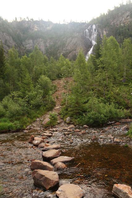
Of all the river crossings, this last one was the trickiest to traverse without getting wet.
After getting past the last of the stream crossings, I then went about 50-60m further before I finally got to a place where I got a pretty satisfying view of the entirety of Gloppefossen.
While there were false trails or signs of other people scrambling further (either for different views or perhaps to get to the bottom fo the falls – requiring yet another river crossing), this was my turnaround point.
The return hike was mostly gradually downhill on the return, so when all was said and done, I took a little over 2 hours away from the car to cover the 6km round trip.
Authorities
Gloppefossen resides in the Valle Municipality. For information or inquiries about the area as well as current conditions, visit their website.
Related Top 10 Lists
No Posts Found
Trip Planning Resources
Nearby Accommodations
This content is for members only. See Membership Options.Featured Images and Nearby Attractions
This content is for members only. See Membership Options.Visitor Comments:
Got something you'd like to share or say to keep the conversation going? Feel free to leave a comment below...No users have replied to the content on this page
Visitor Reviews of this Waterfall:
If you have a waterfall story or write-up that you'd like to share, feel free to click the button below and fill out the form...No users have submitted a write-up/review of this waterfall


Only logged in users can post a comment Please login or sign up to comment