About Triple Falls

Triple Falls was kind of the lone wolf waterfall within the boundaries of the Uvas Canyon County Park mostly because it was a bit out of the way in Alec Canyon compared to the other six waterfalls we had encountered in and around the Waterfalls Loop along Swanson Creek. Just doing the out-and-back hike to this waterfall required an additional 90 minutes. And it was because of the extra effort it took us to get here that I decided to give this waterfall its own write-up instead of including it in an already packed write-up for the rest of the Uvas Canyon Waterfalls. Even though the hike was a modest 2.6 miles round trip (more or less), the trail was time consuming in that there was quite a bit of steep elevation gain for a good part of this hike into Alec Canyon.
As for the waterfall itself, its isolation from the rest of the waterfalls meant that the trail to get up there was very quiet and peaceful (although our experience with the Waterfalls Loop was also pretty quiet relatively speaking). The scenery was also a bit more varied as the elevation gain meant we climbed above most of the trees and were able to get birdseye views of Uvas Canyon as well as the neighboring canyons and gullies along with all the developments within. That said, Triple Falls was fed by a different stream, and during our visit, it had quite a bit less waterflow than what we had seen earlier in Swanson Creek (as you can see in the photo at the top of this page). So I’d imagine it would be best to visit this falls during a Wet Winter shortly after some pretty substantial rainfall had fallen.
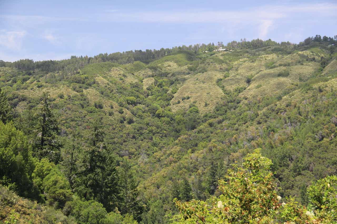
Beyond this overlook, the climb was less severe as it followed the contour of the mountain while going past the junction with the one end of the Contour Trail (the other end was between Upper Falls and Basin Falls in the Waterfalls Loop described here). The trail continued to persist along the contour of the mountain we were on for the next half-mile until we reached Manzanita Point some ten minutes after leaving the first overlook. At Manzanita Point, we were able to get a clearer view of the canyon scenery to the east of Uvas Canyon as well as see the side canyon we were about to enter (Alec Canyon).
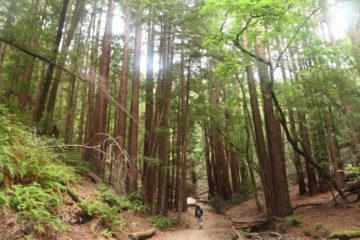
As the trail curved to the right to enter Alec Canyon, it descended for the next quarter-mile as it re-entered the shade of the forest, where we then encountered a trail junction. We kept right at this junction to go the last 0.2 miles to Triple Falls. This last stretch undulated along the creek responsible for Triple Falls, and it was interesting in that we were walking amongst several coastal redwood trees that seemed to be a bit more abundant than what we encountered within Uvas Canyon itself. As for the creek, it was eerily quiet as we were worried Triple Falls wouldn’t be flowing, but as we went further up the trail, we started to see bits of the stream, which meant that the water tended to be concealed beneath the debris deposited in the creek. And the further up the trail we went, the more of the stream we started to see. Eventually, the trail would dead-end at the viewpoint of Triple Falls, where we finally got to see the three-tiered thin drop totalling probably 40-50ft or so.
Once we got our fill of this falls, we went back the way we came. Even though the hike back was mostly downhill, we did have to climb uphill on the initial stretch where we had to get back to the overlook at Manzanita Point. Then, when we had to descend the steep part back to the Uvas Canyon County Park parking lot, we had to be careful not to slip and fall due to the steep grade of the trail.
Related Trip Reports
Related Top 10 Lists
No Posts Found
Related Itineraries

Trip Planning Resources


Nearby Accommodations
This content is for members only. See Membership Options.Featured Images and Nearby Attractions
This content is for members only. See Membership Options.Visitor Comments:
Got something you'd like to share or say to keep the conversation going? Feel free to leave a comment below...No users have replied to the content on this page
Visitor Reviews of this Waterfall:
If you have a waterfall story or write-up that you'd like to share, feel free to click the button below and fill out the form...No users have submitted a write-up/review of this waterfall
Only logged in users can post a comment Please login or sign up to comment