About Sycamore Canyon Falls
Sycamore Canyon Falls (also called Rancho Sierra Vista Falls) sits in Point Mugu State Park, which itself resides in the Santa Monica Mountains on the Thousand Oaks side.
Each time we’ve visited this falls, we’ve found it to be quite a popular (read: crowded) attraction.
I’d speculate that the reason for the popularity of this excursion was due to the presence of other attractions in the area.
Such attractions included the Satwiwa Native American Natural Area, nice panoramic views of the rock-exposed Boney Mountain as well as views towards the Hidden Valley basin, and wildflower (and wildlife) sightings.
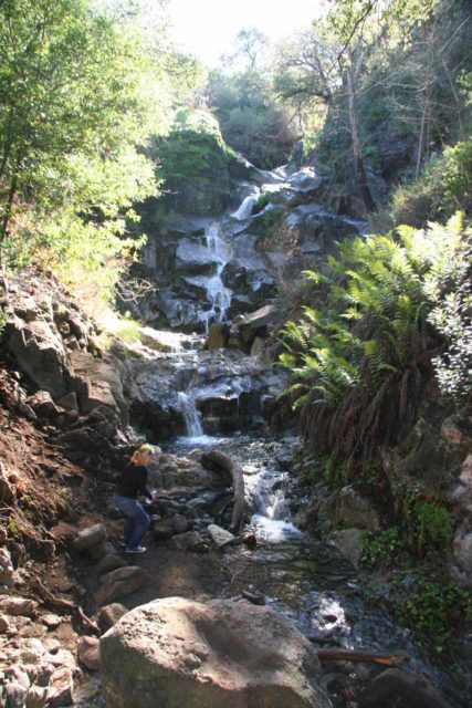
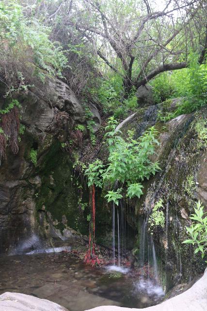
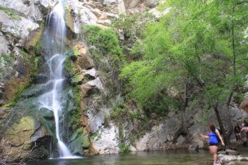
As for the waterfall, it cascaded in multiple tiers for a cumulative height of around 50ft to 75ft.
Admittedly, these are figures that I just pulled out of my gut.
We also saw numerous people scramble up the slippery rocks alongside Sycamore Canyon Falls to its top.
So this waterfall certainly had no shortage of distractions as well as somewhat of a fun factor.
Optimizing the Sycamore Canyon Falls Experience
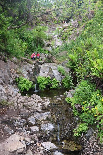
Sycamore Canyon Falls was also a waterfall that had a bit of a temperamental behavior when it came to its flow.
Therefore, an optimal experience with the falls required some degree of timing.
Thus, to maximize the enjoyment of this waterfall, we’d want to time our visit for maximal flow.
The first time we visited the falls was during New Years Day during a dry winter (around the 2002 time frame) so obviously we were disappointed that it was hardly flowing.
The second time we made a visit, it occurred shortly after a Winter storm in late January and the falls had nice flow.
The third time we came to Sycamore Canyon Falls, it occurred late in the season in early June on a high rainfall year, but the falls definitely had seen better days.
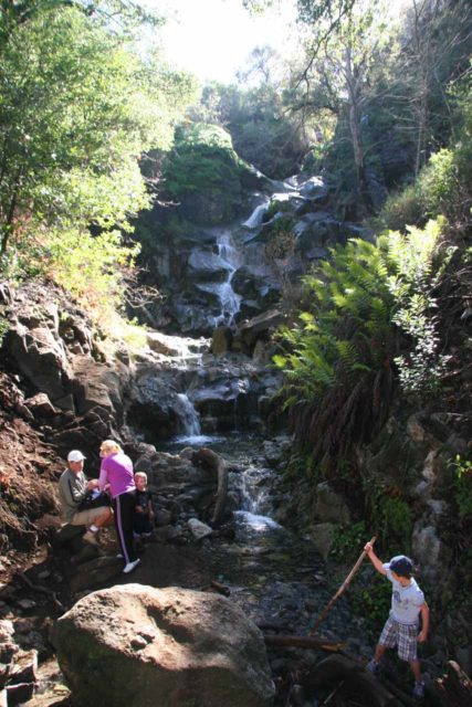
So I guess given these experiences, we speculate that the falls would be at its most impressive after sustained rainfall likely in late Winter or early Spring.
In addition to the flow, we also realized that photographing this waterfall would be best done in the afternoon.
That’s because our experiences have demonstrated that we looked against the morning sun when we tried to beat the crowds by showing up early.
Finally, the hike to Sycamore Canyon Falls used to be as little as 2.4 miles round trip, but that was probably back when it was easier to drive closer to the Satwiwa Cultural Center at the heart of Rancho Sierra Vista.
Over the years, we’ve found that a more realistic hiking distance was more like 3 miles round trip.
Each time we’ve done this hike, we generally took between 90 minutes to 2.5 hours depending on how often we made stops.
We easily could have walked more than this distance, however, due to the many criss-crossing trails with opportunities to go on detours or side excursions, it was easy to get sidetracked and take longer than expected.
Anyways, we’ll talk about the two main ways we’ve done this excursion so you can have an idea of the pros and cons of either approach.
The Wendy Trail Approach to Sycamore Canyon Falls
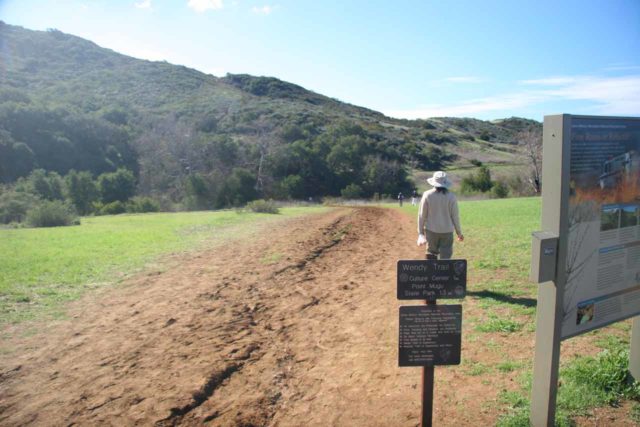
This approach to Sycamore Canyon Falls involved starting the hike from the spillover parking area near the residences along Potrero Road near Wendy Drive (see directions below).
Since this was the directions described in Ann Marie Brown’s book, this had been our favored approach.
From the unpaved shoulder parking area along Portrero Road, we took the Wendy Trail, which started across Portrero Road from Wendy Drive.
We then had a choice of hiking paths.
The Wendy Trail to the Satwiwa Culture Center
The first decision point gave us a choice of following the Wendy Trail on the right or continuing towards the Windmill Trail on the left.
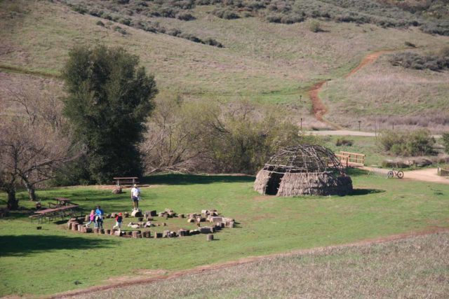
The Wendy Trail was a multi-use trail (i.e. they allowed mountain bikers) that ultimately would lead near the Satwiwa Native American Indian Culture Center in another 3/4-mile or so.
However, we kept left to continue another 0.2 miles to another decision point.
At this fork, we kept left to go another 0.1-mile to another fork in the trail. The path on the right rejoined the Wendy Trail.
Choosing Between the Lower Satwiwa Loop or the Windmill Trail
At the next decision point (after keeping left), we had a choice of keeping right to take the Wendy-Satwiwa Connector Trail to the Lower Satwiwa Loop, or we could have kept left to take the more undulating Windmill Trail.
The Wendy-Satwiwa Connector to Lower Satwiwa Loop Trail would ultimately lead another 0.6 miles to the Danielson Road, which was a trail skirting the contours of Sycamore Canyon.
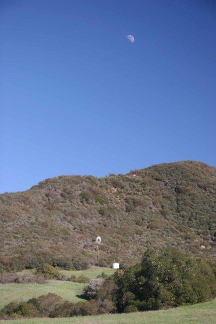
This trail undulated through a combination of grasslands flanked by wildflowers as well as even a rosemary grove.
The Windmill Trail led past an old weather vane next to some kind of water tank.
This trail climbed on the foothills offering views back across the valley, and in one of our visits, we used this trail to get nice views towards rare snow-capped mountains near the Sespe Wilderness in the distance.
The Windmill Trail eventually led back to the Danielson Road near the Satwiwa Loop Trail junction (probably another 0.2-mile longer than the direct Lower Satwiwa Loop Trail route).
However, we could have also taken the Windmill Trail further up the hill towards the Hidden Valley Overlook Trail, but then we’d have to backtrack down the hill towards Danielson Road to resume the waterfall hike.
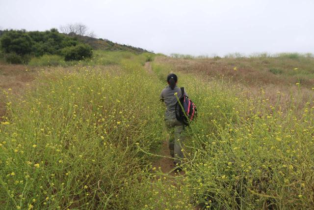
In any case, once we were on Danielson Road, the trail then veered to the east as it climbed and followed the contour of Sycamore Canyon.
Danielson Road to Sycamore Canyon Falls
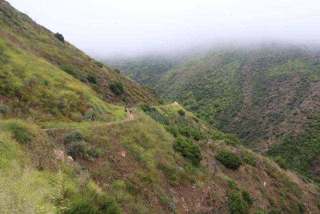
Along this stretch, we had attractive views into Sycamore Canyon.
The trail also revealed more wildflowers as it continued generally uphill towards the upper reaches of the canyon itself.
After about 0.1-mile from the junctions and past the bench overlooking Sycamore Canyon, we reached a fork in the trail where the left fork was the Hidden Valley Overlook Trail while the right fork continued along Sycamore Canyon to the falls.
Note that if you took the Windmill Trail to Hidden Valley Overlook Trail, this is where you would have backtracked to in order to reach Danielson Road.
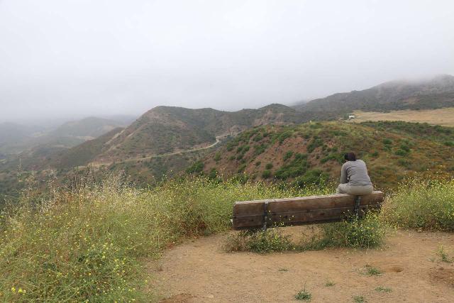
Anyways, taking the lower trail on the right to continue on Danielson Road, we’d eventually enter the canyon itself as the trail descended somewhat and joined up with the Upper Sycamore Canyon Trail in another half-mile.
By this time, the trail skirted alongside the seasonal creek responsible for Sycamore Canyon and we entered a lush area flanked by burnt trees (from several past fires) as well as more wildflowers in bloom.
After crossing the creek, the trail continued ascending for another 0.2 miles before reaching another junction.
We kept left at the junction to continue on the Waterfall Spur to go the final 0.1-mile to the base of Sycamore Canyon Falls.
The switchback on the right would continue uphill deeper into Pt Mugu State Park on the Old Boney Trail.
Once at Sycamore Canyon Falls, we had the choice of just enjoying the views or scrambling higher up the cascading waterfall in an effort to see its uppermost tiers.
Although many people do the steep scramble to the waterfall’s hidden uppermost tiers, there was definitely an element of danger as a slip-and-fall here along with poison oak exposure could ruin a visit here.
Personally, I wouldn’t recommend kids to do the scramble to the top as they may not know the danger they would be putting themselves in.
Anyways, the waterfall itself featured small tiers with pools that often had salamanders or water bugs in them.
So it was a suitable place to relax and enjoy one of the Santa Monica Mountains’ more dramatic waterfalls.
After having our fill of the falls, we returned the way we came though there were many options on which return route to take.
The Satwiwa Loop Approach to Sycamore Canyon Falls
This approach to Sycamore Canyon Falls started from the main parking lot (see directions below).
Over the years, it appeared that the park authorities had made the old Portrero Road approach specific for handicap and park employee access, and that main parking lot became the de facto starting point for most people.
So I’d imagine this would be the most common approach to reach the Sycamore Canyon Falls.
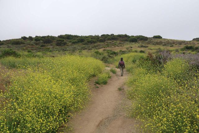
From this parking lot, we hiked for about 0.4 miles along a flower-fringed wide path (shared with mountain bikers) as it eventually joined up with the Big Sycamore Canyon Trail.
The Big Sycamore Canyon Trail was paved near the vicinity of the Satwiwa Native American Indian Culture Center and Chumash Demonstration Village (where the round hay shelter was).
Possible Confusion to get from Satwiwa to Danielson Road
Because there were at least four trails leaving from the Satwiwa area, it was very easy to get sidetracked and wind up going away from Sycamore Canyon Falls (we’ve certainly made that mistake ourselves).
So we’ll talk you through the options in an effort to minimize the confusion.
First, there was a bridge that left the paved part of the Big Sycamore Canyon Trail.
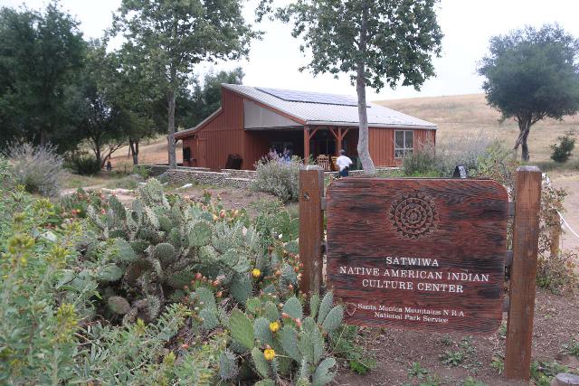
On the other side of the bridge, we headed on a wide path to the left right to the heart of the Rancho Sierra Vista / Satwiwa area (i.e. the cultural center).
Continuing on this wide path past the cultural center would continue further east onto the wide open grassy Satwiwa Loop Trail just north of a pond.
This trail was part of the Satwiwa Loop Trail, and it would eventually intersect with the Lower Satwiwa Loop Trail in about 0.4 miles or the Windmill Trail in another 0.2 miles.
From there, if we took the Lower Satwiwa Loop Trail, we’d have to backtrack 0.3 miles along it to reach Danielson Road.
If we took the longer route to Windmill Trail, we’d have to backtrack about 0.6 miles to get to the same junction.
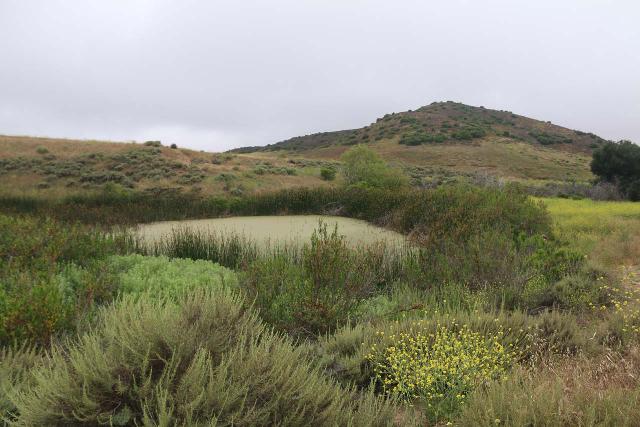
On the Windmill Trail, we would also have the option to go further uphill towards the Hidden Valley Overlook Trail, which would require us to backtrack towards a fork with Danielson Road about 0.1-mile up the hill from the main junction with Danielson Road as described earlier.
The Most Direct Approach from Satwiwa to Danielson Road
However, the most direct trail to the Sycamore Canyon Falls actually climbed immediately to the right after crossing the bridge leaving Big Sycamore Canyon Trail.
Since that path wasn’t signed, it was very easy to miss, especially since the larger signed path went to the Culture Center away from this narrower path.
Anyways, this direct trail went southeast for about 0.4 miles to the Danielson Road (passing south from the pond).
It was as if they wanted you to hike the Satwiwa Loop Trail in a clockwise manner and not in the other direction, which was the most direct route leading to Danielson Road.
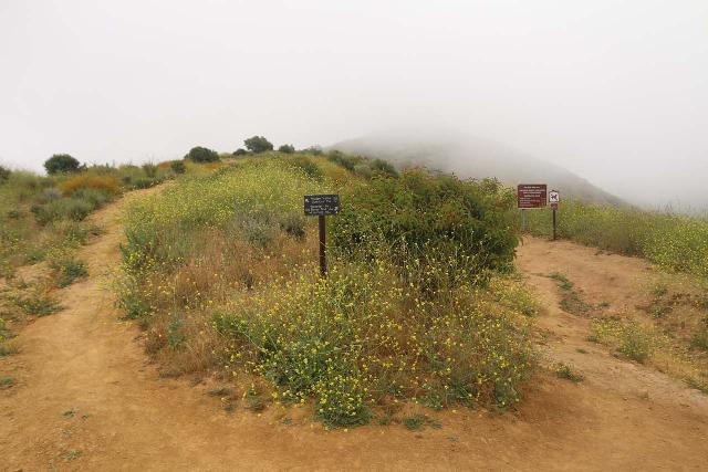
Once at Danielson Road, there were many other trails joining up here right at the edge of Sycamore Canyon.
The Least Confusing (but not the shortest) Approach from Satwiwa to Danielson Road
Of course, if you find it confusing trying to figure out of which of the many paths to take, you could always continue south on the paved Big Sycamore Canyon Trail.
Taking this slightly longer approach south for another 0.3 miles, it would eventually join up with Danielson Road, where we’d leave the pavement and follow the Danielson Road east.
After about 0.3 miles of hiking on Danielson Road (which now skirted the rim of Sycamore Canyon), we’d ultimately arrive at the junction with several other trails in another 0.3 miles.
From this junction, we’d continue on the Danielson Road, which still followed the contours of Sycamore Canyon, and we’d follow the directions as stated above for the final 3/4-mile or so to reach the Waterfall Spur and ultimately the Sycamore Canyon Falls.
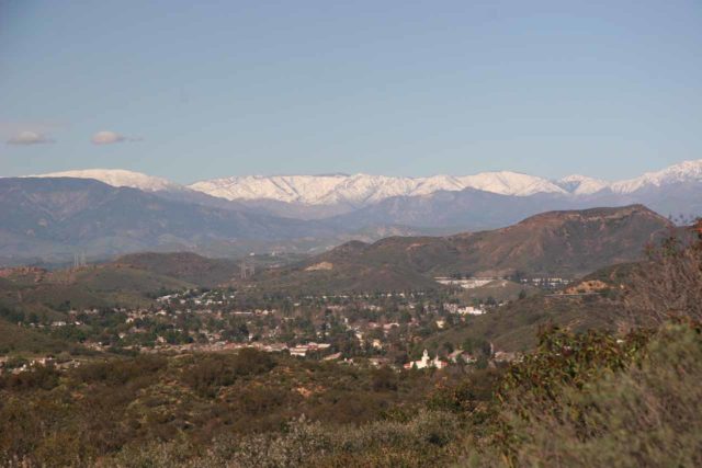
After having our fill of Sycamore Canyon Falls, you can see that there was certainly no shortage of return routes (and subsequent potential for getting lost or confused).
At least on the return, you have the benefit of being in higher ground so you would generally have an idea of where you’re going.
Authorities
Sycamore Canyon Falls resides in Pt Mugu State Park, but it’s also within the Santa Monica Mountains National Recreation Area. For information or inquiries about this area as well as current conditions, visit the NPS website.
Related Top 10 Lists
No Posts Found
Trip Planning Resources
Nearby Accommodations
This content is for members only. See Membership Options.Featured Images and Nearby Attractions
This content is for members only. See Membership Options.Visitor Comments:
Got something you'd like to share or say to keep the conversation going? Feel free to leave a comment below...No users have replied to the content on this page
Visitor Reviews of this Waterfall:
If you have a waterfall story or write-up that you'd like to share, feel free to click the button below and fill out the form...No users have submitted a write-up/review of this waterfall


Only logged in users can post a comment Please login or sign up to comment