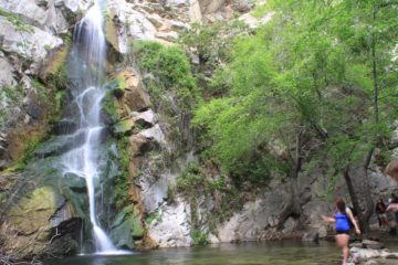
About Portrero John Falls

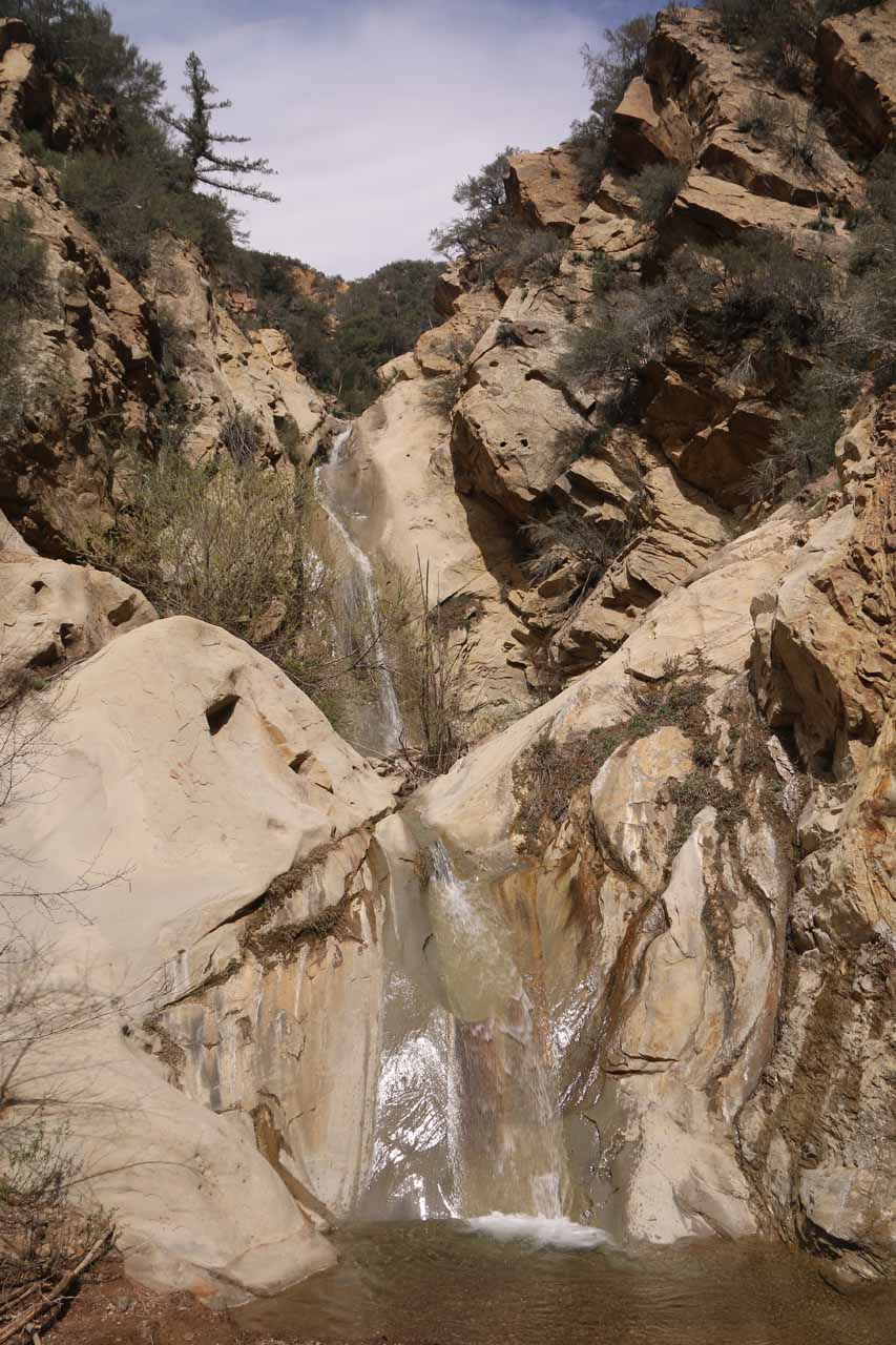
Portrero John Falls was a waterfall that had eluded us ever since we were first made aware of it in an old waterfall book from Chris Schaffer back around 2003 or 2004. After seeing this waterfall make an appearance in one of Ann Marie Brown’s later editions of her California Waterfalls book, we were waiting for the right opportunity to finally experience this falls. However, for one reason or another, that opportunity never came due to other waterfalling priorities followed by a multi-year drought that had plagued us for the last 5-6 years. It wasn’t until mid-March in 2017 when we finally had enough rain in the Winter season to give us the confidence to overcome the time commitment and difficulty to give this falls a try. And as you can see from the photo at the top of this page, we weren’t disappointed in this multi-tiered waterfall dropping down a bright sloping cliff over an estimated cumulative height of 70ft.
In order to reach this falls, we had to overcome many obstacles that would deter the most casual visitors. The first obstacle was the driving distance (at least as far as a day trip from say Orange County would be concerned), which we’ll get to in the driving directions below. Once we got to the unassuming Portrero John Trailhead, we then had to follow a pretty well-established trail that criss-crossed Portrero John Creek a seemingly uncountable number of times. Depending on the water level of the creek, one might need water shoes (I used Keens just in case) instead of Gore-tex high-top hiking boots. There were a handful of head-scratching moments when it came to the best spots to cross the creek or scramble past eroded embankment obstacles, but for the most part, the first 1.6 miles of the hike along the trail was fairly straightforward.
Continuing on after the camp, the mountains had closed in and the trail would eventually coincide with Portrero John Creek. It was here that we had to negotiate the next major obstacle in reaching the falls – the stream scrambling. While we were actively looking for trails alongside Portrero John Creek, more often than not, we were better off just doing the awkward scramble through creek boulders and climbing over fallen trees or pushing aside whipping branches in order to push forward. Aside from an interesting striated cliff that reminded me of a poor man’s version of The Wave in Paria Canyon near the Arizona-Utah border, this 1.2-mile scramble was for the most part featureless. The slow progress of the scramble also meant that this stretch would take another hour.
Eventually, the gorge itself and the creek would become one as we’d eventually find ourselves having to climb waterfalls and cascades themselves. Luckily for us, there were some rock cairns (though they may not necessarily be there all the time) hinting to us where were the easiest spots to make the traverse. At other times, there were ledges that we were able to get a foothold on, especially where the cascades and minor waterfalls had formed notches in the underlying bedrock. Once we got to the top of the series of waterfalls and cascades, we eventually found ourselves right at the base of the lower drop of Portrero John Falls. When viewed directly, we could see the more impressive upper drop right behind it, but in order to get there, we had to make a steep scramble up a steep, slippery, and somewhat overgrown trail-of-use to the left of the lower waterfall, which eventually got us to the area above the lower drop. Then, we were able to make the final descent to get right up to the base of the main drop of Portrero John Falls.
While it took Mom and I about 2.5 hours to get here, there wasn’t a whole lot of shade around this falls to really enjoy a picnic here. Rather, it seemed more like a good spot to cool off on a hot day provided there was water. Given the amount of trouble it took to get here, we were the only ones at the falls as well as on the trail on the Sunday that we showed up. It was hard to say just how reliable the falls would be flowing year in and year out, but the state you see the falls in on this page pretty much reflected nearly a month without significant rain after the nearly record rains we had been getting between December and February.
When it came time to head back to the trailhead, scramble back to the Portrero John Campground was tricky as we happened to lose the trail as we were too focused on the stream scrambling. But once we regained the main trail, the hike was once again pretty straightforward, especially compared to the scrambling on Portrero John Creek. When we got back to the trailhead, we wound up spending about 5 hours away from the car to go the roughly 5.6 miles round trip. The time spent that I’m quoting included our photo stops and the brief half-hour picnic to prepare ourselves for the return scramble and hike. In addition to leg and foot cramps, our arms and faces received quite a few scratches from having to brush up against overgrowth and tree branches that were in the way. Indeed, this was definitely not a family friendly hike, and it was a good thing I didn’t bring my young daughter along on this one.
Related Top 10 Lists
No Posts Found
Trip Planning Resources


Nearby Accommodations
This content is for members only. See Membership Options.Featured Images and Nearby Attractions
This content is for members only. See Membership Options.Visitor Comments:
Got something you'd like to share or say to keep the conversation going? Feel free to leave a comment below...No users have replied to the content on this page
Visitor Reviews of this Waterfall:
If you have a waterfall story or write-up that you'd like to share, feel free to click the button below and fill out the form...No users have submitted a write-up/review of this waterfall
Only logged in users can post a comment Please login or sign up to comment