About “Cold Creek Falls”

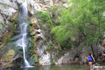
“Cold Creek Falls” was one of those obscure waterfalls that felt to us like it was our own little private waterfall to enjoy in seclusion. This seclusion and tranquility was even more amazing considering how close it was to the busy Hwy 38 running between Redlands and Big Bear Lake. Even though the 15-20ft falls itself wasn’t particularly impressive (as you can see from the photos on this page), it had put us in a relaxed mood as we got to enjoy our little daughter playing in a snow patch next to the falls while we had the falls all to ourselves. This most certainly wouldn’t have been the case with a more impressive waterfall like Big Falls further down the mountain.
We were only made aware of this waterfall after consulting Ann Marie Brown’s book about California Waterfalls. However, in her entry, she had called the falls “Mill Creek Road Falls” as it was right off the Mill Creek Road when she had made her visit. During our visit, we noticed that the same road she was referring to was now called Middle Control Road. And as much as I was compelled to call this the “Middle Control Road Falls”, I had noticed on GoogleMaps that this waterfall was actually on Cold Creek. And so I decided to go with calling this falls “Cold Creek Falls”.
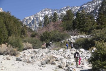
Also contrasting with Brown’s experience, the road leading down to the falls was actually open to traffic. At first we didn’t realize this when we were about to walk down this unpaved road as she had done. But that wasn’t until we saw someone driving a Camry go down the road in front of us. So after having seen that, we then decided to just follow their lead and drive the narrow and bumpy road ourselves. That was when we found this waterfall spilling right besides a hairpin bend on the road, which for all intents and purposes meant that “Cold Creek Falls” was a drive-to waterfall.
The falls gently made its way down some hard bare rocks within a shadowy little north-facing corner that still had a fairly sizable patch of snow next to it (which our daughter enjoyed playing in very much) during our early March 2015 visit. We also managed to notice the same kind of bare rocks, which had some interesting shapes to them, a short distance away from the falls itself. Now while the falls had pretty low flow despite our suspicion that the snowmelt should be pretty maximal at the time of our visit (given high temperatures almost a week after the latest significant storm in a drought year), I suspect this falls probably would have a short season that’s completely dependent on the snow conditions and the subsequent thaw when the snowfall ends. All in all, this little spot made for a nice diversion though admittedly, it probably wouldn’t be worth going out of the way for it. In fact, after we had our fill of this waterfall, we made the detour to the nearby Big Falls before making our way home.
Related Trip Reports
Related Top 10 Lists
No Posts Found
Trip Planning Resources


Nearby Accommodations
This content is for members only. See Membership Options.Featured Images and Nearby Attractions
This content is for members only. See Membership Options.Visitor Comments:
Got something you'd like to share or say to keep the conversation going? Feel free to leave a comment below...No users have replied to the content on this page
Visitor Reviews of this Waterfall:
If you have a waterfall story or write-up that you'd like to share, feel free to click the button below and fill out the form...No users have submitted a write-up/review of this waterfall
Only logged in users can post a comment Please login or sign up to comment