About Beauchamp Falls

Beauchamp Falls was another waterfall that we targeted a visit to while touring the Great Otway National Park as we briefly detoured inland from the famous Great Ocean Road. What attracted us to this 20-25m waterfall was its satisfying rectangular shape surrounded by native bush. It seemed like this particular waterfall didn’t quite get the same fanfare as other neighboring waterfalls in the Otways so that allowed Julie and I to pretty much enjoy this waterfall all by ourselves when we first visited this place back in November 2006. We came back 11 years later, and it appeared that word had gotten out about this falls as I had noticed that many more people were enjoying the falls as well as the campgrounds near the trailhead.
As for its flow, as you can see in the photo above, this waterfall seemed pretty healthy. Each time we’ve been to the falls (both in November 2006 and in November 2017), Deppeler Creek had similar flows each time. This attested to the high rainfall nature of the Otways, which seemed to be more drought resistant compared to other parts of Victoria. And this was even more apparent during our first visit here when a severe drought gripped the southeastern region of Australia for the better part of the decade!
The track started off from the fairly open car park (which some people also used as a campground). The track then descended on a pretty peaceful walk amongst the native forest trees and ferns that seemed to be a distinguishing feature of the Otways rainforest. The track seemed to be on a mix of old logging roads and dirt track as it continued mostly downhill towards Dappeler Creek (the watercourse responsible for Beauchamp Falls). It definitely seemed more primitive and less developed compared to the other neighboring waterfalls like Triplet Falls and Hopetoun Falls. Once the track bottomed out near the creek, it then followed along the creek briefly to the north before making a final bend and steep descent to the waterfall.
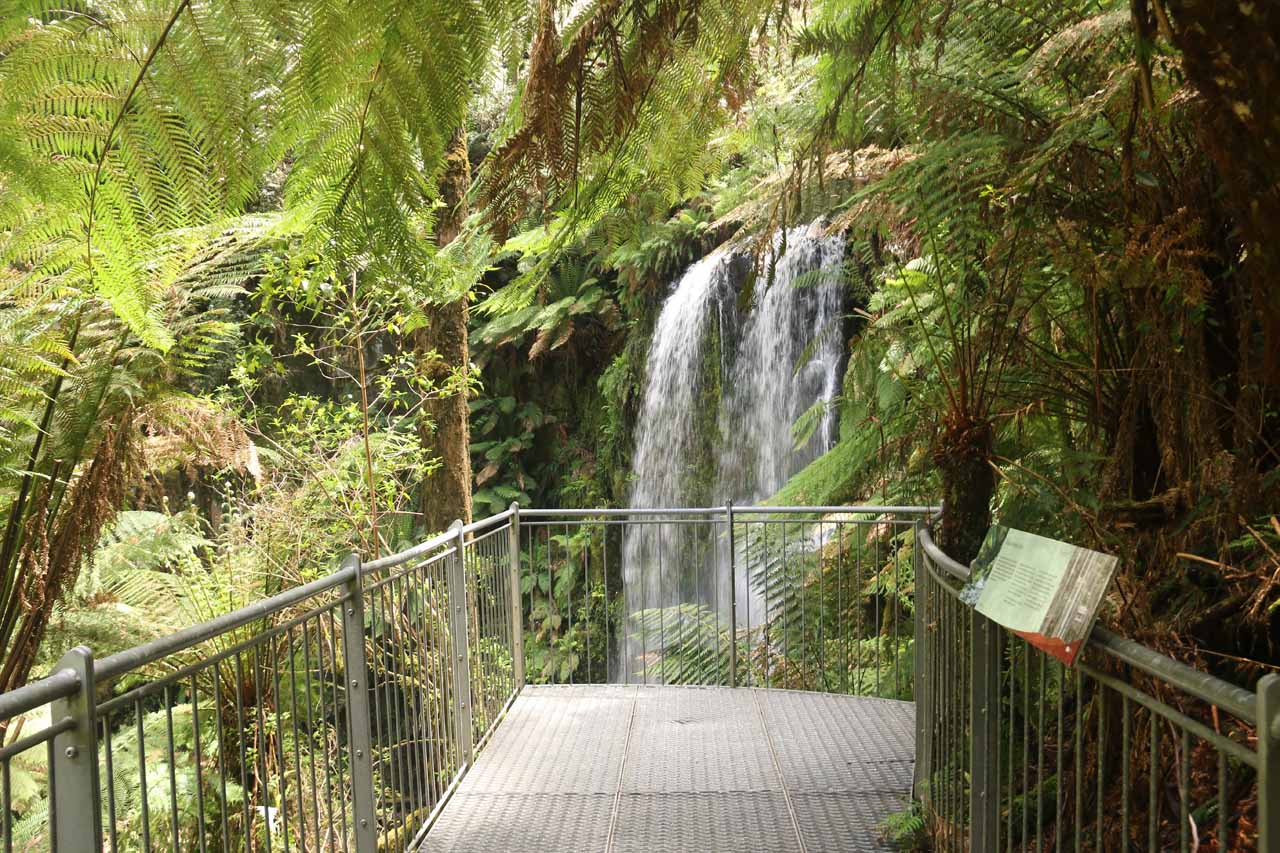
The descent involved going down several steps before reaching a newly developed walkway that would eventually lead right up to a mostly overgrown and non-ideal viewing spot of the upper part of the Beauchamp Falls. The first time Julie and I were here back in 2006, this viewpoint wasn’t there. Instead, we had to walk along Dappeler Creek and enjoy the falls from its very bottom, which I contend would still be the best place to experience the falls. That said, it appeared that Parks Victoria had purposefully built railings along the final portion of the track to obscure the old path to the base of the falls. This development may be to prevent further erosion caused by the scramble to the creek as well as to limit the likelihood of slip-and-fall injuries due to the muddy terrain and slippery rocks.
Despite the infrastructure to obscure the old path, there were still plenty of visitors determined to get a better view of the falls via the old path. The old path wasn’t hard to spot, especially since we knew where to look having been here before. Regardless, after having our fill of the falls, we then made the long climb back up to the car park.
Related Trip Reports

Related Top 10 Lists
No Posts Found
Related Itineraries


Trip Planning Resources


Nearby Accommodations
This content is for members only. See Membership Options.Featured Images and Nearby Attractions
This content is for members only. See Membership Options.Visitor Comments:
Got something you'd like to share or say to keep the conversation going? Feel free to leave a comment below... Tree Ferns February 23, 2018 3:09 pm - Hi, I liked your blog of walk to Beauchamps Falls in the Otways, but noticed you wrote about "umbrella ferns". These are called TREE ferns in Australia, there are only 2 types, Dicksonia & Cyathea. Remnant vegetation from when Australia was joined as part of Gondwana - very slow growing. About an inch per year,… ...Read More
Visitor Reviews of this Waterfall:
If you have a waterfall story or write-up that you'd like to share, feel free to click the button below and fill out the form...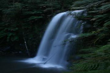 Beauchamp Falls September 2010 July 4, 2011 3:55 am - We visited Beauchamp Falls in September 2010. Our original goal was Hopetoun Falls but somehow we missed that and ended up here instead! A long walk in the rain, but certainly worth the effort and I got one of my favourite photos here. ...Read More
Only logged in users can post a comment Please login or sign up to comment