About Adams Falls

Adams Falls (also known as Adams Canyon Falls) was definitely one of the more adventurous waterfalls that I pursued while waterfalling the Salt Lake City area during our Memorial Day Weekend 2017 Trip. The waterfall was named after Elias Adams who was an early settler of East Layton. In a year where the Wasatch Range received heavy snowfall throughout the Winter and Spring months, that also created conditions that were ripe for a bit more scrambling and stream walking than what was typical according to the locals I’ve met. Indeed, the difficulty score reflected that increased degree of difficulty as a result of the high water conditions. That said, as you can see from the photo above, the attractive 40ft rectangular waterfall was a worthy reward for all the trouble. The underlying red cliffs also added more color to the overall scene, and its spray was refreshing after all the pretty hard hiking it took to get up here. Indeed, this excursion had it all – the attractive waterfall, the adventurous trail, and the views towards the Great Salt Lake to boot. I could totally understand why this was seemingly Layton’s most popular hike.
The hike began from a pretty spacious unpaved lot though there was also parallel parking available on Eastside Road (see directions below). The trail initially followed some fencing preventing the public from accessing some kind of rectangular pond before ascending a series of switchbacks with high wooden fences to prevent people from taking shortcuts. There were several of these switchbacks (maybe a dozen or so wasn’t an exaggeration), where the trail gained some 500ft over a sandy surface, which can sap a bit more energy than a normal packed dirt trail. Eventually, after a half-mile from the trailhead, the path joined up with the Adams Canyon Trail, where I kept right to approach the scenic Adams Canyon while also being able to look back at the views towards Layton and the Great Salt Lake. Apparently, prior to joining up with the Adams Canyon Trail, there was an additional spur trail to the right near some rest benches, and that trail was said to lead to the Lower Adams Canyon Falls. However, since I didn’t do that trail, I can’t say more about it.
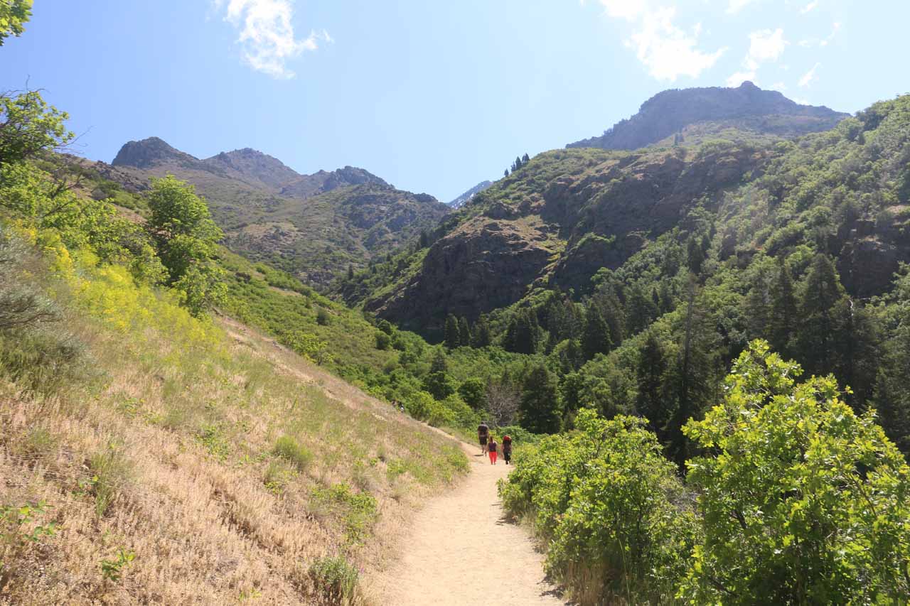
At about 0.8 miles from the Bonneville Shoreline Trail junction, the trail crossed North Holmes Creek over a slanted wooden footbridge. Just beyond this bridge, the trail became increasingly more rugged and steep as I often had to scramble hand over feet in the steepest sections. There were also more attractive cascades that the trail meandered alongside, including one small waterfall where a large boulder formed a kind of “cave” or alcove with water running through it. Further upstream from this spot, the trail then went around a bend in the creek where I opted to hike into the creek itself on its far right side to avoid doing a pretty daring steep scramble further up the embankment (to avoid getting wet).

During the time that I did this hike, the creek was running pretty high so inevitably, I had to get my feet wet as the water was easily ankle- to shin-deep. I’ve also seen trip reports where at lower water levels, it was possible to easily cross North Holmes Creek without getting water inside Gore-tex hiking boots or even day hiking low-top boots. Nevertheless, once I made it to the other side of North Holmes Creek, that was when I could finally see Adams Falls in all its glory (just like in the photo at the top of this page).
When I showed up at about 9:30am, there was still enough of a morning shadow to take decent photos. That said, this was a west-facing waterfall so afternoon provided the best lighting. Of course, waiting until the afternoon to do this hike would mean the initial sandy switchbacked climb from the trailhead to the Adams Canyon Trail junction would be a brutally hot stretch. And if you’re not acclimated to the altitude, it could make an already tough hike even tougher right off the bat. And despite the tree cover for most of the remainder of the Adams Falls Trail once it entered Adams Canyon, it was still mostly uphill, further adding to the difficulty of the hike.
Overall, it took me just under 2 hours to get all the way up to the falls, but it took me around 90 minutes or less to return to the trailhead. According to my GPS logs, I had hiked about 4 miles round trip. And even though it was indeed quite an adventurous hike, there were still many people that I encountered throughout the excursion (especially on the return hike), which attested to this place’s popularity.
Related Trip Reports

Related Top 10 Lists
Related Itineraries

Trip Planning Resources
Nearby Accommodations
This content is for members only. See Membership Options.Featured Images and Nearby Attractions
This content is for members only. See Membership Options.Visitor Comments:
Got something you'd like to share or say to keep the conversation going? Feel free to leave a comment below...No users have replied to the content on this page
Visitor Reviews of this Waterfall:
If you have a waterfall story or write-up that you'd like to share, feel free to click the button below and fill out the form...No users have submitted a write-up/review of this waterfall
Only logged in users can post a comment Please login or sign up to comment