About Kjelfossen
Kjelfossen (I believe it’s pronounced like “SHELL-foss-un”) was considered to be one of the tallest waterfalls in Norway, which was something that was impressed upon us during our pre-trip research prior to our first trip to Norway in 2005.
It turned out that upon seeing this falls in person, we started to appreciate its full height only after seeing its uppermost tiers from the terrace of the Stalheim Hotel.
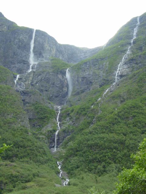
When we went into the Nærøydal Valley and saw the falls from its base, it seemed like the uppermost tiers weren’t as visible.
This was due to cliff obstructions as the falls appeared to be smaller than what the literature had us believe (though it was still very tall even from this perspective).
So it was one of those cases where we had to appreciate the falls from two different perspectives to get the whole picture.
Based on my interpretation of Norgeskart, I’m measuring the cumulative height of Kjelfossen can be between 700m and 810m over the steepest run of the falls (but admittedly, it’s hard to tell where the exact start and end is to the falls from the map).
Some sources in the literature have said that the falls had a 755m cumulative height.
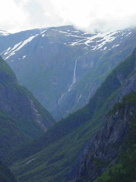
The drop that we noticed from the Stalheim Hotel could have a 200m height.
However, we were a bit confused about whether this was one of the segmented drops we’d see at the bottom (like the topmost image on this page), or if it had its own drop possibly above the more visible segments visible within the valley.
As for the waterfall’s longevity, based on our pair of visits to the waterfall (once in late June 2005 and again in late July 2019) the falls seemed to have similar appearance, which suggested to us that it had a surprisingly permanent flow.
I found this surprising because of how thin the falls appeared, but from looking at the maps, the falls was fed by a series of lakes called the Kjelfossvotni (literally the Kjelfoss Lakes), which ultimately drained over the falls.
Distant Perspective of Kjelfossen
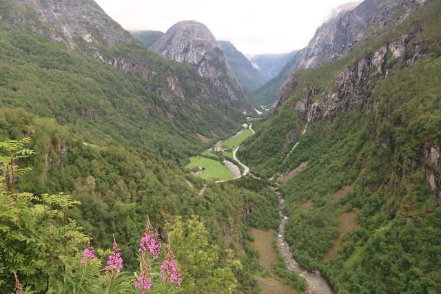
As mentioned above, viewing the uppermost drop of Kjelfossen required us to get a distant view from the terrace of the Stalheim Hotel.
From this vantage point, we couldn’t see (or at least make out) the lower segmented drops that you see in the photo at the top of this page.
So apart from signs letting us know that was Kjelfossen, we otherwise would have never figured out that it was the same waterfall that we would see from the bottom (which we’ll get into in the next section below).
In any case, the Stalheim Hotel was originally in Voss before the owner moved it nearby its current location in 1885.
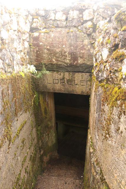
The hotel featured this “backyard” with picnic tables, a little bunker with “Lorelei” written above it, and of course, sweeping views into the Nærøydal Valley.
The panoramas from here had been well-known, but apparently, it also attracted the likes of Emperor Wilhelm II of Germany.
By the way, the bunker with “Lorelei” on it reminded me of something we noticed in Germany’s Romantic Rhine, and we wondered if there was tie in with that, especially during Nazi Germany’s occupation of Norway in World War II.
The Base of Kjelfossen
The bottom of Kjelfossen pretty much sat towards the mouth of the Nærøydal by the junction to the town of Gudvangen as well as near one end of the 11.5km-long Gudvanga Tunnel (Gudvangatunnelen).
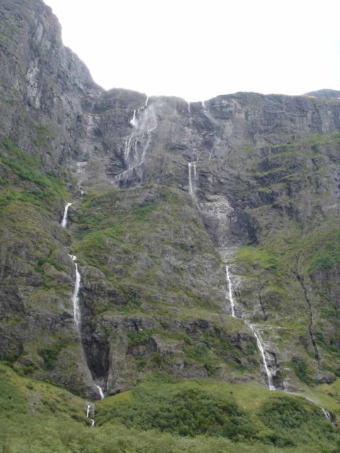
Once we were at the bottom of Kjelfossen and looked up from it (see directions below), we witnessed what appeared to be a series of at least three main segments or strands of the waterfall.
These segments tumbled side-by-side before converging at the base of the waterfall.
It was a fairly neck-cranking view to say the least, which kind of further attested to the lofty height measurements that had been touted in the literature.
At least two of the strands appeared to have names – Store Kjelfoss (Big Kjel Falls; the one on the left in the photo above) and Vetle Kjelfoss (the one in the middle).
The strand on the far right didn’t appear to have a formal name.

By the way, the uppermost (or leftmost?) drop seen from the Stalheim Hotel was apparently named just Kjelfoss, which further confirmed our suspicions that it was the main part of the waterfall.
For both of these views, there was a minimal amount of walking so we tended to think of this waterfall as a roadside attraction.
In addition to the roadside views from the E16, we also viewed parts of this waterfall both from the Viking Town in Gudvangen as well as from the Nærøyfjord Cruise.
Authorities
Kjelfossen resides in the Aurland Municipality. For information or inquiries about the area as well as current conditions, visit their website.
Related Top 10 Lists
Trip Planning Resources
Nearby Accommodations
This content is for members only. See Membership Options.Featured Images and Nearby Attractions
This content is for members only. See Membership Options.Visitor Comments:
Got something you'd like to share or say to keep the conversation going? Feel free to leave a comment below...No users have replied to the content on this page
Visitor Reviews of this Waterfall:
If you have a waterfall story or write-up that you'd like to share, feel free to click the button below and fill out the form...No users have submitted a write-up/review of this waterfall



Only logged in users can post a comment Please login or sign up to comment