About Dettifoss
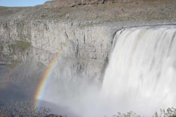
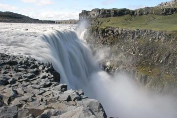
Dettifoss definitely blew us away with its sheer size and power. Perhaps a waterfall so wild and fierce was befitting of an area that just screamed natural and raw as it flowed on the glacial river Jökulsá á Fjöllum (“YUK-ul-sou ow FYUHT-lum”) meandering through Iceland‘s version of the Grand Canyon – Jökulsárgljúfur (“YUK-ul-sour-glyoo-fur”). And to back up our adjectives, we’ve learned that this falls was said to have a flow of about 500 cubic meters per second at high flow, with dimensions of 44m tall and 100m wide. Add it all up and we witnessed a monster that was quite possibly Europe‘s largest and most powerful waterfall (let alone Iceland’s biggest). The milky color of the waterfall was due to the fact that the massive river was fed by the sediment-rich meltwaters of the vast Vatnajökull glacier.
Given the wild nature of the falls (it was unregulated and protected by being part of the vast Vatnajökull National Park [it was Jökulsárgljúfur National Park or Jökulsárgljúfur þjóðgarður when we were there in 2007]), its rate of erosion (and therefore its propensity to move further upstream) was very high. Such raw power and fury almost made it feel like the ground was trembling beneath our feet, which made us very hesitant to get too close to the edge and potentially fall into the raging and frigidly cold river (there were no guard rails)!
We managed to experience this waterfall from both sides of the river – each quite different in their own way. So we’ll describe the experiences separately.
Because the Jökulsá á Fjöllum River could not be crossed in the vicinity of Dettifoss, there were two separate roads that left the Ring Road – one for each side of the river. The specific directions and descriptions are further below.
[tabby] [tabby title=”East Bank”]East Bank
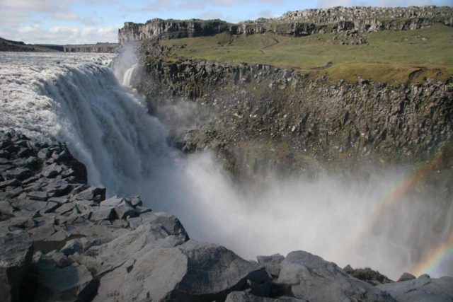
I believe it took us on the order of 20-30 minutes walk to get from the official car park to the falls overlook area.
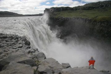
While on the east bank, we got angled and profile views of Dettifoss near its brink. The lookout area on this side was long so it was also possible to scramble a little further downstream to get better views of the entire falls including its misty and inaccessible base. The trail continued further upstream from the brink of the falls where there was a fairly straightforward walking path that went to the brink of the horseshoe-shaped Selfoss (see that page for more details).
To access the east bank from Reykjalið, head east on the Ring Road for about 37km (or 19km beyond the turnoff for Route 862). Just beyond the bridge over Jökulsá á Fjöllum, turn left onto Route 864 and follow this wide and relatively tame unsealed road for about 31km. There’s a signposted turnoff to the left leading the last kilometer to the car park.
Overall, the drive from Reykjalið to the east bank of the falls took us a little over an hour.
[tabby title=”West Bank”]West Bank
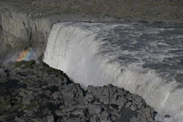
The trail ultimately descended right onto the cliff that was both obstructing views of the bottom of the falls from this side as well as getting us face-to-face with mammoth waterfall. There were some low rope barricades to suggest to us not to go any further. Also, some parts of the ground here were wet from any mist that happened to be wafted up above the cliff then blown in our direction.
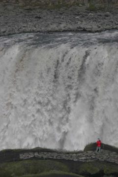
But with the fickle weather, we also happened to be on this side during a frigidly cold and rainy day where it was very difficult to see anything. That might be something to consider if the weather’s foul and you’re flexible enough to defer a visit here until the weather improves.
There was also a short trail that took us slightly further upstream for get distant view of Selfoss.
To reach the west bank, drive east along the Ring Road from Reykjalið on the eastern shores of Mývatn for about 18km (in case you didn’t know, Mývatn translated as “Midge Lake”, yikes!). Then, turn left onto the rough and rugged signposted 4wd route 862 (though we’ve seen some 2wd risk damage to their rental car to get here). Continue about 20km from the Ring Road then turn right at the signposted turnoff for Dettifoss. Ignoring another turnoff for Hafragilsfoss at 1.8km from the turnoff, continue another 1.3km to the car park.
From looking at our logs, driving from Reykjalið to the west bank of Dettifoss also took us an hour.
[tabbyending]Related Top 10 Lists
Trip Planning Resources
Nearby Accommodations
This content is for members only. See Membership Options.Featured Images and Nearby Attractions
This content is for members only. See Membership Options.Visitor Comments:
Got something you'd like to share or say to keep the conversation going? Feel free to leave a comment below... Impressive due to its power (Dettifoss) February 12, 2014 11:54 am - I find Dettifoss very impressive due to its power, mass and energy. I guess the grey water color empathizes this impression even more. At home, you can get an idea when watching in full-size and in HD quality, but be warned, it's really powerful ;-) ...Read More
Visitor Reviews of this Waterfall:
If you have a waterfall story or write-up that you'd like to share, feel free to click the button below and fill out the form...No users have submitted a write-up/review of this waterfall


Only logged in users can post a comment Please login or sign up to comment