About Tahquitz Falls
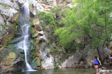
Tahquitz Falls (pronounced “TAH-kitz” and not “tah-KITZ”) was one of the more spectacular desert waterfalls we’ve ever experienced. Typically, we avoid driving way out to the deserts for waterfalls, especially when we perceive them to be not worth the trouble, particularly if we felt they wouldn’t flow. But after our recent experiences with this roughly 50 or 60ft waterfall, we’re seriously reconsidering those thoughts and perceptions! Indeed, this place really opened our minds up to the possibility of experiencing more waterfalls in the deserts this far east of the Los Angeles basin.
Julie and I were amazed how we could’ve missed this waterfall during our years of waterfalling. One reason could be that this waterfall sat in a canyon that was hidden from pretty much the rest of Palm Springs as the canyon’s mouth didn’t face the rest of the city. Meanwhile, the canyon itself was mostly concealed by tall cliffs. But perhaps the main reason why we weren’t even aware of this falls until 2011 and later was that it was closed to the public before 2001 when the Agua Caliente band of Cahuilla Indians finally finished work to restore the area, which included work to remove of graffiti, to evict transients, and to make the otherwise rugged trail more manageable for visitors from the neighboring resorts in Palm Springs. Indeed, the fee to visit this part of tribal lands seemed pretty steep, but at least those fees were being put to good use as evident in the benign trail conditions.
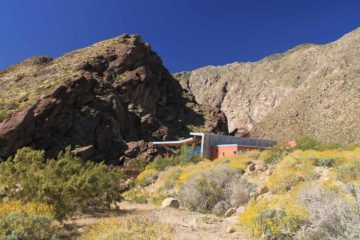
Even though the loop could be done in less than an hour, we very easily could’ve consumed the better part of a half-day checking out these various spots. We ended up spending about 90-120 minutes on the trail, including all the stops and picture taking.
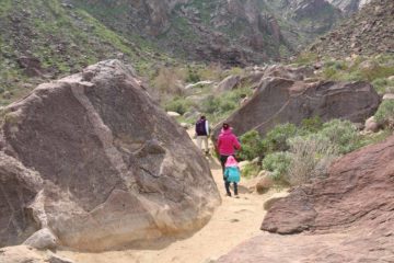
We would generally do this hike in a clockwise direction because the left side of the trail (at least towards the beginning) seemed to get most of the morning shade. That said, by the time we were on the trail in the late morning, most of the shade was gone. A little more than half the walk followed Tahquitz Creek on its “upper” side starting with a brief climb, then descending towards the creek before crossing over about three bridges before climbing moderately some more until reaching the waterfall. The last stretch of the trail involved going up a series of steps to make up the majority of the 350ft elevation gain.
For more frontal views of the falls (see photo at the top of this page), we had to rock hop our way onto the middle of the stream where foliage above us and the cliffs to the side of the falls didn’t obstruct the view. From here, it looked as if the falls had split the cliff as deep blue skies contrasted the bright white cliff face. Perhaps the only thing keeping this spot from being the de facto spot to take photos was the mist from the falls itself (that was how well it flowed during our visits!).
I actually thought the rock hopping part was a rock bridge before it became partially submerged due to the high water. Indeed, the loop trail continued beyond the stream crossing and continued following Tahquitz Creek’s flow downstream on its “lower” side. It was during this stretch that it seemed the more sparsely spaced steps were taller (maybe that was what the visitor center warned us about regarding the 12″ to 18″ steps).
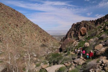
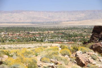
This stretch also passed by a USGS gauging station followed by a pair of attractive small cascades as well as an old irrigation ditch. After a brief interlude where the loop trail merged, it split once again as it made its final descent back towards the visitor center. Since we were following this trail clockwise, we were able to get nice views of downtown Palm Springs from this part of the trail.
There is one more thing we do want to mention about this waterfall. Ever since we became aware of Tahquitz Falls, we’ve seen in the literature other photos where the falls either was trickling or wasn’t flowing well. As far as we could tell, our visits just so happened to have occurred during wet years where substantial snowmelt from the San Jacinto Mountains resulted in very high flow, which we suspect would most likely peak during the March through May timeframe. It really depends on the snowpack and how hot the weather becomes to melt the snow. Thus, our Tahquitz Falls experiences were likely to have coincided with unusually high flow, which was certainly much higher than normal. We had still yet to experience this waterfall in more “normal” conditions as shown on the trail brochure and elsewhere in the literature.
Related Top 10 Lists
No Posts Found
Trip Planning Resources
Nearby Accommodations
This content is for members only. See Membership Options.Featured Images and Nearby Attractions
This content is for members only. See Membership Options.Visitor Comments:
Got something you'd like to share or say to keep the conversation going? Feel free to leave a comment below...No users have replied to the content on this page
Visitor Reviews of this Waterfall:
If you have a waterfall story or write-up that you'd like to share, feel free to click the button below and fill out the form...No users have submitted a write-up/review of this waterfall

Only logged in users can post a comment Please login or sign up to comment