About Wasserlochklamm Waterfalls
The Wasserlochklamm Waterfalls were a series of waterfalls tumbling within a steep and narrow gorge in a pretty out-of-the-way (as far as the typical tourist route is concerned) part of North Central Austria. It turned out that Austria was full of these waterfall-laden gorges (i.e. schluchts or klamms), and this was one such excursion that yielded not only many waterfalls but also a view over the Salzatal as well as a natural bridge.
According to the trail maps and brochures here, there was said to have been at least five signed waterfalls though there were additional surprise waterfalls throughout the excursion, including one that faced the natural bridge at the very top of the hike! The flow was said to be about 5 cubic meters per second.
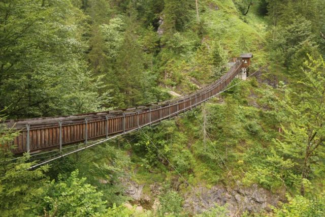
Although the hike to experience all the waterfalls and its surprises was within a modest 2km stretch of trail (or 4km round trip), the verticality of the trail in addition to the many stops along the way ensured that I would be spending at least three hours here. Indeed, the gorge itself was said to be 900m in length and 325m in elevation change.
From the roadside car park along the B24 (see directions below), I promptly got into the gift shift where I paid for my admission (about 6.50 euros per adult as of Summer 2018) then went out to the back. There was a video and some interpretive signs in German behind the gift shop as well as a trail passing by the neighboring cafe before crossing a suspension bridge (Hängerbrücke) spanning the gorge over the Salza River.

Anyways, once I was on the other side of the bridge, I used the purchased ticket to scan the bar code at the automated turnstile, which then let me through. Next, the trail descended briefly before following along the Salza for about 300m further. Then, the trail veered inland as it followed the interior of the Wasserlochklamm Gorge.
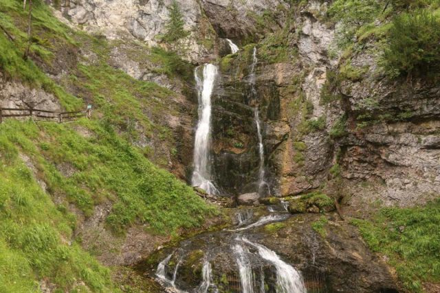
At roughly 20 minutes into the hikefrom the turnstile (500m or so according to my GPS logs), I encountered the first signed waterfall. This one was said to be 22m tall though it had a nice plunge before continuing its tumble beneath the ledge trail. Shortly above the first waterfall, the trail then passed by a very narrow section of the Wasserlochklamm labeled “Canyon”, where more intermediate waterfalls and cascades were crashing within the depths of the gorge below the trail.
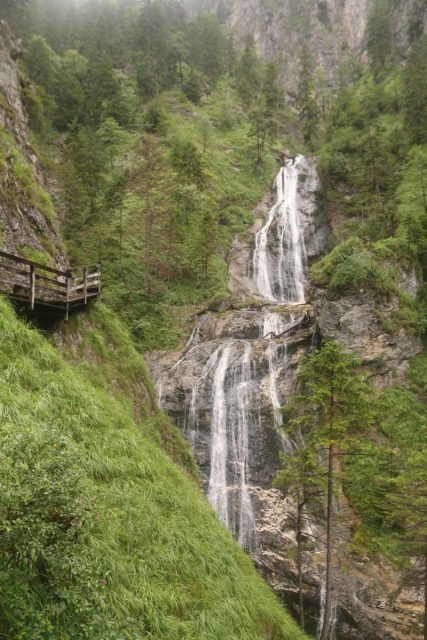
Shortly after the second waterfall, the trail continued its steep climb up steps alongside Waterfall 3, which was said to be 28m tall (though it was hard to tell given that it didn’t seem to be its own individual entity). Immediately above the third waterfall, I then reached the base of the fourth waterfall, where a signpost called it the Schleierfall. This waterfall was said to have a height of 39m, but from the signpost, it didn’t seem like it.
It wasn’t until I continued climbing further up the trail did I realize that the Schleierfall had an upper component to it. And together, I could totally understand why they singled out this waterfall with a name, because it was very impressive. After continuing its steep ascent yielding more impressive frontal views of the Schleierfall, the trail then petered out for a short while as the wooden trail was now hugging a cliff as it rounded a bend towards a minor gully.
Then, the trail continued its steep climb as it was climbing alongside the Schleierfall. After another 300m or so from the base of Schleierfall, the ascent finally reached the fifth and final signposted waterfall 5, which was said to be 37m tall. I honestly thought that height figure was a little exaggerated compared to the Schleierfall, but then again, maybe there were some hidden tiers.
Up at this shelter, there wasn’t a whole lot to see. However, if not for the opaque walls, it might have been the best spot to peer towards the natural bridge further downstream. Instead, I continued on the hike, which skirted then went above the natural bridge. Then, it went up a long flight of steps towards the Salzatalblick (an overlook). Along the way, I noticed a surprise waterfall tumbling beneath the shelter, and it seemed to be coming out of a cave as a spring, and thus this was the namesake Wasserloch itself!
At the very top, the Salzatalblick was supposed to be the reward for such a long climb up. However, it was raining pretty hard on the day of my visit so there were low rain clouds everywhere and the views weren’t as expansive as they could have been. There was also a trailhead register up here so you can write down your name, the time, where you’re from, and a brief comment.
Once I had my fill of this spot (it took me about 2 hours and 15 minutes to make it up here), I then headed back down the way I came. The return journey only took me around an hour though given the slick conditions, I managed to take a spill on one of the wooden ramps alongside the Salza River. Even with sturdy hiking boots, I still should have made sure that my steps were sure and not hastily done.
Related Top 10 Lists
No Posts Found
Trip Planning Resources
Nearby Accommodations
This content is for members only. See Membership Options.Featured Images and Nearby Attractions
This content is for members only. See Membership Options.Visitor Comments:
Got something you'd like to share or say to keep the conversation going? Feel free to leave a comment below...No users have replied to the content on this page
Visitor Reviews of this Waterfall:
If you have a waterfall story or write-up that you'd like to share, feel free to click the button below and fill out the form...No users have submitted a write-up/review of this waterfall




Only logged in users can post a comment Please login or sign up to comment