About Bailey Canyon Falls
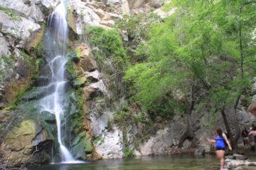
Bailey Canyon Falls was one of the locally obscure waterfalling excursions that we’ve done. We suspect that a large reason for this apparent obscurity was that it didn’t appear in any of our local guidebooks, and that it appeared that most visitors to the Bailey Canyon Park were more interested in going to Jones Peak as opposed to this waterfall. Moreover, perhaps a much greater reason for the waterfall’s obscurity was due to its very short season, which the photo at the top of this page kind of hints at. In fact, the last photograph that we’ve seen in the literature showing the falls having any appreciable waterflow was taken in the year 2011, which was a very wet year as far as Southern California was concerned. So for all intents and purposes, in our minds, this was a practically difficult (more like next-to-impossible) waterfall to visit when flowing satisfactorily as we’ll get into below.
To illustrate the types of conditions to even see this waterfall flow, we made two visits. The first visit happened on a warm Saturday afternoon in early February less than a week removed from the last fairly significant storm, which replenished a little bit of snow in both the San Gabriel and San Bernardino mountains. The second visit happened less than 24 hours after some heavy downpours bombarded much of the Southland. Yet even after the second visit, the falls was nothing more than a trickle. So given the lack of water in the entire lower parts of the Bailey Canyon drainage, we believe that there may be some degree of water siphoning or diversion in order to support the sprawling foothill communities along the base of the mountains at Sierra Madre and the surrounding suburbs. It’s either that or the Bailey Canyon watershed must be very small compared to other longer lasting neighboring waterfalls like Monrovia Canyon Falls, Sturtevant Falls, and Eaton Canyon Falls among others. And while it may be tempting to time a visit to this falls right when there’s a storm (just to see this waterfall flow), as you’ll see in the trail description below, it may not be a very wise thing to do given the flash flood hazards and dangerous conditions when exacerbated by heavy rains.
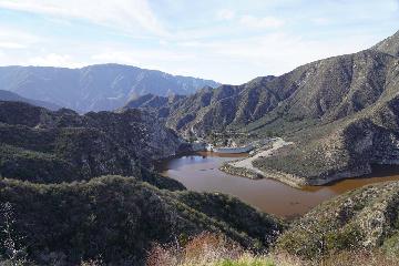
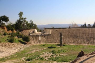
We then walked uphill along this road, which peaked adjacent to the Bailey Canyon debris basin. The road then briefly descended alongside this basin (which was dry during our visit) before the pavement gave way to conventional dirt trail immediately after a sign warning of the flash flood hazard in the area. We then kept left on the trail bypassing (not going on) a bridge over the dry creek to our right, then we walked for a few more minutes before the trail continued its ascent at a signposted trail junction. The sign indicated that the waterfall was another 1/4-mile to the left alongside the creekbed, and it was at this point that we deviated from the main trail (which headed towards Jones Peak and joined with other trails further up the mountains) to continue to the Bailey Canyon Falls.
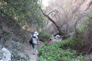
It didn’t take long before the trail became somewhat of a stream scramble as we found ourselves climbing over a few smooth rocks while minimizing skin exposure to some of the overgrown within the creek itself (some of which looked like poison oak). With the canyon walls narrowed in, I could easily see why it wouldn’t be wise to be here during a storm as the risk of the flash flood would far outweigh the chance at timing the visit to see Bailey Canyon Falls flowing. That said, we were still able to follow a fairly obvious trail within this creek, and our daughter didn’t seem to have too much trouble with it despite the somewhat rough scrambling that had to be done (especially near a landslide area involving a narrow and steep traverse to get around the obstacle). Of course, had the creek contained flowing water, then this hike might not have been as easy as it was during our visit when the creek had no water.
Eventually, we’d reach the trail’s dead-end, which was right at a rock wall that was probably 20-30ft tall. All that was left on that wall was some wet streak that was all the water we’d be seeing on our visit. This was our turnaround point, and overall, we spent about an hour away from the car. According to our logs, this hike was on the order of about 1.25 miles round trip.
Related Top 10 Lists
No Posts Found
Trip Planning Resources
Nearby Accommodations
This content is for members only. See Membership Options.Featured Images and Nearby Attractions
This content is for members only. See Membership Options.Visitor Comments:
Got something you'd like to share or say to keep the conversation going? Feel free to leave a comment below...No users have replied to the content on this page
Visitor Reviews of this Waterfall:
If you have a waterfall story or write-up that you'd like to share, feel free to click the button below and fill out the form...No users have submitted a write-up/review of this waterfall


Only logged in users can post a comment Please login or sign up to comment