About Cascade de Fachoda
Cascade de Fachoda (or the Fautaua Waterfall since it’s in Fautaua Valley) has to be one of the more spectacular waterfalls I’ve been fortunate enough to sample in Tahiti.
The reason why I say this is because it’s got one of those classically tall freefalls that might be more typically found in the hidden gulches and hanging valleys on helicopter tours in Hawaii. It is also backed by sharp mountains attesting to the advanced erosion that the islands of French Polynesia exhibit as they tend to be far older than the Hawaiian Islands. In fact, I think the sharp peak in the background behind the falls is the shapely Diadème, which might also be seen on Tahiti 4×4 tours through Papenoo Valley or even from Papeete on days when clouds don’t get in the way.
I got the feeling that this waterfall didn’t really have a consensus name though when I referred to it as the “Cascade de Fautaua” (Fautaua Waterfall) the locals seemed to know what I was talking about. I’ve also seen this waterfall referred to as Cascade de Fachoda (also spelled Fachauda) because there’s an old fort called the Fachoda Fort near its top.
This waterfall is said to be 443ft tall though I have seen exaggerated claims that it’s over 300m or 1000ft tall, or that it’s one of the highest waterfalls in the world. I’ve also seen the words “Fautaua Waterfall” being applied erroneously on TripAdvisor to the Faarumai Waterfalls. Yet despite the misinformation in the literature, I found this to be one of the more mysterious waterfalls that you can access. I wonder if I felt this sense of mystery because I had to earn it with a pretty hard hike.
The hike began at a large unpaved parking area right behind some infrastructure that looked like it belonged to Polynesie des Eaux. From there, I had to walk past a gate and onto a 4×4 road, which was a continuation of the road up Fautaua Valley past Bain Loti (Loti’s Bath – more on this later).
I noticed there were plenty of unsigned footpaths meandering through the jungle between the Fautaua River and the 4×4 road, but it turned out that those foot trails led to some hydro structures alongside the Fautaua River and were not necessary to continue towards the Cascade de Fachoda.
Throughout the walk, I could see the picturesque V-shaped valley capped by sharp and nearly vertical peaks along its ridges despite the cloud cover. There were several hard-to-photograph or hidden side waterfalls en route during my visit. However, it was hard to tell if they were merely ephemeral waterfalls, seasonal Wet Season-only waterfalls, or if they were permanent. There were also a few buildings (with lots of graffiti on them) that seemed to be for water diversion or processing.
As mentioned earlier, at the end of the 4×4 road, the foot trails branch in different directions thereby marking the start of the two approaches to Cascade de Fachoda.
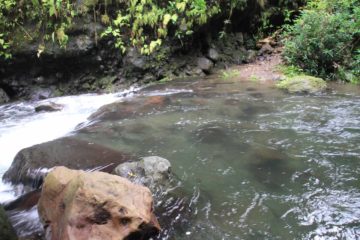
After about 15 minutes of hiking though, a sign indicated where I was supposed to cross the river (so avoiding the river was no longer an option). It was here that I turned back because the river levels were too high and too fast moving for my liking. I have read in my pre-trip research that there were multiple river crossings like this to get all the way to the base of the falls. However, until I manage to successfully complete this part of the hike, I can’t say anything more.
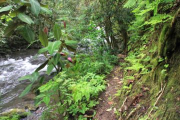
As for the upper approach, the trail branched to the left of the end of the 4×4 road and went over a bridge spanning the Fautaua River. Once past the bridge, the trail immediately started ascending steeply on a combination of switchbacks and muddy track with exposed tree roots.
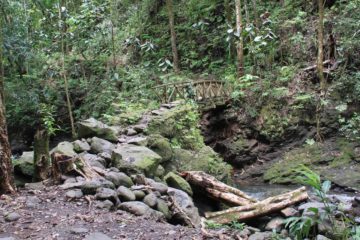
Eventually after nearly another 20 minutes there was a minor stream crossing where I saw yet another hidden waterfall. And it was another 10 more minutes before I finally found some large pile of rocks, which I’d imagine acted as a trail marker though I can’t say for sure.
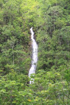
Finally after about 40 grueling minutes of uphill hiking from the bridge, I finally got to a view of the impressive Cascade de Fachoda (the view you see at the top of this page). While the majority of the falls could easily be seen from this point, the foliage below conspired to cover up most of its bottom. Still, this was a good place to get a second wind to keep going, or to turn back.
The uphill hiking continued beyond this “bellevue” (as the locals I met called it), and it got to a point where the trail narrowed even more with some dropoff exposure. There were wires bolted into the cliffs so the unsure could hold onto the wires while proceeding.
Perhaps in my impatience and fatigue, I didn’t go much further than the wires as I had seen that the views of the falls seemed to have gotten more overgrown and worse off than the “bellevue.” However in hindsight, I probably should’ve kept going to at least the Fachoda Fort at the top of the falls. So until that happens, I’m afraid I can’t say anything more about this hike.
On the descent back to the footbridge, I definitely had to be careful because the footing was slippery and muddy in many spots, especially in light of the steepness of the trail. Still, I was under the impression that this would be a reliable all-season hike while the lower approach could be more confidently undertaken when river levels would be much lower (like in the Dry Season).
All in all, it took me about 4.5 hours. I can easily envision this hike taking the better part of 6 hours or more had I been able to visit both the base of the falls and the Fachoda Fort at the very top of the falls.
Related Top 10 Lists
No Posts Found
Trip Planning Resources
Nearby Accommodations
This content is for members only. See Membership Options.Featured Images and Nearby Attractions
This content is for members only. See Membership Options.Visitor Comments:
Got something you'd like to share or say to keep the conversation going? Feel free to leave a comment below... Pools at the top of Cascade Fautaua September 26, 2015 7:38 pm - Duuuuude! You missed the 2 pools right at the top of the Cascade. Continue a short way past the walls of the fort and bear right. There is a steep hill that had a rope rigged when I was there (2012).Before going over the falls the stream dumps into 2 beautiful deep rock pools that… ...Read More
Visitor Reviews of this Waterfall:
If you have a waterfall story or write-up that you'd like to share, feel free to click the button below and fill out the form...No users have submitted a write-up/review of this waterfall



Only logged in users can post a comment Please login or sign up to comment