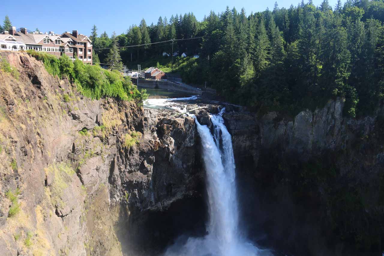
About Snoqualmie Falls

Snoqualmie Falls was easily the most popular and most visited waterfall that we have visited so far in the state of Washington. However, we think the adjectives spectacular and powerful should also be thrown in there as well. And this was despite the fact that the Puget Sound Power and Light Company managed to divert some of the Snoqualmie River’s flow for the purposes of hydroelectricity. So even though this waterfall was in a compromised state, it was still an awesome sight with its gushing year-round flow. We could only imagine how wild this 268ft waterfall must have been during its wilder days before regulation.
Given all these factors, I guess it shouldn’t have been surprising that this waterfall was so popular. After all, it was merely a half-hour or so of driving from Seattle to get here (depending on the severity of the traffic). Moreover, we had a pretty easy time checking out the falls from its well-developed walkways and viewing platforms that allowed us to view the falls from above as well as from below. In fact, we even witnessed some road rage as people were competing for limited parking space where one person managed to snag a parking spot right in front of someone who was patiently waiting for the prior occupant to pull out. Indeed, things can get pretty tense when something like this is so popular.
Meanwhile, the walk between the upper lookouts and the lower lookout was said to be a half-mile in each direction. While the view from here wasn’t close enough to be totally bombarded with the spray from the falls, it was noticeably cooler down here. Plus, this different perspective at the river level was certainly worth the exercise and the experience.
In our first visit in 2006, we followed a pretty naturesque trail towards a boardwalk going past some hydroelectric facilities that appeared to still be in use. It was far less crowded and more primitive back then. On our second visit in 2011, the lower area was inaccessible as it was in the midst of some pretty extensive construction to completely make over the facility and public access. When we returned for a third time in 2017, it looked like the work was complete. Even though it still seemed like the lower parts of the Snoqualmie Falls complex remained far less busier than its upper counterparts, it appeared to be better able to handle the increased visitor numbers, and there was even a separate trail leading to river itself for an opportunity to cool off on hot days.
As for the timing during the day to photograph this waterfall, our experience has shown us perhaps morning wouldn’t be the best time to visit. That was because the falls was easily shrouded in fog and mist in the morning. Conversely, we happened to be here on at midday on a sunny late August day in 2011 when the sun was right on top of us thereby leaving the gorge darkened by shadows while the gorge rim was washed out in the sunlight. On our third visit in late July 2017, we arrived late in the afternoon where the falls started to become completely shaded by the neighboring cliffs. So given these observations, if it was a sunny day, the best photographic conditions would probably be in the mid-afternoon.
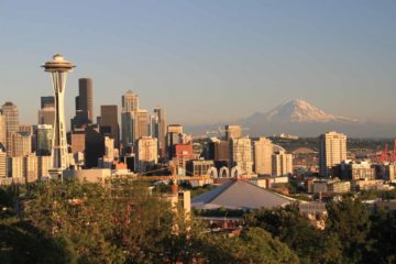
The building at the topleft of Snoqualmie Falls (as shown in the photograph at the top of this page) was the Salish Lodge and Spa. It certainly seemed pretty upscale though we didn’t dine and stay there. It did seem to be a pretty popular spot to have weddings, which was definitely the case on our last visit here in 2017. Moreover, something that was interesting was that there was a stream gauge indicator in the lobby area indicating what the flow of the Snoqualmie River was.
Related Trip Reports

Related Top 10 Lists
Related Itineraries
Trip Planning Resources


Nearby Accommodations
This content is for members only. See Membership Options.Featured Images and Nearby Attractions
This content is for members only. See Membership Options.Visitor Comments:
Got something you'd like to share or say to keep the conversation going? Feel free to leave a comment below...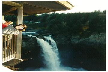 Name of Waterfalls (Snoqualmie Falls) February 14, 2009 5:23 am - Do you know the name of the waterfalls in this picture? Thanks & Regards Linde ...Read More
 Snoqualmie Falls October 6, 2008 9:28 am - Hi, I went to Seattle during 2002 along with my wife to visit my son working for Tata Consultancy Services, at Seattle. I was 58 years old during my visit. I had the opportunity to visit the Snoqualmie Falls. I felt very enchanted and happy. After reading this article, I feel like visiting US again… ...Read More
Visitor Reviews of this Waterfall:
If you have a waterfall story or write-up that you'd like to share, feel free to click the button below and fill out the form...No users have submitted a write-up/review of this waterfall
Only logged in users can post a comment Please login or sign up to comment