About Comet Falls

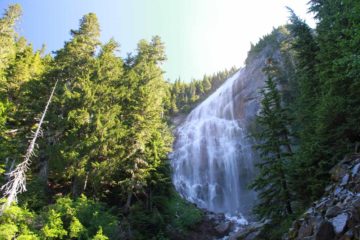
Comet Falls could be arguably Mt Rainier National Park’s most beautiful waterfall (though I could easily see how Spray Falls or Narada Falls could challenge that assertion). It’s said to plunge at least 320ft in mostly freefall from a hanging valley (which I believe is known as Van Trump Park). There were also additional tiers both above and below the main plunge so the reported height could conceivably be an underestimate.
Adding to the scenic allure was that Julie and I were lucky with our timing as we witnessed a very bright rainbow across its base on the morning of our visit.
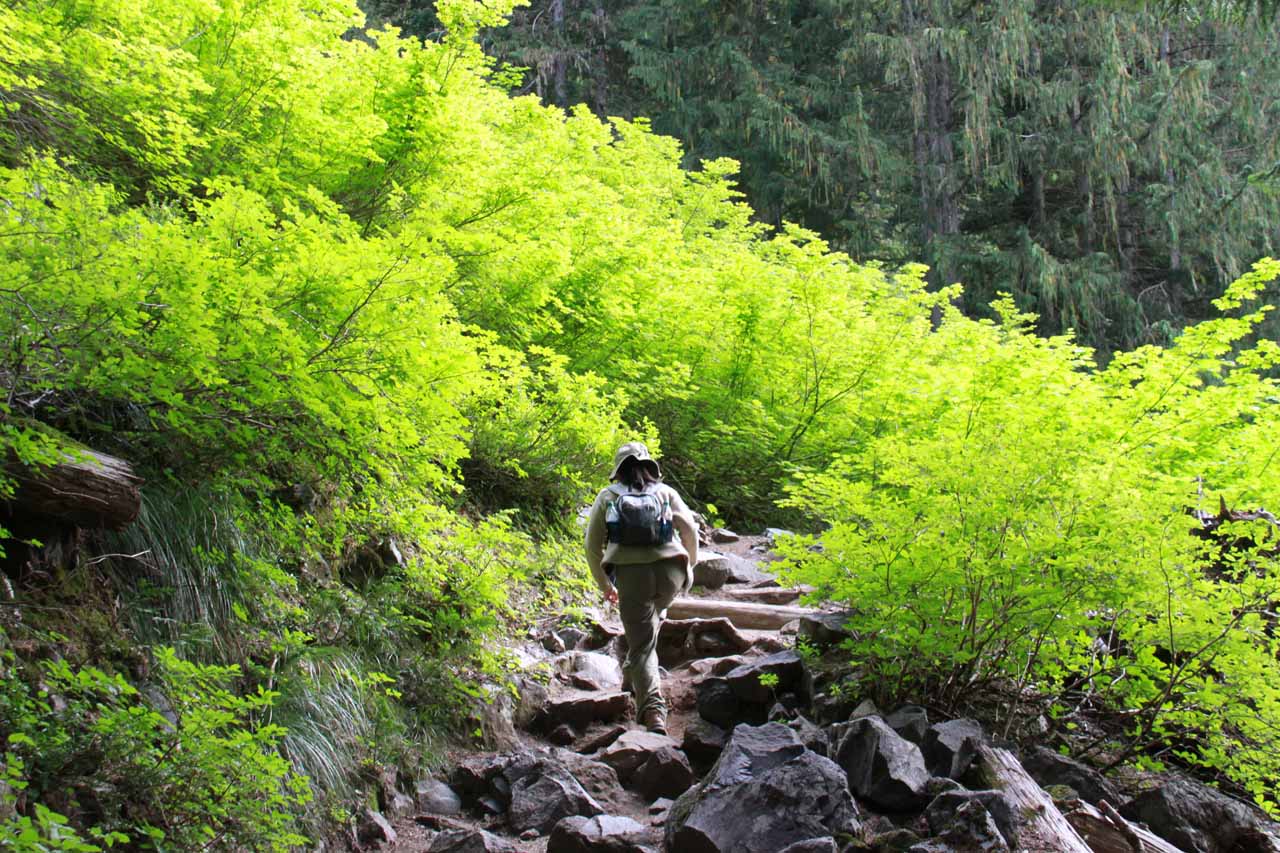
In order to reach this waterfall, we had to earn it with a pretty hot and tiring uphill hike of about 2 miles each way (4 miles round trip). Although the distance was modest, it was the relentlessly uphill nature of the hike that took a lot out of Julie and I. Essentially, it was one switchback after another with very few breaks in between, and the climbing began almost immediately from the car park.
First, after ascending the stairs leaving the car park into the forest, we crossed a bridge over Van Trump Creek above Christine Falls. Looking upstream from the bridge, we saw some cascades in addition to the cascades we noticed tumbling downstream below us.
Beyond this creek crossing, the trail began its first very long climb, which passed by a handful of fair-sized cascades along Van Trump Creek itself as the trail pretty much followed its eastern banks. Author Gregory Plumb in his Pacific Northwest Waterfalls book called these cascades Lower Van Trump Falls.
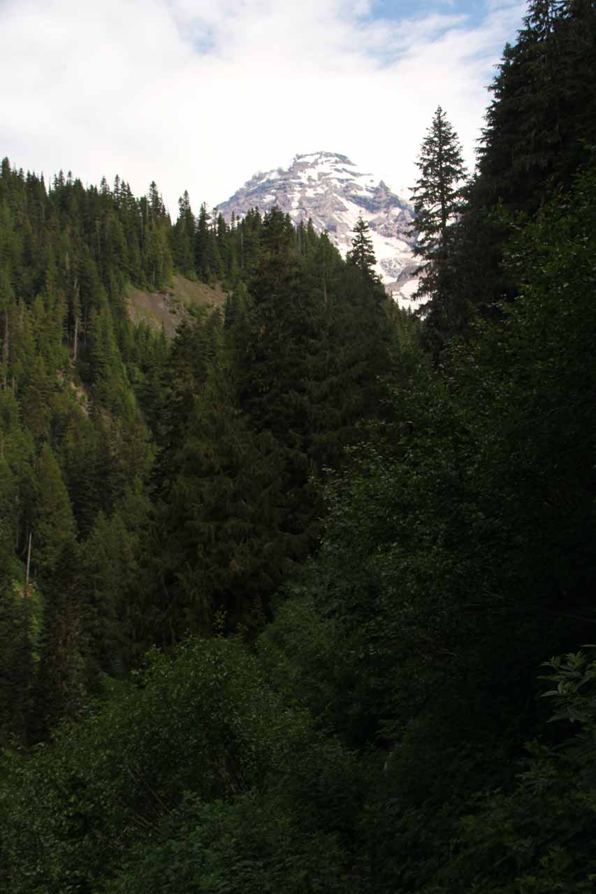
When the trail finally flattened out for a bit of a breather, it then narrowed as it hugged the volcanic slope with a bit of overgrowth protruding onto the trail. Julie and I couldn’t tell, but we thought the vegetation resembled poison ivy so we were careful to minimize skin exposure to them. Anyways, it was also in this stretch that the clouds started clearing thereby allowing us to get glimpses of Mt Rainier.
At the end of this ascent, the trail then rounded a bend before a one-sided log bridge made another traverse of Van Trump Creek. This was where we were a little confused and nearly mistook Van Trump Falls (or Upper Van Trump Falls) for Comet Falls!
The reason for this confusion was that the three-tiered Van Trump Falls looked impressive in its own right. After such a long and tiring climb to get to this point, if we hadn’t seen Comet Falls photos in the literature, we could have stopped here and turned back prematurely!
Fortunately, our pre-trip research along with us noticing a sign indicating that Comet Falls was another 200 feet away on the other side of the one-sided log bridge were enough to indicate to us that we weren’t done with the hike yet. In fact, it turned out that Comet Falls wasn’t even on Van Trump Creek (it fed that creek instead).

After about the 2nd or 3rd switchback, there was a spur trail leading right to the misty base of the falls. This also happened to be the place where we saw the rainbow at its boldest.
I managed to climb another 3 or so switchbacks more before I finally turned back. From up there, I got some additional views of the main tier of Comet Falls. But I felt the views had gotten progressively worse the higher I went so I didn’t continue any further.
It turned out that had I continued up the rest of the switchbacks, I would have gone beyond the waterfall and into Van Trump Park. Like Spray Park above Spray Falls, I believe this was another subalpine meadow with wildflowers and views of Mt Rainier. I could imagine that under Winter and early Spring conditions, this meadow would contain the snow that would ultimately source the waterfall when it would melt as the weather warmed up.
Related Trip Reports

Related Top 10 Lists
Related Itineraries
Trip Planning Resources


Nearby Accommodations
This content is for members only. See Membership Options.Featured Images and Nearby Attractions
This content is for members only. See Membership Options.Visitor Comments:
Got something you'd like to share or say to keep the conversation going? Feel free to leave a comment below...No users have replied to the content on this page
Visitor Reviews of this Waterfall:
If you have a waterfall story or write-up that you'd like to share, feel free to click the button below and fill out the form...No users have submitted a write-up/review of this waterfall
Only logged in users can post a comment Please login or sign up to comment