About Stuibenfall
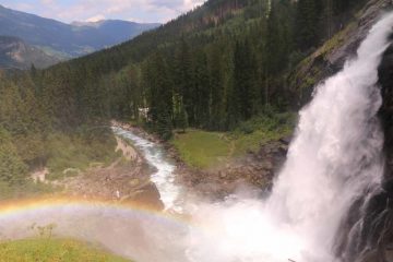
Stuibenfall (or Stuiben Falls) was said to be Tirol’s biggest (and tallest) waterfall where the Horlachbach Creek drops 159m into the Oetztal (Ötztal) Valley between Niederthai and Umhausen. Such a tall waterfall like this having the volume that it did during my visit was pretty special. However, what really made the experience memorable and over-the-top, was the hiking trail.
Indeed, the trail involved crossing a very high and bouncy suspension bridge with the kind of views of the Stuibenfall that would typically be reserved for only birds, and drones. And on the other side of the bridge were a pair of spiral stair towers before ultimately reaching another bridge across the brink of the falls featuring a pair of natural bridges!
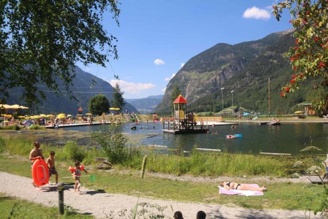
I began from the well-signed and very popular trailhead parking just on the outskirts of the town of Umhausen (see directions below). After paying for parking and walking past the Naturbadesee (basically a developed swimming area that was the perfect relief from the Summer heat during my visit), I then found myself on a pretty wide trail that also seemed to double as an unpaved road.
Since I made my visit in the afternoon, much of this part of the trail was shaded. Along the way, there was a Greifvogelpark (or an Eagle Park) as well as a cantina called the Waldcafe Stuböbele, which featured a little mill in front of it. Beyond the cantina, the trail crossed a bridge over the Horlachbach before resuming the uphill climb alongside the creek towards the first of a handful of lookouts taking in the Stuibenfall. It took me around an hour to get here from the car park.
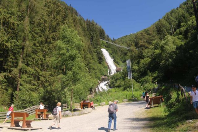
Next, the trail then climbed up a series of switchbacks. The first two signed waterfall lookout platforms were in this fairly long stretch. But it was from the second lookout and beyond that I finally got to appreciate the entirety of the Stuibenfall as its uppermost drops were revealed. A short distance after the second labeled waterfall lookout, I then ascended to the start of the suspension bridge.
As stated earlier, this bridge was bouncy, especially when lots of people were on it at the same time or you have a clown or two intentionally trying to make the bridge rocking and rolling. The bridge generally went uphill and was about 80m long. Just on the other side of the bridge, the footing was sturdier as it passed by the third waterfall platform (roughly 20 minutes from the busy area near the first lookout platform or “Stuibenfallblick”), which was being blasted with Stuibenfall’s mist.
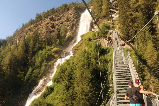
Once at the top of the towers, the trail was back to the more conventional dirt surface as it made its way towards a fork. The right fork went towards Niederthai while the left fork crossed a bridge right over the brink of the Stuibenfall. From this bridge, I was able to look at some smaller drops of the waterfall as the Horlachbach flowed beneath a natural bridge. However, as I looked downstream from this bridge, it was over the brink of another relatively small drop before the creek went beneath a more pronounced natural bridge.
Beyond this footbridge, the path then reached another junction, where I continued on the left to make the final descent towards the fifth viewing platform (Aussichtsplatform 5). This was where I was able to look back towards the natural bridge (where some climbers walked on a wire rope attached to it) while also looking downstream towards the main drops of the Stuibenfall in a pretty dizzying and disorienting view. The signage suggested it was 45 minutes from the main viewing area though I probably took a bit longer than that given all the stops I had made.
Despite it being about 2.4km in each direction (or 4.8km round trip), there was always lots of people throughout the hike. Indeed, this was a very popular hike, especially since they opened up the thrilling parts of the trail in April 2016 following a rockslide that made the waterfall inaccessible in 2013. Overall, it took me about 3 hours away from the car to fully experience the falls, but I suppose it could be as little as 2.5 hours round trip if I didn’t make as many stops as I did.
Related Top 10 Lists
Trip Planning Resources
Nearby Accommodations
This content is for members only. See Membership Options.Featured Images and Nearby Attractions
This content is for members only. See Membership Options.Visitor Comments:
Got something you'd like to share or say to keep the conversation going? Feel free to leave a comment below...No users have replied to the content on this page
Visitor Reviews of this Waterfall:
If you have a waterfall story or write-up that you'd like to share, feel free to click the button below and fill out the form... Stuibenfall (Austria) October 9, 2017 4:59 pm - The powerful Stuibenfall can be found in the Tyrol region of Austria near the village of Umhausen. The Horlachbach stream plunges 159 meters into the valley in a cascade of spray which gives the fall its name. We were also lucky to see some beautiful rainbows. There is a car park just outside the village… ...Read More



Only logged in users can post a comment Please login or sign up to comment