About Schleierfall
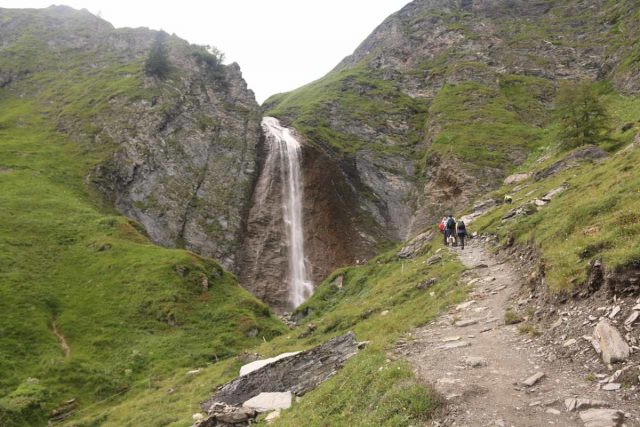
The Schleierfall (I’ve also seen it called the Schleierwasserfall; “Veil Waterfall”) was probably the most impressive of the waterfalls in the Hintertux Resort Area. Sitting where the Weitentalbach plunged at least 30m, it sat tucked away beneath the Weitental Valley, which was a side valley above the Tuxertal (i.e. the main valley containing the Hintertux Resort Area). Therefore, I had to earn my visit with a bit of a strenuous uphill hike to reach it.
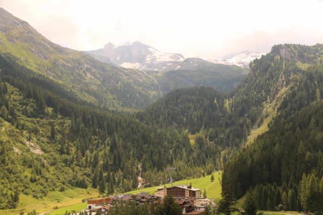
From the Hintertux Resort Area, I walked followed the signs and walked along a gently sloping path along the foot of the west end of the Tuxertal Valley. After about 500m, the trail started to reach a part where the climb became steeper while affording me views back towards the Hintertux Resort Area showing parts of the Hintertux Glacier as well as long cascades coming from the melting ice and down towards the head of the valley as the Kesselfall, Schraubenfall, and other waterfalls further upstream.

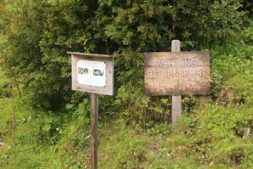
It would eventually lead up to a sign that was somewhat misleading as it made no mention of the Schleierfall. I actually made the mistake of giving into my doubts and turned back at this point, but with hindsight being 20/20, I should have continued along this narrow trail as it would go through a rope stile before entering a forested area.
The trail then continued along the forested path, which was a little rocky and steep in parts. Eventually, the forested part would give way to expansive views once again before traversing a grassy area flanking the Weintalbach. At nearly a kilometer from the fork with the trail to the Bichlalm, I would reach a trail junction next to a bridge over the Weintalbach. Turning right at this junction, I would then reach the next fork in the trail shortly thereafter.

However, the trail continued nearly another 100m uphill before reaching a much wider (albeit rockier) trail. This was the trail that would ultimately make it to the Tuxerjoch Haus, which was a high mountain hut. For the purposes of experiencing the waterfall, however, it was sufficient for me to get up to the fence and benches for an attractive profile and top-down view towards the Schleierfall with the surrounding mountains as the backdrop.
That was my turnaround point, and so to end the excursion, I had a choice of going back down the way I came (for the shortest amount of hiking) or taking the wide road back down to the even wider Bichlalm Trail (with a cantina at the alm itself) before continuing the descent via a much longer and more roundabout path. The shortest path was roughly 6km round trip from the Hintertux Resort Area. Meanwhile, visiting the Schleierfall via the alm would have added another 4km in one direction.
I wound up spending over 2 hours on this trail, but some of that time was wasted on mistakenly turning back and taking the Bichlalm Trail (when I shouldn’t have), and then taking a very steep “shortcut” to cut from the lower switchback of the Bichlalm Trail to the upper switchback of the Bichlalm Trail along some former snowmobile path or something.
Related Top 10 Lists
No Posts Found
Trip Planning Resources
Nearby Accommodations
This content is for members only. See Membership Options.Featured Images and Nearby Attractions
This content is for members only. See Membership Options.Visitor Comments:
Got something you'd like to share or say to keep the conversation going? Feel free to leave a comment below...No users have replied to the content on this page
Visitor Reviews of this Waterfall:
If you have a waterfall story or write-up that you'd like to share, feel free to click the button below and fill out the form...No users have submitted a write-up/review of this waterfall


Only logged in users can post a comment Please login or sign up to comment