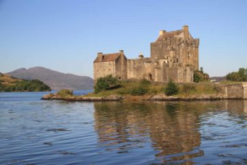
About Plodda Falls

Plodda Falls (Eas Ploda in Gaelic; pronounced “es-PLOD-duh”) was a very tall 46m high waterfall that we did as a side excursion somewhat out of the way from the busy northern or western shores of Loch Ness. Since the falls was part of the Glen Affric National Nature Reserve, it turned out that we were treated to a refreshing hike amongst tall trees punctuated with this waterfall. We didn’t encounter sheep, clearings from logging, or other unsightly things where compromises with Nature were made. In fact, I would learn later that the Glen Affric we experienced today was the result of an ongoing restoration effort spearheaded by Findlay MacRae, who was the head forester when the Forestry Commission bought this area in 1951. Basically, the restoration began with a concerted effort to save the remaining native Caledonian pine forest from any further exploitation or damage by means of fencing off the areas to be protected while culling deer who didn’t have natural predators to keep damage to a minimum amongst the young trees to be grown. So this pretty much explained why we were in the presence of many tall pine trees (though some were non-native douglas fir planted by Lord Tweedmouth in 1855), and the Plodda Falls certainly held its own when compared to the other giants of the forest.
From the car park (see directions below), we took the most straightforward path to the falls and back. Of course, we did notice that there were several other options to extend this walk, including one that would’ve led us to the highest douglas fir pine trees in Scotland along the Tweedmouth Walk. In any case, we followed the signs, then embarked on a gently downhill hike that briefly took us alongside the Abhainn Deabhag (Deabhag River) before the river made its dramatic plunge beneath a viewing platform that we also stood upon to take in the views as well as to get that sense of vertigo when looking down at the falls beneath our feet.
After having our fill of the lookout platform, we then continued down a series of steps leading for a few minutes more to a small lookout area peering right back up at the waterfall with the viewing platform right above it (see picture at the top of this page). It turned out that the platform (built in 2009) was said to have been there as a replacement for a footbridge that was built by Lord Tweedmouth in 1880 who had owned the Guisachan estate at the time. This was probably where the most satisfying views of Plodda Falls came from.
On the way back up, I did take a short but deceptively dangerous detour that followed other trails of use (they were actually false paths) past some very eroded ledges leading down to a rock outcrop where I was able to get an obstructed view back up at the Plodda Falls. Due to the tree obstructions, the view wasn’t great, and it was probably questionable whether to do that scramble in the first place. Nonetheless, you can see the photos below and evaluate for yourself whether you deem this detour worthy of your time, effort, and risk tolerance. But in the end, we spent about an hour to do the 0.4 mile out-and-back excursion, and this included my detour to the very bottom of the falls.
Related Trip Reports
Related Top 10 Lists
No Posts Found
Related Itineraries
Trip Planning Resources

Nearby Accommodations
This content is for members only. See Membership Options.Featured Images and Nearby Attractions
This content is for members only. See Membership Options.Visitor Comments:
Got something you'd like to share or say to keep the conversation going? Feel free to leave a comment below...No users have replied to the content on this page
Visitor Reviews of this Waterfall:
If you have a waterfall story or write-up that you'd like to share, feel free to click the button below and fill out the form...No users have submitted a write-up/review of this waterfall
Only logged in users can post a comment Please login or sign up to comment