About Gossnitz Waterfall
The Gossnitz Waterfall (or Gößnitz Waterfall; Goessnitz without the German letters) was the one waterfall that we did on our Grossglockner High Alpine Road Tour that actually required us to earn it. Indeed, most of the waterfalls on the famous road were primarily roadside attractions so that made this particular waterfall all the more memorable.
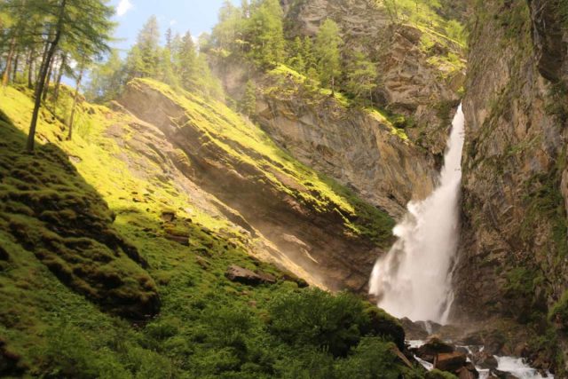
The Gossnitz Falls gushed with high volume, which was kind of unusual for one possessing a 70m plunge. The notch in the 100m rock wall supporting the waterfall suggested that a giant might have struck the rock wall with a giant axe according to some local myths.
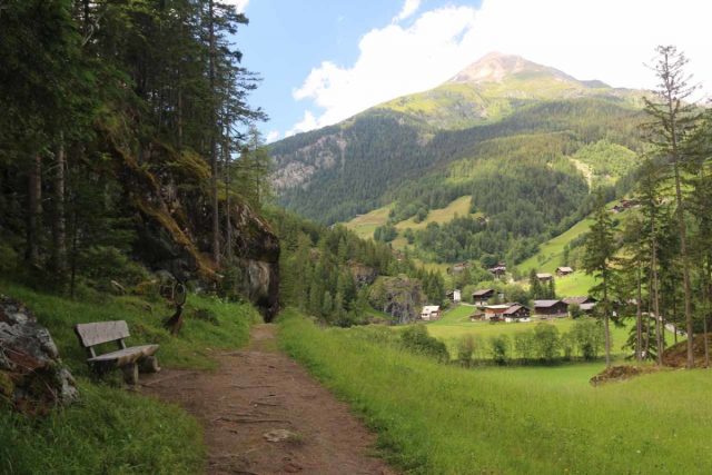
From the aforementioned car park (you’ll know it when you see it because there’s a Natura Mystica Oracle with its Stonehenge-like organization of rocks and pillars), I followed an ascending trail that led behind a fence then skirted along the foothills overlooking the village of Winkl.
The undulating trail then descended into a forested area where I kept right at a fork, which was the start and end of a loop trail. This path went by a clearing with some wavy “lounge chairs” for laying down and resting by a meadow before reaching some other less-advertised unpaved parking area near where the Gößnitzbach joined up with the Möll River. It took me around 20 minutes to get to this point.
After another five minutes of scrambling alongside the creek (I wouldn’t recommend this off-trail scramble if the creek was flooding or the terrain slippery like during a rain), I finally saw a very attractive side view of the Gossnitz Waterfall while seeing it from the foot of some very vertical rock cliffs (some of which were overhanging). Indeed, the rockfall danger was real here, and I didn’t linger for long.
Back at the footbridge on the main trail, I then crossed it and followed the trail downstream along the Goessnitzbach before reaching another signed junction. This time, I went right and took the spur trail that climbed steeply up a combination of switchbacks and steps. The footing here was a little dicier because of the mist from the Gößnitz Waterfall wafting up and wetting the slopes.
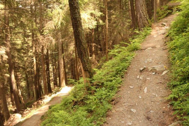
Once I had my fill of this view of the Gossnitz Waterfall, I then descended back down to the main trail, then kept right to complete the loop. Afterwards, I returned back to the Retschitzparkplatz roughly 20 minutes later.
Overall, had I started from the Retschitzparkplatz, I would have hiked about 3.4km round trip and it would have taken me between 60-90 minutes depending on how long I would have lingered at each lookout or how often I would take breaks.
However, I actually made a mistake in parking at the structure in Heiligenblut and did the hike from there. So that wound up adding another 1.5km in each direction (3km round trip) to the overall hike. So what should have been about 3.4km wound up being 6.4km total, and thus I wound up spending over 2 hours away from the car.
Finally, given the spelling of the Gossnitz Waterfall, I’ve seen it referred to as the Goessnitz Waterfall, Gößnitz Wasserfall, Gößnitzfall, and the Goessnitzfall.
Related Top 10 Lists
No Posts Found
Trip Planning Resources
Nearby Accommodations
This content is for members only. See Membership Options.Featured Images and Nearby Attractions
This content is for members only. See Membership Options.Visitor Comments:
Got something you'd like to share or say to keep the conversation going? Feel free to leave a comment below...No users have replied to the content on this page
Visitor Reviews of this Waterfall:
If you have a waterfall story or write-up that you'd like to share, feel free to click the button below and fill out the form...No users have submitted a write-up/review of this waterfall


Only logged in users can post a comment Please login or sign up to comment