About Janet’s Foss and the Gordale Scar

The Janet’s Foss Waterfall as well as the waterfalls within the gorge known as the Gordale Scar were my waterfalling excuses to see this geological oddity in the Yorkshire Dales National Park. The Gordale Scar was a giant limestone gorge closing in on the Gordale Beck where there were a pair of small waterfalls tumbling over tufa-like formations (a characteristic of the jagged limestone formations here). The cliffs, which seemingly enclosed upon the waterfalls themselves were said to be over 100m high, and it was speculated that this scar was the result of either a cavern collapse or melting glaciers. When I inspected the upper waterfall in the scar, I thought there was a pothole or natural arch that the beck fell through. But upon closer examination, it turned out to be nothing more than a bright rock that gave me the illusion that there was a natural arch up there.
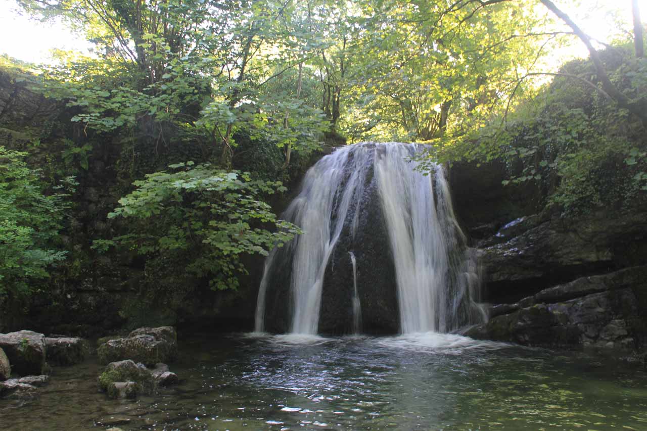
Meanwhile, the Janet’s Foss waterfall was a small and tranquil falls (maybe 15-20ft high) spilling into a peaceful cove. It was only a short distance downstream on the Gordale Beck from the alternate car park on the narrow single-track road (Gordale Lane) leading to the Gordale Scar campground roughly 4 miles northeast of Malham. It only took me about 10-15 minutes to walk to and check out this waterfall before returning back to where I parked the car. Then, I continued for a few minutes into and past the Gordale Scar campground, where a path continued further into the imposing depths of the limestone cliffs. And after rounding a bend, that was when I saw the waterfall hidden in this cove dwarfed by the towering and overhanging cliffs. I really felt like the cliffs or the rocks could give at any minute and fall into this gloomy gorge.
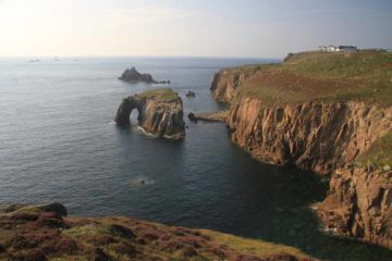
The hike to the Malham Cove (going in the opposite direction of the longer 7-mile loop hike) passed through extensive sheep pastures as it hugged sheep walls while providing views in the direction of the village of Malham and its surrounding farmlands. After crossing over the Malham Rakes Road (another single-lane road leaving from Malham), I then entered another area of sheep pastures full of grass and sheep dung before finally getting to the wrinkly cliffs atop the Malham Cove. It took me about 35 minutes to get from the car to this point. I had to be careful given the uneven nature of the wrinkly limestone surface atop the cliffs, especially when some of the gaps between the limestone had some non-trivial drop offs that could be hazardous if I wasn’t careful and fell in. I also had to be careful not to get too close to the cliff edges as I peered over and down towards the base of the Malham Cove, where the Malham Beck is said to continue its journey towards the town of Malham further to the south and eventually joining with the Gordale Beck to form the River Aire.
After having my fill of this side excursion (which I’m not counting towards the overall difficulty of this hike since it wasn’t necessary to see the waterfalls), I then headed back down the hill towards my parked car. Overall, the entire excursion took about 2 hours and 15 minutes, but the last hour or so was for the Malham Cove (which would have made the difficulty more like a 3 had I included that side excursion in the difficulty rating as well). I didn’t have time to continue another mile or so towards the Malham Tarn to complete the longer hike that has been said to be perhaps the best Yorkshire Dales day hike given the quantity of sights and their variety.
Note that the excursion would have taken even much longer still had I began from the official pay and display car park just to the south of the town of Malham (see directions below). I got the feeling that the place I parked at only had room for a couple of cars, and the more spacious section across the narrow road was reserved for a refreshment truck. Had I done it the way they want you to do it, this excursion would’ve added another hour or two to the overall time it took me to do the excursion. Again, the difficulty rating I provided only reflected my own experience at the time, and not what the local authorities wanted me to do.
Related Trip Reports

Related Top 10 Lists
No Posts Found
Related Itineraries
Trip Planning Resources

Nearby Accommodations
This content is for members only. See Membership Options.Featured Images and Nearby Attractions
This content is for members only. See Membership Options.Visitor Comments:
Got something you'd like to share or say to keep the conversation going? Feel free to leave a comment below...No users have replied to the content on this page
Visitor Reviews of this Waterfall:
If you have a waterfall story or write-up that you'd like to share, feel free to click the button below and fill out the form...No users have submitted a write-up/review of this waterfall
Only logged in users can post a comment Please login or sign up to comment