About Golling Waterfalls

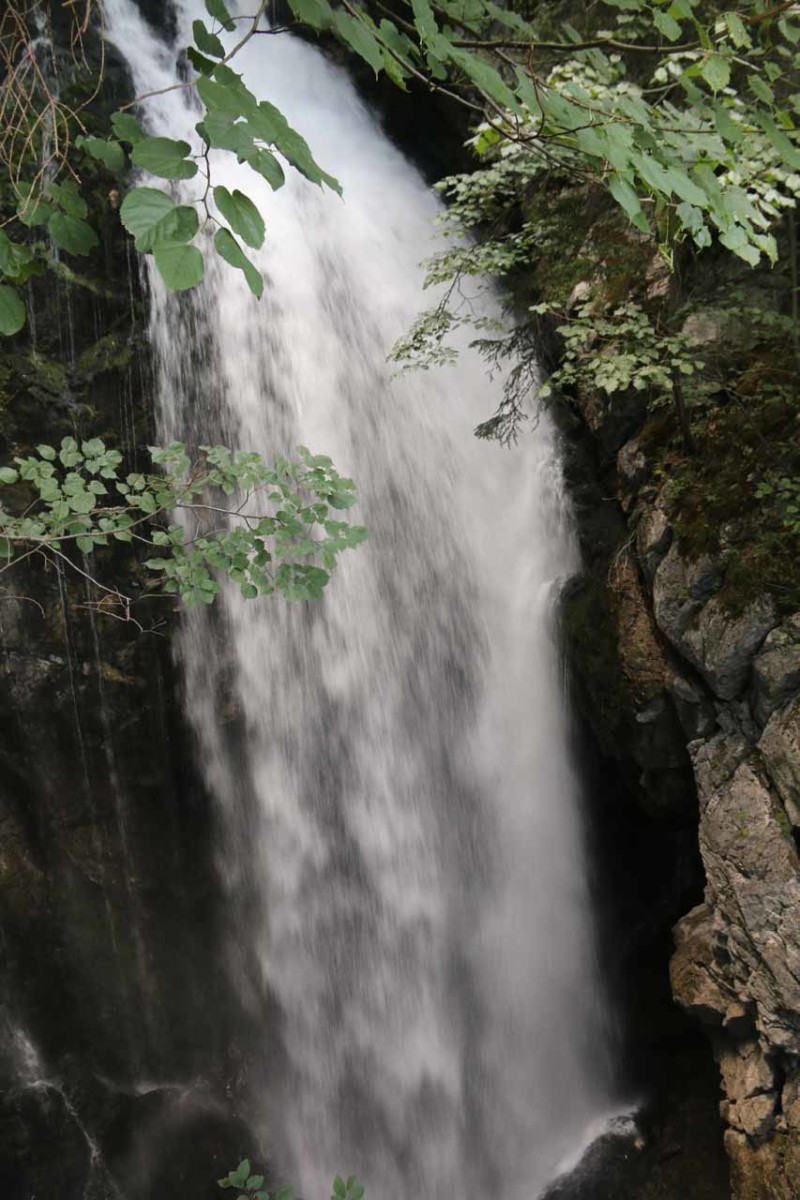
The Golling Waterfalls consisted of a main waterfall, which turned out to be a lower waterfall, as well as a very concealed upper waterfall. That upper waterfall was concealed because it managed to punch a hole in a wall revealing a natural bridge that I believe was called the Hexenkesselsteg (or Witches Cauldron).
Together the Schwarzbach Creek was said to have a cumulative drop of 76m over the waterfalls. The main lower waterfall probably dropped on the order of 30m or so, and it was by far the more accessible of the two. The upper drop is said to be taller at 45m but given its concealed location, it was harder to tell if that height figure was true or not.
Next, the trail followed the Schwarzbach (Black Creek) upstream less than 200m before arriving at a curve right in front of the impressive Lower Golling Waterfall. Along the way, we noticed a mill on the other side of the Schwarzbach, which a signpost merely referred to it as the Old Mill at the Golling Waterfall (or Alte Mühle am Gollinger Wasserfall). This mill dated back to 1618 back at a time when the Torren District sought to be self-sufficient on locally grown agricultural goods, especially grains tilled and processed here.
After having my fill of the base of the Lower Waterfall, I then went up moderately ascending steps revealing more elevated views of the main Golling Waterfall. The trail continued climbing towards one end of a metal footbridge (called the Rainbow Bridge) fronting the base of the Upper Golling Waterfall.
Unfortunately, most of the waterfall was hidden from view as a result of a rock wall blocking most of the line-of-sight. However, a lot of mist came blasting out of the natural arch at the bottom, which often made photographing the hole from the bridge difficult. Beyond the bridge, the trail continued its ascent until reaching another fork.
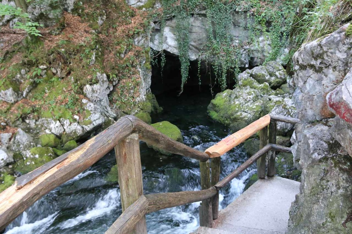
The left side of the fork descended towards the Witches Cauldron Bridge, which was right atop the rock wall supporting the natural bridge. You can’t see the natural bridge from up here, but you can get awkward very close views of the Upper Golling Waterfall itself. Also from this vantage point, I was able to look downhill across the Salzachtal, which was the very valley within which the city of Salzburg resided in.
After having my fill of these spots, I returned the way I came. Overall, I spent about 75 minutes away from the car. Of course if the goal was just to visit the lower waterfall and come back, then this excursion could be as little as 30 minutes.
Given its close proximity to Salzburg, this was a very popular waterfall. It could very well have been the closest waterfall to the famous city that we visited on our big Austria and Germany trip in 2018.
Finally, I should mention that this waterfall was referenced in the literature several different ways. While I’ve gone with the plural reference since there was more than one waterfall, people have also referred to this as the Golling Waterfall, Gollinger Wasserfall, and Schwarzbach Wasserfall (though there happened to be a waterfall by the same name in South Tyrol in Northern Italy).
Related Trip Reports
Related Top 10 Lists
No Posts Found
Related Itineraries

Trip Planning Resources

Nearby Accommodations
This content is for members only. See Membership Options.Featured Images and Nearby Attractions
This content is for members only. See Membership Options.Visitor Comments:
Got something you'd like to share or say to keep the conversation going? Feel free to leave a comment below...No users have replied to the content on this page
Visitor Reviews of this Waterfall:
If you have a waterfall story or write-up that you'd like to share, feel free to click the button below and fill out the form... Golling Waterfall (Austria) December 29, 2015 2:45 pm - The lovely Golling waterfall is set amidst pine trees and plunges 75 metres in 2 drops. It is located not far from the city of Salzburg near the village of Golling an der Salzach. You have to pay to view the fall but it is not expensive. From the car park it is a pleasant… ...Read More
Only logged in users can post a comment Please login or sign up to comment