About Finsterbach Waterfalls
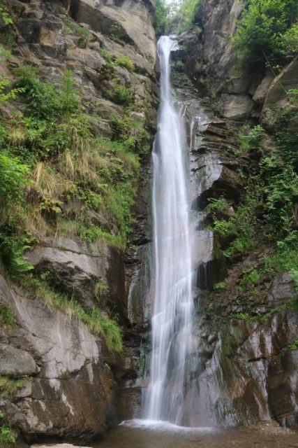
The Finsterbach Waterfalls were a series of three waterfalls with heights of 23m, 21m, and 34m, respectively. To my knowledge, the first waterfall was called the namesake Finsterbachfall, the second waterfall was called Kesselfall (Cauldron Falls?), and the uppermost one was called the Schleierfall (Bridal Veil Falls?), which was by far the most impressive of the lot.
With teasing glimpses of the Lake Ossiachersee, this was kind of my waterfalling excuse to check out the partially geothermally heated lakes of the Austrian province of Carinthia, which by the way was a part of the country that I don’t think many foreign tourists have put on their itineraries.
I began my hike after finding makeshift street parking on the main drag through the small town of Sattendorf (see directions below). I’m actually not quite sure if we were allowed to park there or not. In any case, right off the bat, I was treated to partial views towards the impressive Ossiachersee before I backtracked towards the signed Wasserfallweg leading uphill just to the left of the Finsterbach Creek.
This initial part of the trail was pretty much along a residential road flanked by homes sprinkled with a couple of guesthouses. The path then veered to the right as it went around some of the charming buildings here before continuing further uphill. Barely ten minutes into the hike, I encountered the first of the Finsterbach Waterfalls, which featured a heart-shaped frame for taking photographs as well as a short spur trail to get a closer look from its base.
Next, the trail then climbed more steeply as it made its way further up and above the first Finsterbach Waterfall. Eventually, there was another trail junction, where I kept straight to check out another spur trail leading to the second Finsterbach Waterfall (or Kesselfall). It took me about 15 minutes to get from the first waterfall to the second one.
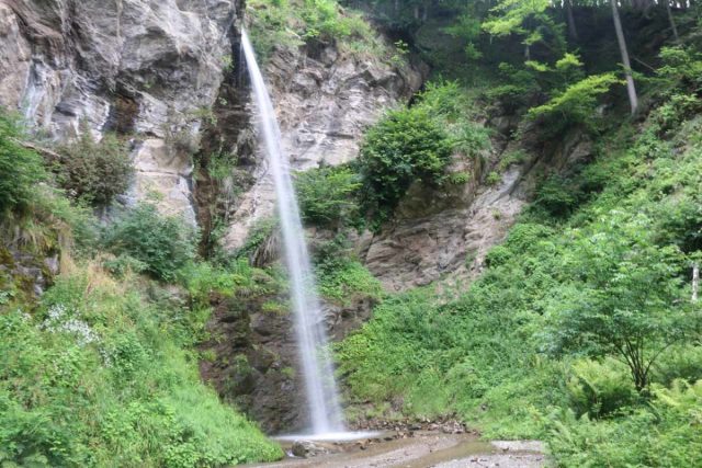
There were also some concrete barricades to discourage scrambling right up to the base. Looking back downstream, I was able to get some pretty nice partial views towards Sattendorf and the Ossiachersee behind it.
Continuing on the waterfall trail, the trail became increasingly steeper and rockier the further I went. The stretch between the second and third waterfall was also the longest section without coming into contact with the Finsterbach so I’d imagine that this was the most difficult part of the hike.
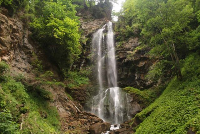
Beyond the bridge, the trail continued to climb steeply up stone steps, then across another bridge, before making the final approach to the third Finsterbach Waterfall – Schleierfall. The trail dead-ended at this point with fencing to discourage any further scrambling to get closer as the giant boulders at the bottom attested to past rockfalls.
After having my fill, I returned back the way I came, and when I got back to the parked car, I wound up spending about 75 minutes away from the car. The return hike went way faster since it was pretty much all downhill.
Finally, I should mention that I’ve seen these waterfalls referenced collectively in other ways like the Finsterbacher Waterfalls, Finsterbach Wasserfälle, Finsterbacher Wasserfall, and Finsterbachfälle (literally Finsterbach Falls in German).
Related Top 10 Lists
No Posts Found
Trip Planning Resources
Nearby Accommodations
This content is for members only. See Membership Options.Featured Images and Nearby Attractions
This content is for members only. See Membership Options.Visitor Comments:
Got something you'd like to share or say to keep the conversation going? Feel free to leave a comment below...No users have replied to the content on this page
Visitor Reviews of this Waterfall:
If you have a waterfall story or write-up that you'd like to share, feel free to click the button below and fill out the form...No users have submitted a write-up/review of this waterfall


Only logged in users can post a comment Please login or sign up to comment