About Falls of Clyde

The Falls of Clyde (we’re not talking about the ship here) were a series of three main waterfalls consisting of the Dundaff Linn, Cora Linn (pictured above), and the Bonnington Linn. All of these waterfalls were on the River Clyde suggesting they should be permanent and powerful. But it turned out that these waterfalls were merely my waterfalling excuse to check out what the UNESCO designation of the town of New Lanark was all about. For the moment I stepped foot into the strangely industrial yet historical-looking town from where the waterfall hike started, I got the sense that this place played a pretty critical role in not only Scotland’s heritage but the world’s heritage as well.
It turned out that the town of New Lanark (founded in 1785) was the result of a Utopian vision by Robert Owen, who modeled this industrial mill town to be free of crime, poverty, and misery while still producing textiles. At least that would explain why I saw numerous signs dedicated to Robert Owen himself. Under these humanitarian principles of fair work and living conditions (which were radical at the time), Owen managed to successfully carry out his form of benevolent industrialism in this town, and it apparently was said to be a key influence on how society should be run to the present day. In fact, I’ve read that many of his principles gave rise to things like garden cities as well as socio- and economic systems that are now widely accepted. So I guess given the significance of Owen’s ideas and how they were literally applied here, that was ultimately what warranted the awarding of UNESCO World Heritage status.
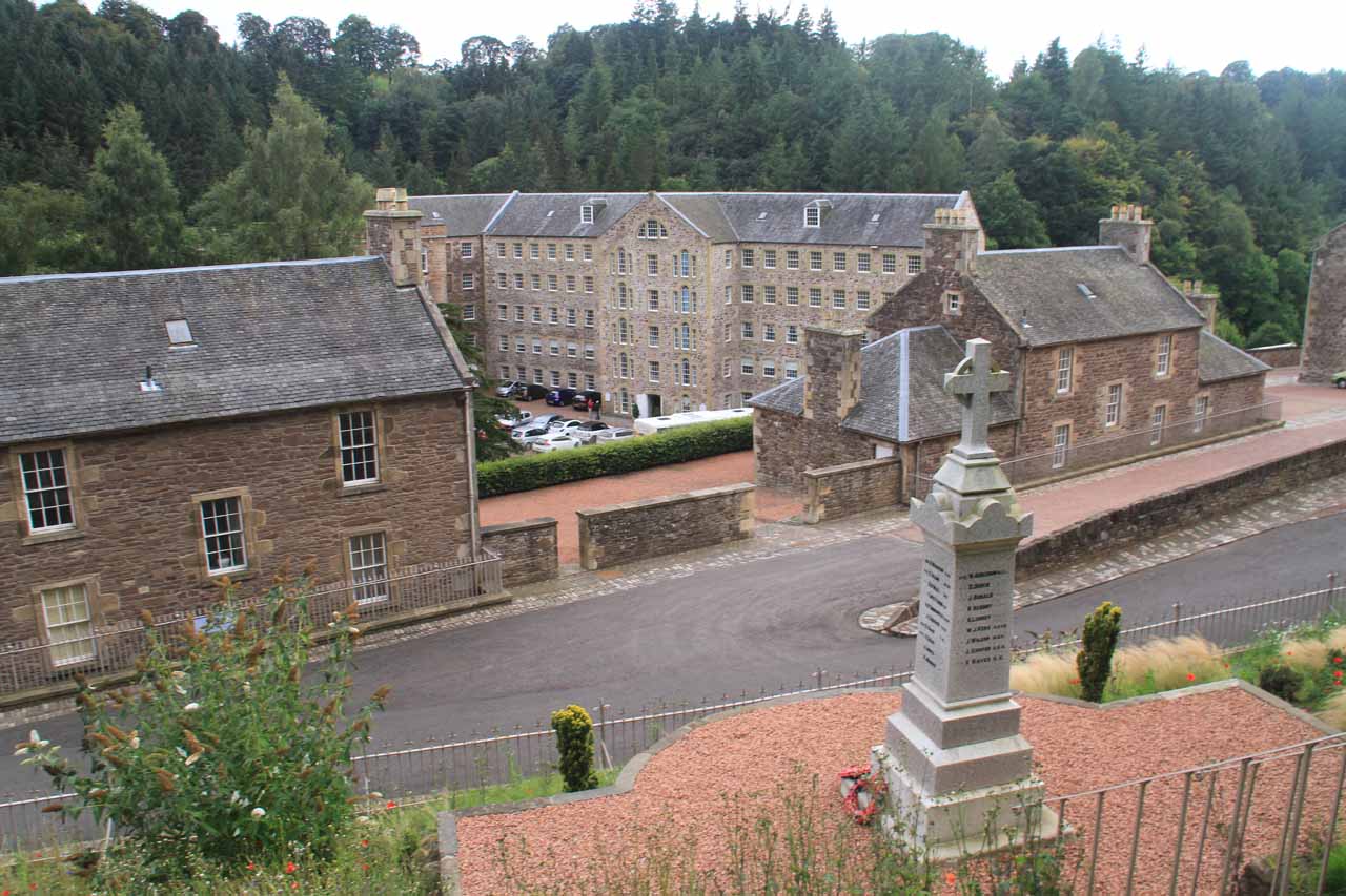
The hike to all of the Falls of Clyde began from the public access car park (see directions below) just up the hill from the actual town of New Lanark itself (where traffic access was limited unless you were working, living, or overnighting here). From there, I had to walk downhill on an established footpath that brought me right into the heart of New Lanark, where I followed the light purple badger signs that would ultimately lead me to the Falls of Clyde Visitor Centre, very close to Dundaff Linn, which was the first of the Falls of Clyde. Now it turned out that the actual trail itself was not from the visitor center, but a short distance up some steps towards a gate flanking some water channels.
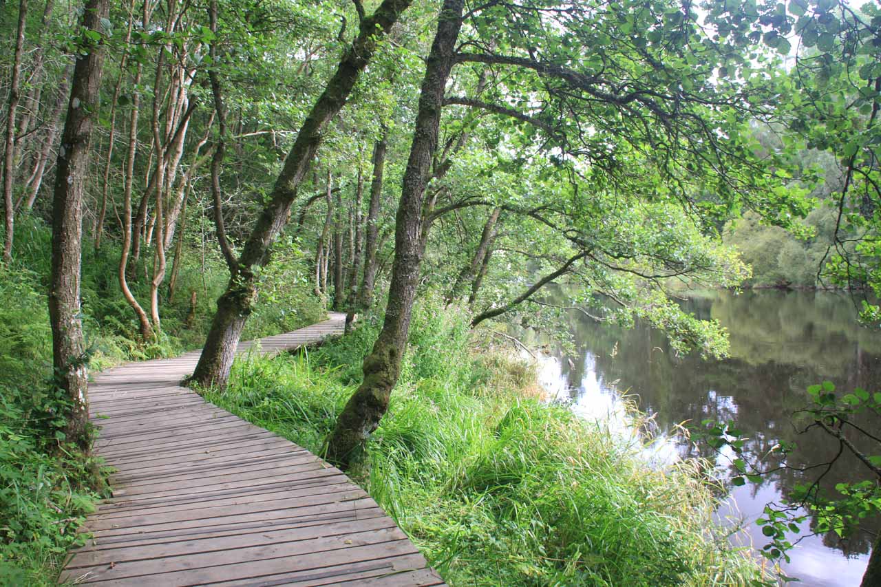
Beyond Cora Linn, the trail then entered into a small gorge as it continued meandering alongside the River Clyde. After another 30 minutes beyond Cora Linn, I’d ultimately make it to the unsightly dam called the Bonnington Weir. This structure was what ultimately controlled the flow of the River Clyde, and from what I could see, it pretty much robbed the thunder from the Bonnington Linn, which was the last of the waterfalls I’d encounter on the River Clyde. The best viewpoints of this waterfall actually required me to cross over the weir, then hike briefly downstream towards a pair of overlooks. That was where I could see that the current flow of the falls was but a mere fraction of the spectacle I’m sure that would’ve been on display had the River Clyde be allowed to flow in full spate and the entire width of the bedrock would be under water.
This was my turnaround point as there was no way I could continue on the trail then cut right back to New Lanark across the River Clyde. I believe the next crossing of the River Clyde wouldn’t be for another 3.5 miles anyways (though I’m sure there were more things to see in that direction). Thus, I can’t comment more on what else was further on this side of the river since I didn’t go past this point. When I eventually got back to New Lanark, I had a little more time to explore the town a bit, and that was where I got more direct views of Dundaff Linn as I was standing near an active waterwheel (Mill Number Four).
When I finished the uphill walk back to the car park, I ended up spending about 2.5 hours away from the car. Again, if Tahia and Julie had joined me on this excursion, I easily could have envisioned us spending at least 3 hours here.
Related Trip Reports
Related Top 10 Lists
No Posts Found
Related Itineraries
Trip Planning Resources

Nearby Accommodations
This content is for members only. See Membership Options.Featured Images and Nearby Attractions
This content is for members only. See Membership Options.Visitor Comments:
Got something you'd like to share or say to keep the conversation going? Feel free to leave a comment below...No users have replied to the content on this page
Visitor Reviews of this Waterfall:
If you have a waterfall story or write-up that you'd like to share, feel free to click the button below and fill out the form...No users have submitted a write-up/review of this waterfall
Only logged in users can post a comment Please login or sign up to comment