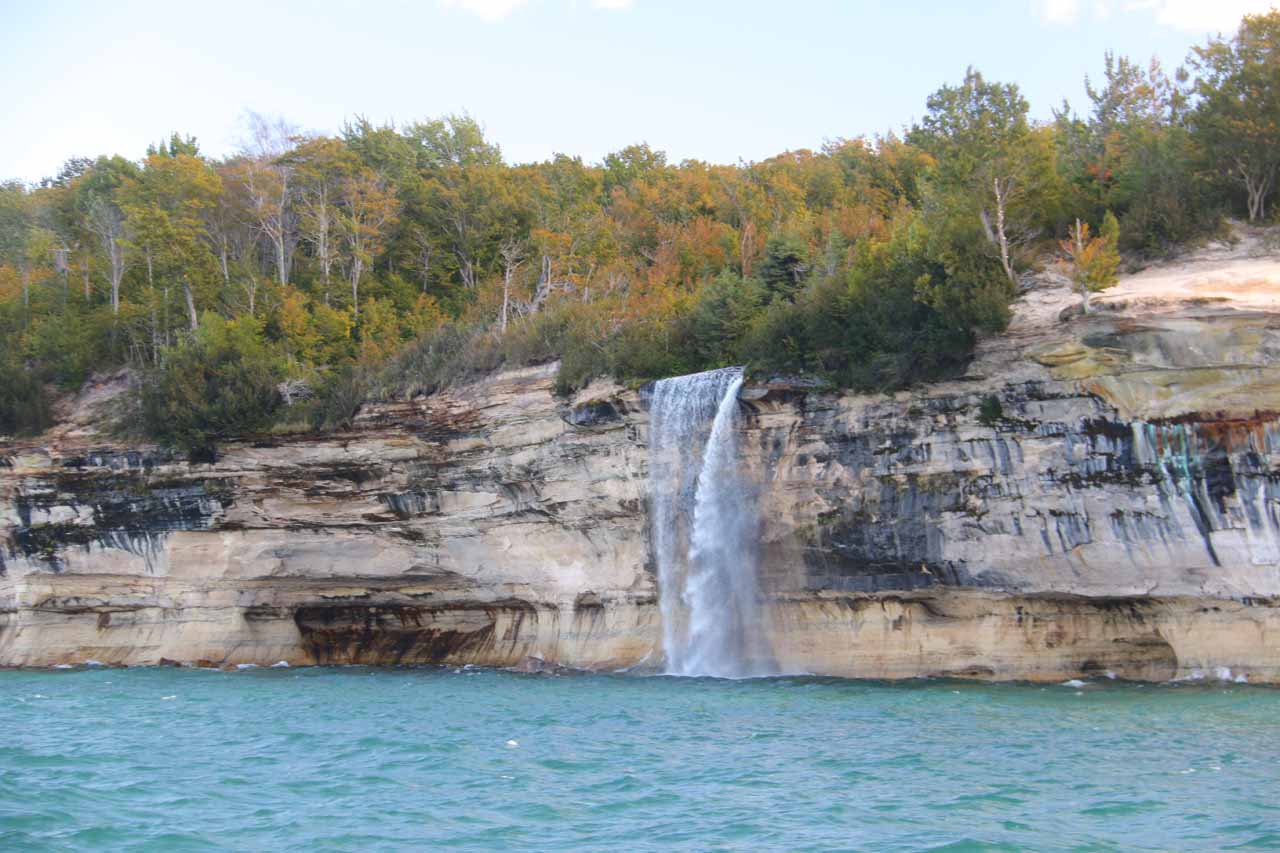
Spray Falls was one of the more unique waterfalls that we’ve seen. I guess what made it so memorable was that it dropped 70ft directly into the turbulent southern shores of Lake Superior. And since each of the Great Lakes seemed to be more like oceans complete with waves, beaches, cliffs, temperature moderation, and its own influence on the weather (including “coastal” fog), this waterfall could’ve passed for one of those waterfalls that fell directly into the ocean (or very close to it) like McWay Falls or Alamere Falls among others! So with that said, we were definitely excited at the prospect of visiting this falls, especially when we learned that it could be combined with touring the Pictured Rocks, which was the main attraction of the Munising vicinity.
Speaking of touring the falls, we’ve managed to visit it in a couple of very different ways. The most obvious way to do it would be the boat tour that would tour both the colorful and shapely cliffs of the Pictured Rocks as well as Spray Falls (though the waterfall option only left at specific times of the day). The other way involved land-based self-touring, and that pretty much meant doing a long hike along the shores of Lake Superior until the waterfall would be visible.
Both ways of experiencing Spray Falls have pros and cons. The water-based option was clearly the easiest way to witness the falls, and it was an added option to the already popular default way of getting frontal looks at the famous Pictured Rocks cliffs themselves. However, such tours weren’t cheap (we paid $75 for the three of us), the boat was crowded, and the tour was subject to cancellations due to weather. In fact, high winds resulted in high waves that cancelled all tours on the day that we originally planned to exercise this option. So we had to be flexible in order to accommodate.
The land-based option was nice in that the experience was quiet as it was pretty much all nature (as it should be) while I was able to do the hiking at pretty much any reasonable time during the day that I wanted to as well as at my own pace. Of course, the drawback was that the duration of the hiking was not trivial as it would require a minimum of a half-day to even experience the shortest of the hiking routes to access a distant view of the falls. We’ll get into the logistical details and detailed firsthand accounts of each option below…
[tabby]
[tabby title=”Boat Tour”]
Pictured Rocks Cruise with Spray Falls (Difficulty: 1)
The front of Spray Falls seen directly from the boatThere were two types of boat tours – the regular cruise and the Spray Falls cruise. There was also the Sunset cruise, which was basically the regular cruise at the end of the day. We had to make sure that we took the Spray Falls cruise, which was typically 15 minutes longer than the 2-hour 30-minute regular cruise. Given that these cruises were the shortest and easiest way to experience the Pictured Rocks (kayaking would be more intimate but would require more time and some degree of self-sufficiency), we had to book our tickets in advance. We actually bought them in person the day before our cruise, but apparently it’s possible that they might sell-out to the extent that you’d have to buy them online. We paid $75 total as it was $37 per adult and $1 for our daughter since she was less than 6 years old.
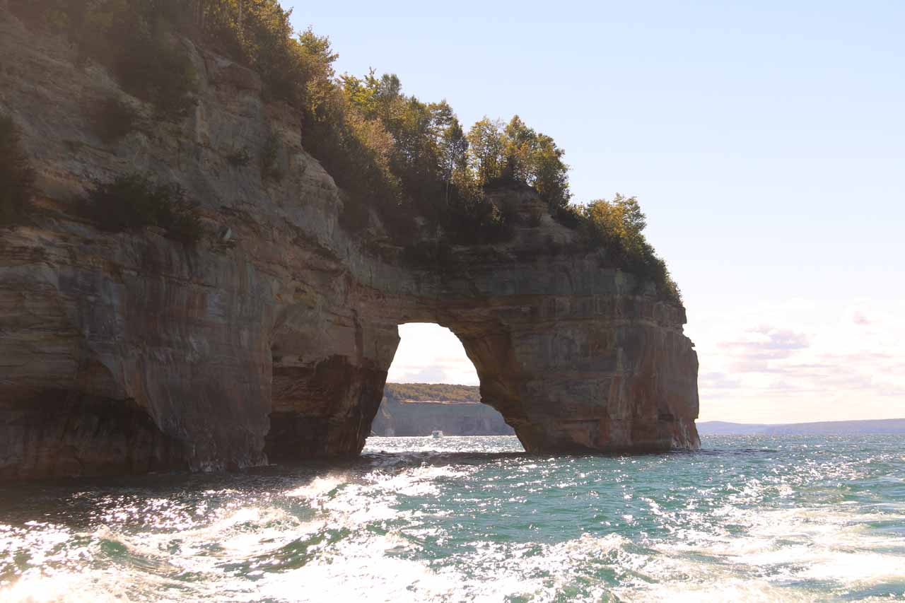
The Lover’s Leap arch looking against the early afternoon sun as the boat went pastDuring the peak Summer months, cruises would leave every hour from 10am with the last cruise around 7pm or later and the Spray Falls cruises starting at 4pm and the last tour would either be 5pm and/or 6pm. Since our visit was during the shoulder season of autumn in late September/early October, cruises left every two hours from 10am with the last tour at 5:15pm, and the Spray Falls cruises left at either 2pm or 4pm. Pamphlets containing a table of the full departure schedule were readily available at the boat dock in Munising as well as some accommodations (the Holiday Inn Express that we stayed at had some available). Of course, for trip planning purposes, the Pictured Rocks Cruises website also has up-to-date schedules and fares.
As for which cruise to take, we knew that the Pictured Rocks tended to get a nice late afternoon glow, which would get amplified the later in the day the tour would commence. And since we had to include the waterfall as part of the tour, that meant we aimed to take the 4pm tour (as the sunset cruise wouldn’t go to the falls). But alas, the cancellation due to high winds forced us to do the tour the following day, but since we had to be in Paradise, Michigan instead of Munising, Michigan on that day, we had no choice but to take the 2pm tour so the lighting on the cliffs weren’t as optimal (and there was always the chance that the winds might pick up and cause another cancellation).
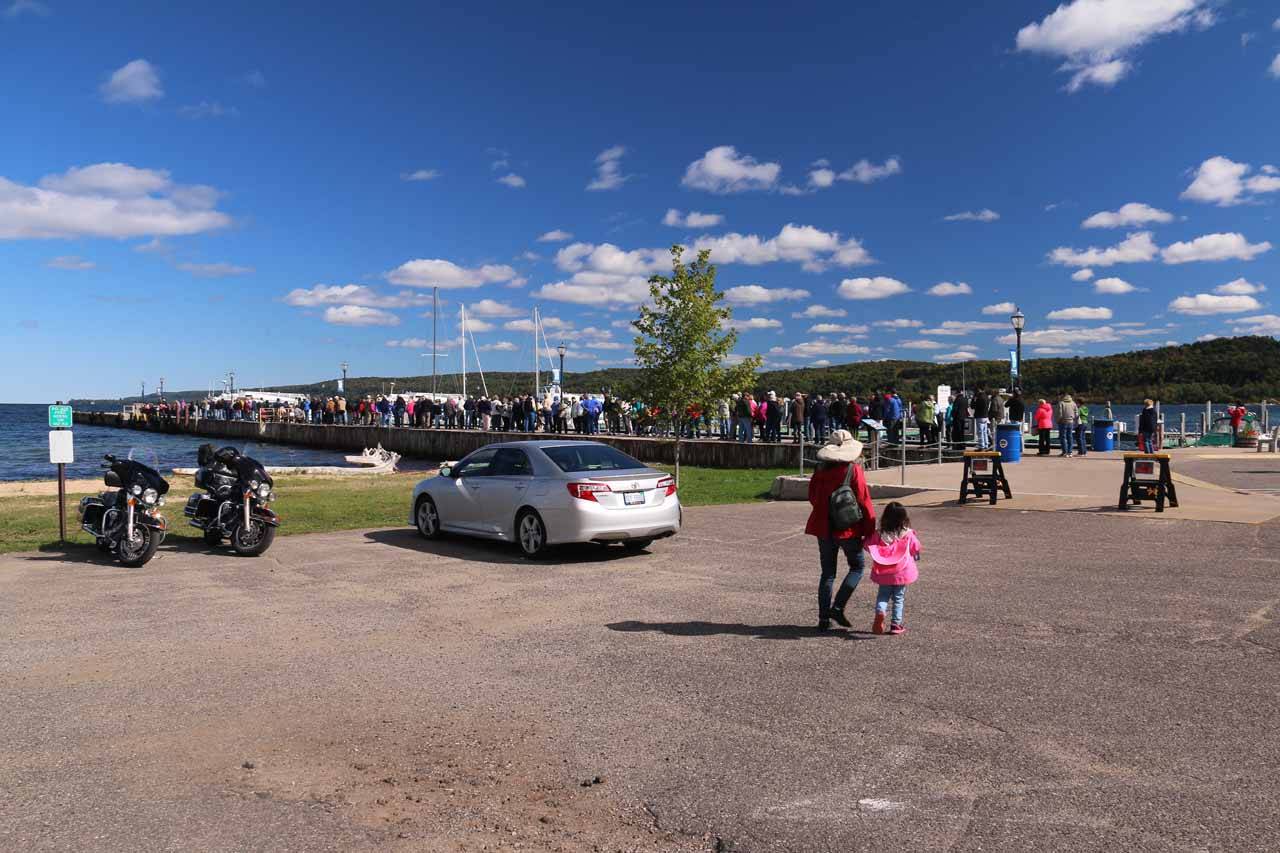
When we first showed up to the docks in Munising about 45 minutes early, there was already a huge line covering the entire dock!The Spray Falls cruise was said to average about 2 hours and 45 minutes. In order to get choice seating, it’s pretty much first-come first-serve. There was already a giant line an hour before our cruise departure time. It took a good 30 minutes or so to zoom along the lake from Munising towards the start of the Pictured Rocks cliffs. When the PA announcer told us that we were free to move in the aft deck (the back of the boat), I used the initial part of the cruise as an opportunity to make my way to the back on the right side since it would face the cliffs on the way there (the left side would face the cliffs on the way back).
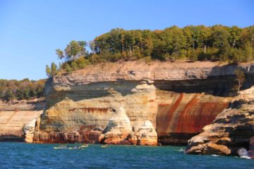
Along the way, we saw some exclusive Summer homes on both Grand Island and on the more remote shores of Michigan’s UP. Once we got to the Pictured Rocks (especially around Miner’s Castle and beyond), that was when the aft deck got really crowded (so it was good I got there early, but now I could hardly move). In any case, from a photo standpoint, this was where the hit parade occurred as there were small sea caves, impressive natural arches, colorful streaks on the shapely and sloping cliffs, impressive rock formations, and beaches along the way. The DSLR camera was useful as the rocking motion of the boat conspired to make photos blurry.
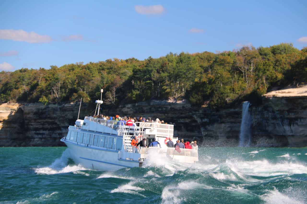
Context of another Pictured Rock cruise boat turning around before Spray FallsOnce we got past Chapel Rock, the boat then went the extra mile to Spray Falls. Right at the falls, the boat turned around and that was when my position at the rear right corner of the aft deck was no longer advantageous. Since the left side of the aft deck was full, I pretty much retreated to my seat and tried to take what photos I could though you can imagine how tricky it would be when you’re seated in the middle and not the edge of the boat. If you were seated in inside the heated cabin like Julie and Tahia were, taking photos through the window would be difficult at best, especially with all the people in front to contend with.
[tabby title=”Land Tour”]
Hike to Spray Falls (Difficulty: 4)
Spray Falls from the distant lookout along the North County TrailThere were a couple of hiking options to go about the land-based self-tour of Spray Falls. One started from the end of Chapel Road, which was also near both Mosquito Falls and Chapel Falls. The other was from the Little Beaver Lake Trailhead. I would up doing the latter as it was said to be the shortest hike to Spray Falls. But even then, based on the signage there, it was 4.1 miles each way (or 8.2 miles round trip). I believe the Chapel Road Trailhead was a little bit longer, but in hindsight, I probably should’ve tried that approach just to experience the other waterfalls as well.
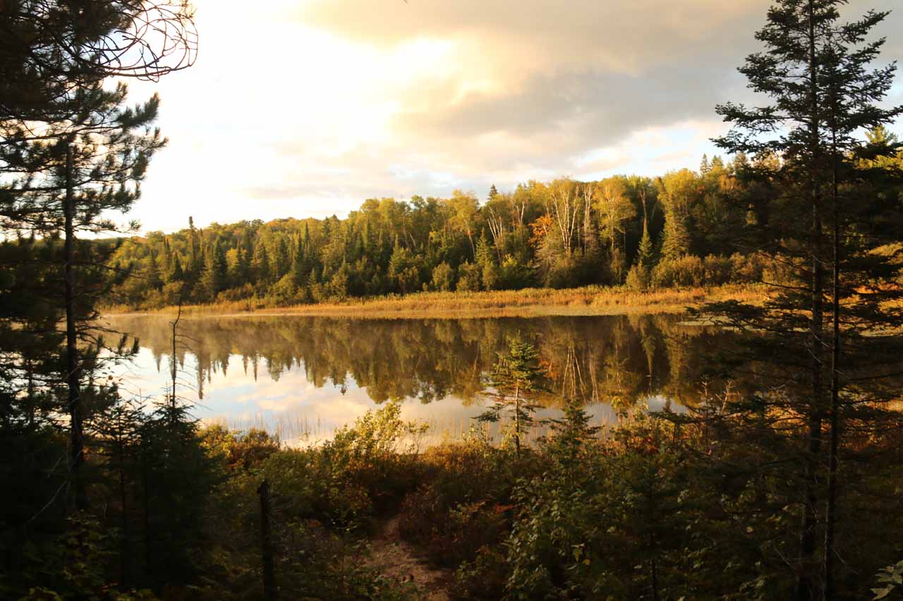
Partial view of the scenic Little Beaver Lake in the early morning hours during my Spray Falls hikeIn any case, I started from the trailhead parking near Little Beaver Lake (see directions below). From there, I followed the White Pine Trail for the first 1.5 miles. The trail was fairly straightforward to follow with a few bridges and boardwalks over the marshiest spots. For practically the entire time, the trail was surrounded by trees and even went past some interesting rock formations (some with tiny caves). At about 0.1-mile from the North County Trail (which skirted Lake Superior), there was another spur trail on the right leading to Beaver Lake. I didn’t make it all the way to the lake on that detour, but I did explore enough of it to get a nice reflective shot of a calm section of Little Beaver Lake before resuming the Spray Falls hike.
Once I got to the well-signed North County Trail (the signs were important so on the way back, I would know when to turn back inland to get back to the trailhead along the White Pine Trail), I then hiked the remaining 2.6 miles to Spray Falls. This section of the hike pretty much skirted along the shores of Lake Superior. There were some sandy spur trails leading down to the beaches in the more flatter parts of the lakeshore, but most of this trail was skirting along cliffs with some limited dropoff exposure except for the bluffs that afforded me some of the more satisfying views of the lakeshore.
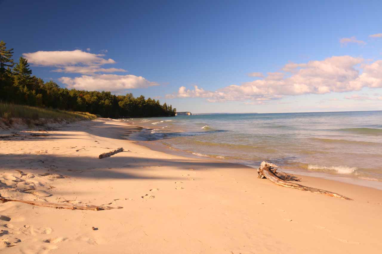
One of the attractive beaches on Lake Superior’s shorelines accessible from the North County Trail along the out-and-back hike to Spray FallsOn the inland side of the trail, there were other spur paths leading to the Cover’s Campground and group sites. The North County Trail was mostly level except for a couple of spots where I had to go up and down some very steep steps and slopes to get around some rocky alcoves and bluffs along the way. This part of the hike represented some of the most peaceful moments of our entire Great Lakes trip, and I could easily see why people would want to go on a much longer trek involving overnight backpacking along this trail. In fact, I didn’t see another person until I was returning to the car park from Spray Falls. And I only saw one other person after that at the White Pine Trail on the return.
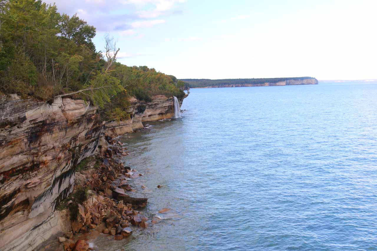
Anyways, there was a signpost marking “Spray Falls”, which led me on a short spur to a precarious overhanging bluff with a distant view of Spray Falls as I peered towards the southwest direction. There was definitely dropoff exposure at the edges of this bluff, and given the tendency of the shoreline to erode and fall into the lake (the same forces that caused the Pictured Rocks as well as all the arches and caves), I was keenly aware of how dangerous it would be to linger at the edges. Nevertheless, I knew that this was the best view I could get of the waterfall from land so this marked my turnaround point.
Full context of Spray Falls and its distance from the signposted lookout spotThe North County Trail actually kept going along the lakeshore towards Spray Creek and beyond, but I knew from my pre-trip research that I wouldn’t be able to see Spray Falls without doing some very daring and dangerous scramble (which I wasn’t up for doing). When I returned to the car, I wound up spending about 3 hours and 10 minutes on this excursion. However, since I couldn’t keep Julie and Tahia waiting back at Munising, I admittedly had to do a little trail running as I had previously thought that this hike was around 5 miles round-trip. So on a more relaxed pace, this out-and-back hike can easily take around 4 to 5 hours.
[tabbyending]
Tagged with: munising, pictured rocks, national lakeshore, alger county, marquette, michigan, waterfall, lake superior, upper peninsula, up, great lakes, cruise, north county trail, white pine trail, little beaver lake, spray creek
Visitor Comments:
Got something you'd like to share or say to keep the conversation going? Feel free to leave a comment below...
No users have replied to the content on this page
Share your thoughts about what you've read on this page
You must be logged in to submit content. Refresh this page after you have logged in.
Visitor Reviews of this Waterfall:
If you have a waterfall story or write-up that you'd like to share, feel free to click the button below and fill out the form...
No users have submitted a write-up/review of this waterfall
Have you been to a waterfall? Submit a write-up/review and share your experiences or impressions


Only logged in users can post a comment Please login or sign up to comment