About Munising Falls

Munising Falls was one of the more convenient waterfalls that we had visited while staying in the town of Munising (pronounced “MEW-ni-sing”). Visiting this waterfall (and others around Munising) was really our excuse to pass the time while awaiting our opportunity to visit the famed Pictured Rocks by water. Access to the falls was only a few minutes drive from where we were staying (see directions below), and the hike to the main lookout of the falls (yielding the view you see in the photo at the top of this page) was only 800ft on a well-developed and flat trail (less than five minutes walk in each direction). On our visit, this waterfall had a tall plunge where the falls wasn’t even making contact with any surface for most of its overall drop until it struck a slope at its base to comprise rest of its overall height, which was said to be 50ft tall.
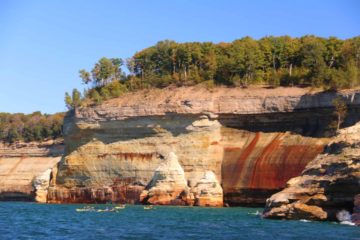
During the short walk, we had encountered a pair of spur trails branching off the main path and boardwalk. The first one we encountered on our right (roughly at the half-way point of the main trail) went up some stairs before becoming a boardwalk hugging an interesting cliff ledge hinting at the geologic forces at play that gave rise to the falls (let alone the cliffs comprising the Pictured Rocks). At the end of this spur path was a signposted dead-end with a somewhat satisfying angled view of Munising Falls. It looked like the barricade erected at the dead-end was a relatively new development as it appeared that the trail used to continue to the backside of the falls. The deep recession or cove behind the falls suggested to us that it was an old waterfall. Of course, it was also the main reason why part of the drop of the falls was completely airborn thereby resulting in its somewhat wispy appearance.
The second spur trail was just before the main overlook at the end of 800ft from the trailhead. This one went up some stairs to the left, which quickly led up to another signposted dead-end with a very unsatisfactory and obstructed view of Munising Falls from the opposite side. Again, the barricade forming the dead-end seemed to be new, and it led to the big alcove behind the falls. The authorities must’ve really not wanted people to go behind the waterfall for safety and/or liability reasons, I’m sure. That said, I’d imagine that before it was verboten (i.e. forbidden) to go behind the falls, the ideal route for visiting this falls would have been to take the upper trail on the right, then go behind the falls, and finally enjoy the front of the falls from the main lookout before completing the lollipop loop by hiking back to the car park. We spent about 40 minutes away from the car to take it all in legally.
I had read that the waterfall would see its greatest flow in the late Spring and early Summer months (when the creeks and streams would have benefitted from the thaw of snow and/or ice given the harsh Winters here). During our visit in late September 2015, the falls had seemingly lighter than average flow, but it was still pretty nice as you can see from the photos here.
Related Trip Reports

Related Top 10 Lists
No Posts Found
Related Itineraries
Trip Planning Resources

Nearby Accommodations
This content is for members only. See Membership Options.Featured Images and Nearby Attractions
This content is for members only. See Membership Options.Visitor Comments:
Got something you'd like to share or say to keep the conversation going? Feel free to leave a comment below...No users have replied to the content on this page
Visitor Reviews of this Waterfall:
If you have a waterfall story or write-up that you'd like to share, feel free to click the button below and fill out the form...No users have submitted a write-up/review of this waterfall
Only logged in users can post a comment Please login or sign up to comment