About Lower Whitewater Falls

Lower Whitewater Falls is a smaller version of its bigger brother the Upper Whitewater Falls further upstream and across the state border.
This 200ft waterfall cascades and plunges in a similar manner to its bigger brother, but accessing this waterfall requires a bit of a longer hike as well as getting past some of the uninviting Duke Energy gates and infrastructure. This probably explains why we noticed a considerably quieter experience compared to its more famous counterpart further upstream as we were the only ones on this trail the entire time.
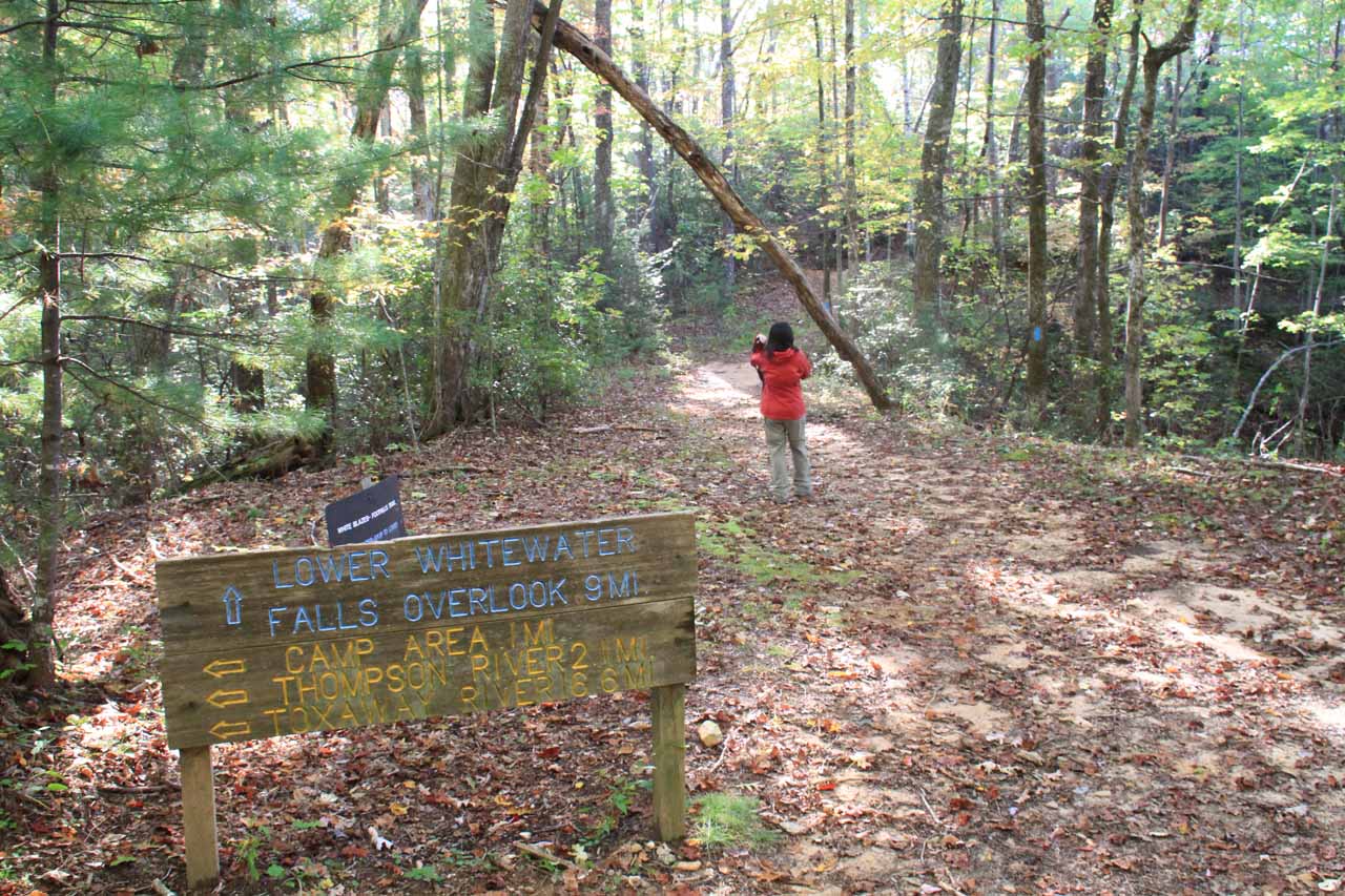
We were able to view this waterfall at the end of a quiet 4-mile return hike (2 miles each way; don’t trust the sign at the trailhead saying it’s only 1.7 miles each way). The viewing deck offered a rather distant view of the falls and from what we could tell, we didn’t see any safe means of finding a different or better view than from this spot.
We happened to show up in the late morning so on a sunny day, we got shadows concealing the base of the falls from the sensors of our cameras. Perhaps later in the day (say around midday), the sun would be high enough to eliminate the shadows and thus allow you to be able to take better photos than the ones we offer on this page.

From the large trailhead parking area (right next to a Duke Pumped Storage facility; see directions below), we hiked up along some gutter before the trail plateaued. It was possible to see Lake Jocassee from here.
Next, the trail veered left into a shady and forested area. This part of the trail undulated briefly before making a descent towards a pair of footbridges crossing over the Whitewater River. A sign here indicated that it was still 1.7 miles to the waterfall overlook, which led me to believe that the sign at the trailhead (also saying it was 1.7 miles) was a lie.
Next, the hike coincided with the fairly rough and unpaved Musterground Road before some more blue hashes indicated where the trail branched off and resumed away from the gravel road.
From here, the trail initially started to climb before flattening out for some distance. Then, the trail made a rather long and steep final descent to the lookout platform with a distant yet frontal view of Lower Whitewater Falls.
All told, it took us 2 hours and 20 minutes to do the entire out-and-back hike plus time to take pictures. While the falls was impressive, the long hike to get here felt somewhat like an anticlimax, especially since it followed the Upper Whitewater Falls experience.
So now we’ll introduce a “cheater’s shortcut.” Had we known beforehand where to stop the car and resume the hike, we probably would’ve employed this method to save on time and energy. Oh well. Our loss, your gain.
This shortcut only works if you happened to be here during the hunting season from around October through December and in April. That’s because the unpaved Musterground Road is ungated (which was the case when we were there). We were able to drive this road to the ATV parking area though keep in mind that the road can get pretty rough so it has the potential to do damage to your rental car if you’re not careful.
As you’ll recall from the hiking description above, it’s a short walking distance along Musterground Road from the ATV parking area to where the trail branches off and resumes towards the waterfall overlook. I’d imagine that had we done this, we might have chopped off an entire hour or more of physical exertion and time.
Related Trip Reports
Related Top 10 Lists

Related Itineraries
Trip Planning Resources

Nearby Accommodations
This content is for members only. See Membership Options.Featured Images and Nearby Attractions
This content is for members only. See Membership Options.Visitor Comments:
Got something you'd like to share or say to keep the conversation going? Feel free to leave a comment below... Not Worth It (Lower Whitewater Falls) September 22, 2014 4:28 am - you are right. the end of the hike was anticlimatic. wish we had read this before went to this area. oh well good exercise. the view sucked as the trees blocked the view of at least the bottom two thirds of the falls in early september. might go back sometime but when the leaves are… ...Read More
Visitor Reviews of this Waterfall:
If you have a waterfall story or write-up that you'd like to share, feel free to click the button below and fill out the form...No users have submitted a write-up/review of this waterfall
Only logged in users can post a comment Please login or sign up to comment