About Linville Falls

For us, Linville Falls represented an exercise in confusion because there were apparently two different trailheads (one administered by the Forest Service and the other administered by the National Parks). In hindsight, I probably should’ve paid more attention to the sign at the trailhead telling us how to get to the “paved parking lot.”
Technically, it shouldn’t have mattered from a hiking distance standpoint which trailhead we started from (we happened to start from the US Forest Service trailhead), but I got the feeling that the National Park trailhead was better suited for visitor facilities plus easier and more explicit access to all of the waterfall’s overlooks and access trails. As a result, we only managed to view the falls from one side of the Linville River, but we didn’t bother going to the waterfall’s base or check out an overlook that would’ve given us a look at the falls from the opposite side of the river. Call us lazy, but after seeing the falls, we didn’t feel like extending our stay here as we knew there we’d be short on time to do other things if we did.
Anyways, the falls actually consisted of a small twin waterfall in its upper drop before twisting and plunging some 40ft or so into the steep Linville Gorge over the waterfall’s main drop. On the morning we arrived, there were rather terrible shadows making photography of the main drop of the falls suboptimal, but at least the Autumn colors exploding higher up the Linville Gorge added a bit of contrast and life to the scene.
From the quiet and unpaved US Forest Service car park (see directions below), we descended a well-used trail towards an intersection with the National Park service trail. One thing we immediately noticed about this place was the National Park service trail was way busier (and crowded) than the trail we took. At this point, we kept right to get to the waterfall overlooks (going left would’ve gone to the National Park Service car park).
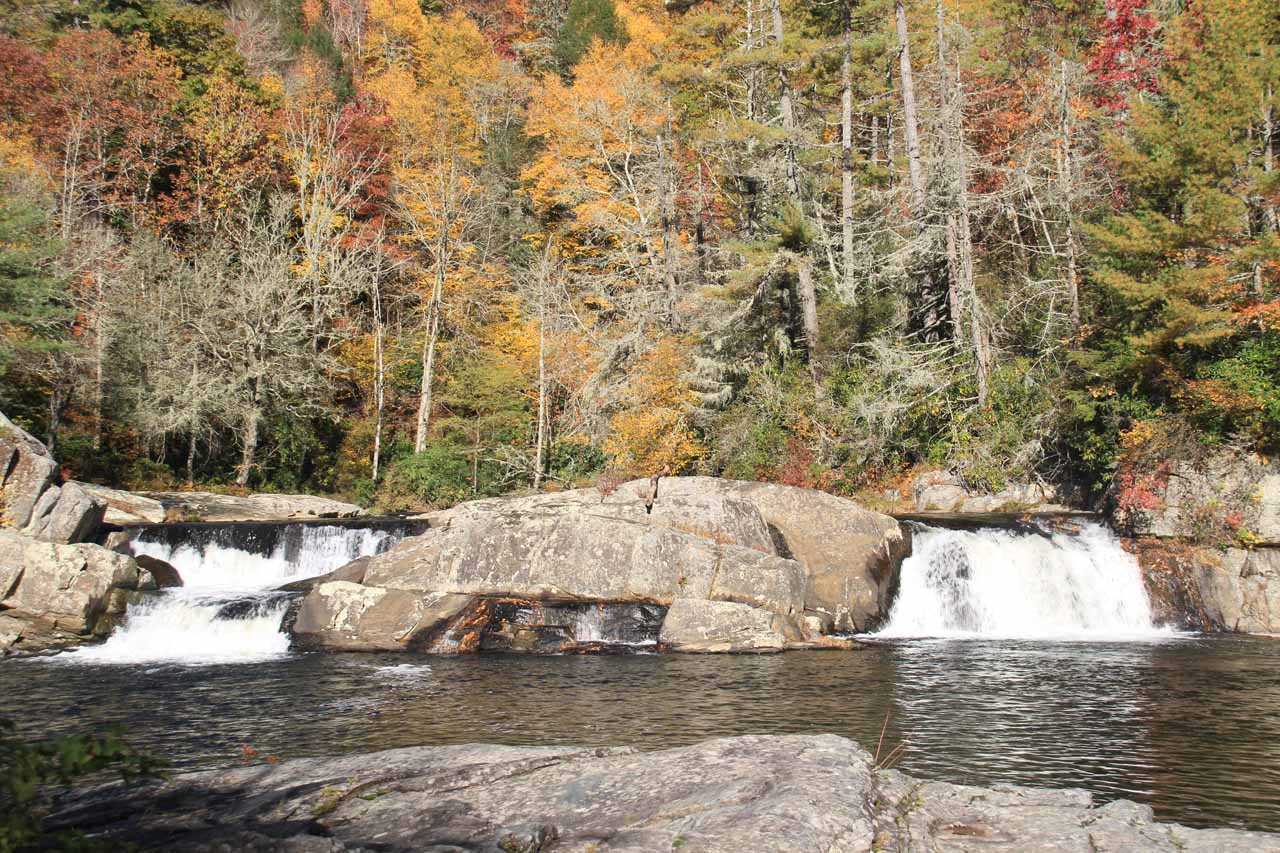
Anyways, the rather crowded Upper Falls overlook afforded us views of the short twin falls backed by pretty Autumn foliage with nice backlighting from the morning sun. However, the main falls was further downstream hidden from view within a slot chasm just below the viewing area. Nonetheless, we knew it was a gushing waterfall because it could be heard loudly from this spot.
Going back onto the main trail, we then continued walking another 0.3 miles (0.7 miles from the trailheads or 1.4 miles round trip), which ascended most of the way until it finally started to plateau. From there, we saw a signpost by a trail junction fronting a little shelter. Turning left at this junction, we descended some stairs, which eventually led to the Chimney Rock Overlook.
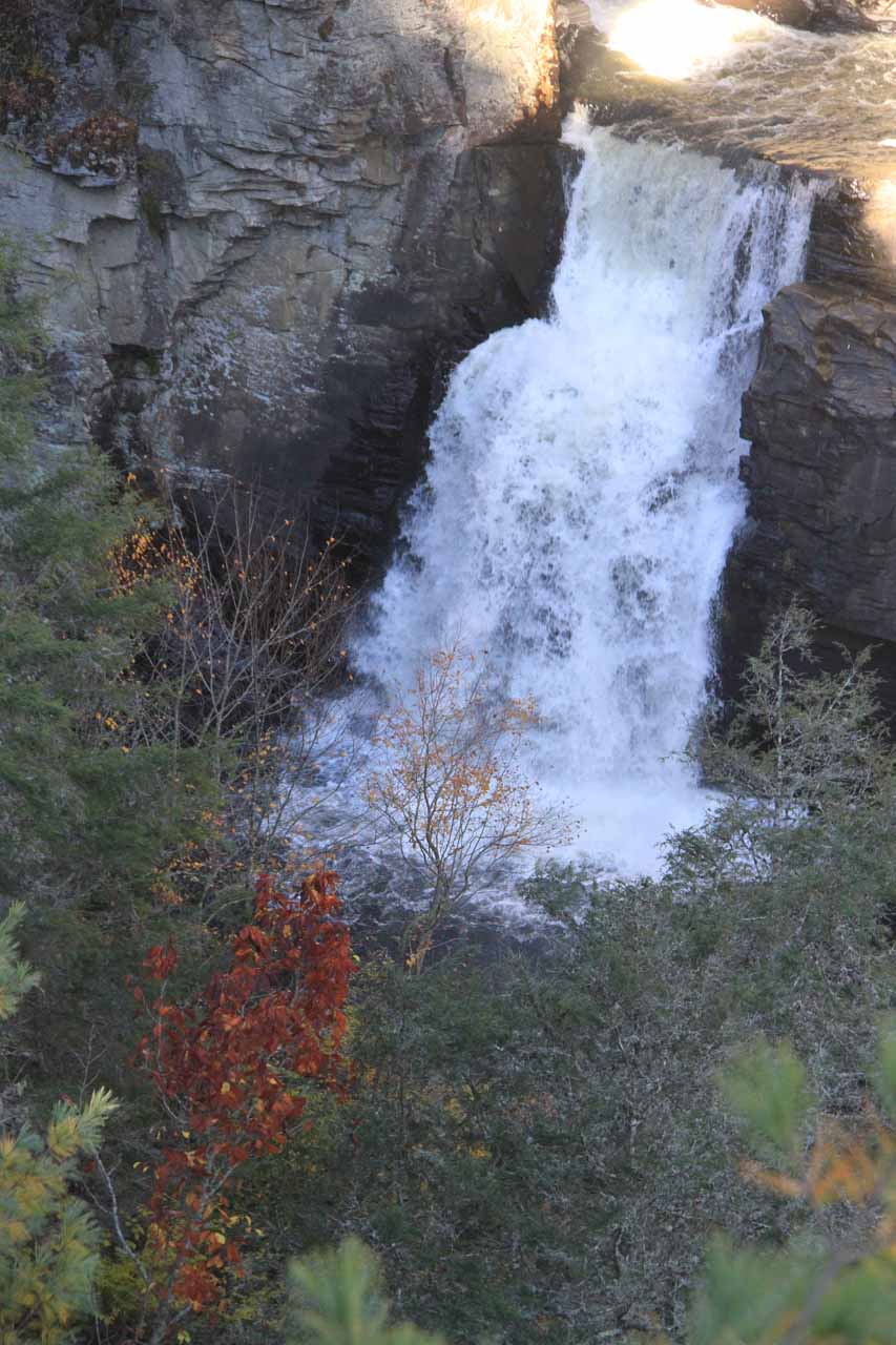
While the name was a little misleading in that there was no Chimney Rock formation to check out (at least not from what we could tell), I think the viewing platforms were probably on top of the Chimney Rock itself, though I’m just guessing here. In any case, it was from this overlook that we were finally able to see the front of the main Linville Falls (said to be 45ft tall) plus part of its Upper Falls, and we were able to look downstream at the steep Linville Gorge.
Returning once again back to the main trail, we then continued walking uphill for another 800ft following the signs for Erwin’s View (about 0.8 miles from the trailhead or 1.6 miles round trip). This overlook offered a more distant view of Linville Falls, but at least we were able to photograph the entire gorge with the falls in context. It was also from this lookout when we noticed there were people who hiked to the base of the falls (said to be 0.7 miles from the National Park Service trailhead or 1.4 miles round trip) and made us ponder the decision whether to do it or not.
Related Trip Reports
Related Top 10 Lists
No Posts Found
Related Itineraries
Trip Planning Resources

Nearby Accommodations
This content is for members only. See Membership Options.Featured Images and Nearby Attractions
This content is for members only. See Membership Options.Visitor Comments:
Got something you'd like to share or say to keep the conversation going? Feel free to leave a comment below...No users have replied to the content on this page
Visitor Reviews of this Waterfall:
If you have a waterfall story or write-up that you'd like to share, feel free to click the button below and fill out the form...No users have submitted a write-up/review of this waterfall
Only logged in users can post a comment Please login or sign up to comment