About High Falls (Rock City)

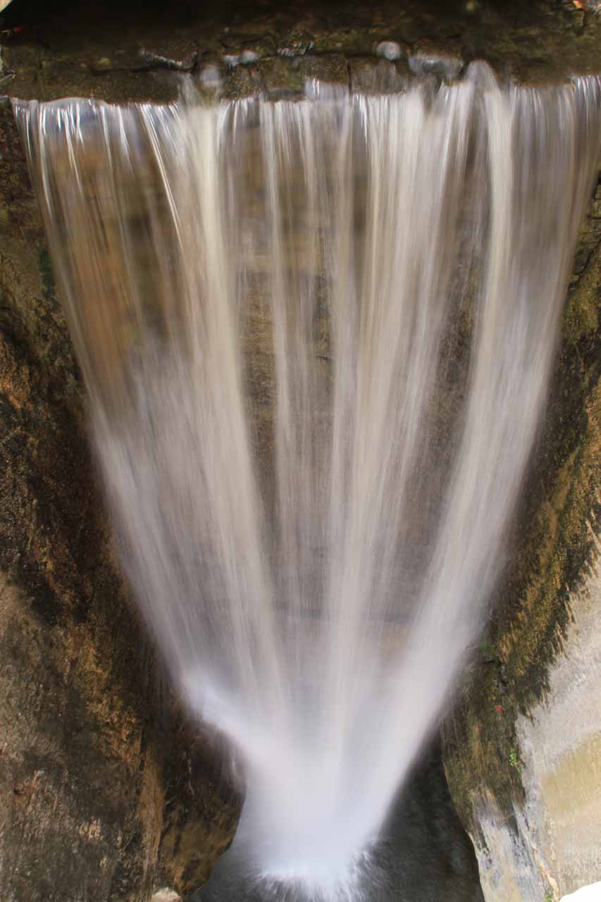
High Falls (which also goes by the name Lover’s Leap) is an artificial waterfall and is arguably the signature attraction of the Rock City Lookout and Gardens on the Georgia side of Lookout Mountain.
Because it’s not a natural waterfall, I struggled with whether or not it should be included on this website, especially when considering the contrived factor that permeated this complex. But I guess given that it can easily be coupled with a visit to Ruby Falls and that it has a backdrop that’s hard to ignore, I gave this one the benefit of the doubt and added this page.
We were able to view the falls from its top over a stone bridge as well as from further below towards a lookout platform precariously protruding from a cliff with a more frontal view like you see in the photo at the top of this page.
We happened to show up in the late morning and apparently that was probably the worst time to see it as it was totally against the sun. However, there were enough clouds in the area to allow us to wait for them to cover the sun so we could get decent photos.
About half-way through the walk past either a stone bridge or a swinging bridge, the path takes you to the top of the waterfall where there’s also a large lookout area where it’s claimed that you can see seven states from this very spot. We find that to be a bit of a stretch, but then again if the weather was totally clear and free of pollution haze and/or water vapor, then perhaps it might be true. Who knows?
The frontal view of the waterfall is towards the end of the walk after a deer park and some stained-glass windows casting some colored natural light on a tunnel hugging a cliff.
The walk ends after going through the so-called Fairyland Caverns, which is perhaps the most Disney-like part that was very reminiscent of a cross between the Pirates of the Caribbean and a cave that pretends to be natural. It’s here that we saw most of the gnomes, which seemed like a rather consistent theme throughout the walk.
All in all, it took us about 90 minutes to do the whole thing at a very leisurely pace. The experience felt more like a theme park than that of a garden or self-tour.
Depending on how much fun you’re having though, I suppose you could spend a whole day here. But if you’re not into the wannabe Disneyland style, then you might do as we did and hastily make our way out of here after seeing the High Falls.
Related Trip Reports
Related Top 10 Lists
No Posts Found
Related Itineraries
Trip Planning Resources

Nearby Accommodations
This content is for members only. See Membership Options.Featured Images and Nearby Attractions
This content is for members only. See Membership Options.Visitor Comments:
Got something you'd like to share or say to keep the conversation going? Feel free to leave a comment below...No users have replied to the content on this page
Visitor Reviews of this Waterfall:
If you have a waterfall story or write-up that you'd like to share, feel free to click the button below and fill out the form...No users have submitted a write-up/review of this waterfall
Only logged in users can post a comment Please login or sign up to comment