About High Falls of the Pigeon River
High Falls of the Pigeon River was one of the lesser known trans-national waterfalls in the world, which was amazing since we’re talking about a waterfall shared between the USA and Canada! Yet even given its relative obscurity, we noticed that it was still quite popular given its close proximity to the border patrol station between the two countries (see directions below). Julie and I thought what really set this waterfall apart was its multi-segmented and multi-tiered characteristic as the Pigeon River rushed its way through a deep gorge that added to the drama of the scene. It also didn’t hurt that this was said to be the highest waterfall in Minnesota at about 120ft.
Another surprising aspect about this waterfall from an administrative standpoint was that the Grand Portage State Park was on land owned by the Grand Portage Band of Chippewa as opposed to the state of Minnesota. The land was said to be leased to the state of Minnesota to be administered as a state park. I’m not sure whether the Pigeon River Provincial Park on the Canadian side has a similar arrangement with the Native Americans or First Nations People here. The area was known as Grand Portage because the Pigeon River was known to be a key river for navigation. However, the lower 20 miles consisted of rapids and cascades that could not be canoed or kayaked and thus would require an extensive portage to reach calmer waters further upstream. High Falls was a dramatic example of such a navigation barrier.
This impressive waterfall yielded very different experiences from either side. So I’ll go into these different ways of doing this falls below…
[tabby] [tabby title=”Usa Side”]The American Side (Difficulty: 2)
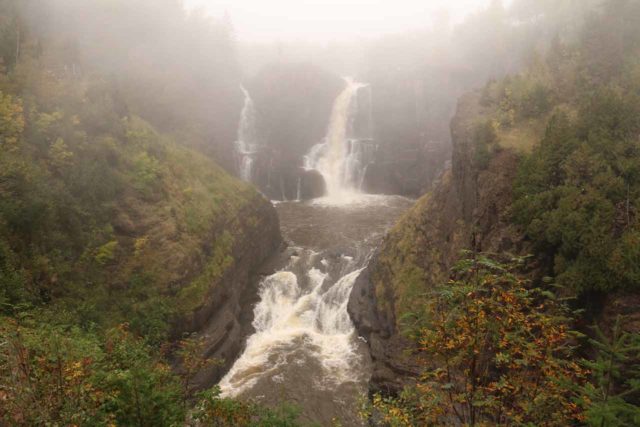
In the steeper parts of the trail, there was a boardwalk with stairs that got us up to the bluffs with a direct look at the High Falls of the Pigeon River. Near the boardwalk, there was an outhouse (for pit toilet) as well as the start of a 3.5-mile (round-trip) trail leading to the Middle Falls of the Pigeon River. Since I didn’t do this detour from the American side, I can’t say more about this way of doing it.
Looking across the river, we were also able to clearly see the lookouts on the Canadian side. In fact, during our visit, we even saw some visitors on the other side get precariously close to the brink of the waterfall. While the viewing angle was quite satisfying from the American side, the unseasonably foggy weather kind of kept the viewing experience from being as optimal as we would have liked. That said, while we were able to see most of the falls from the pair of viewing decks, there was a cliff that tended to obstruct the far left segment of the falls.
Overall, Julie, Tahia, and I had spent about an hour away from the car at a very leisurely pace.
[tabby title=”Canada Side”]The Canadian Side (Difficulty: 2.5)
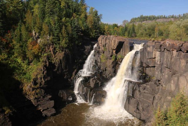
Just before the bridge (about another 0.3 miles from the Finger Hill spur), there was a trail that returned 0.5km back to the trailhead, which led me to believe that I could’ve taken this more direct trail to get from the car park to here. However, given that the signage was more obvious going in the other direction, I suspect that this was more of a direct trail on the return hike.
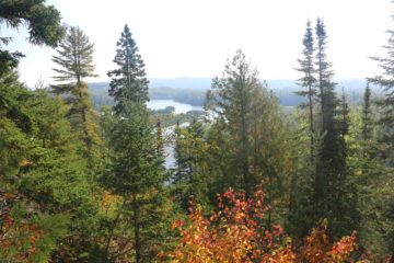
When the trail descended, I then reached a junction (roughly 1/4-mile from the previous junction). Going right at this junction led to the unprotected brink of the High Falls of the Pigeon River. I dared not get near the water so I had to settle for standing on a precarious bluff, where I managed to get partial profile views of the falls from here. I was also able to get decent upstream as well as downstream (against the sun) views from here.
Back at the junction, a short distance further led me to another spur trail deviating from the main trail on the right. This then crossed a bridge (might have been a rock sluice during the logging heyday), where interpretive signs told of how logs could make it past High Falls and eventually to the waiting tug boats at Pigeon Bay in Lake Superior given the wooden slides that were constructed here.
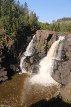
Once I had my fill of this lookout, I then completed the loop, which descended several steps leading me down to the banks of the Pigeon River. At roughly 0.4 miles from the lookout, there was another spur trail leading to some historical plaque. I didn’t investigate that spur trail further so I can’t comment more about it. Eventually, in another 0.1-mile I returned to the original junction, where I then returned the way I came at least to the bridge, then I took the 0.5km trail alongside the road back to the Provincial Park Center and the parked car.
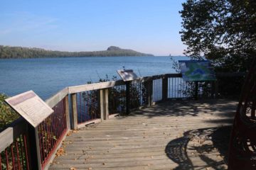
Overall, I had spent about 90 minutes away from the car, which included the optional 15-minute out-and-back boardwalk to the Pigeon Bay lookout. That lookout wasn’t anything dramatic from a photographic standpoint, but it did provide us the ability to get close to a calm and protected part of the Lake Superior shoreline.
[tabbyending]Related Top 10 Lists
No Posts Found
Trip Planning Resources
Nearby Accommodations
This content is for members only. See Membership Options.Featured Images and Nearby Attractions
This content is for members only. See Membership Options.Visitor Comments:
Got something you'd like to share or say to keep the conversation going? Feel free to leave a comment below...No users have replied to the content on this page
Visitor Reviews of this Waterfall:
If you have a waterfall story or write-up that you'd like to share, feel free to click the button below and fill out the form...No users have submitted a write-up/review of this waterfall


Only logged in users can post a comment Please login or sign up to comment