About Glory Hole Falls

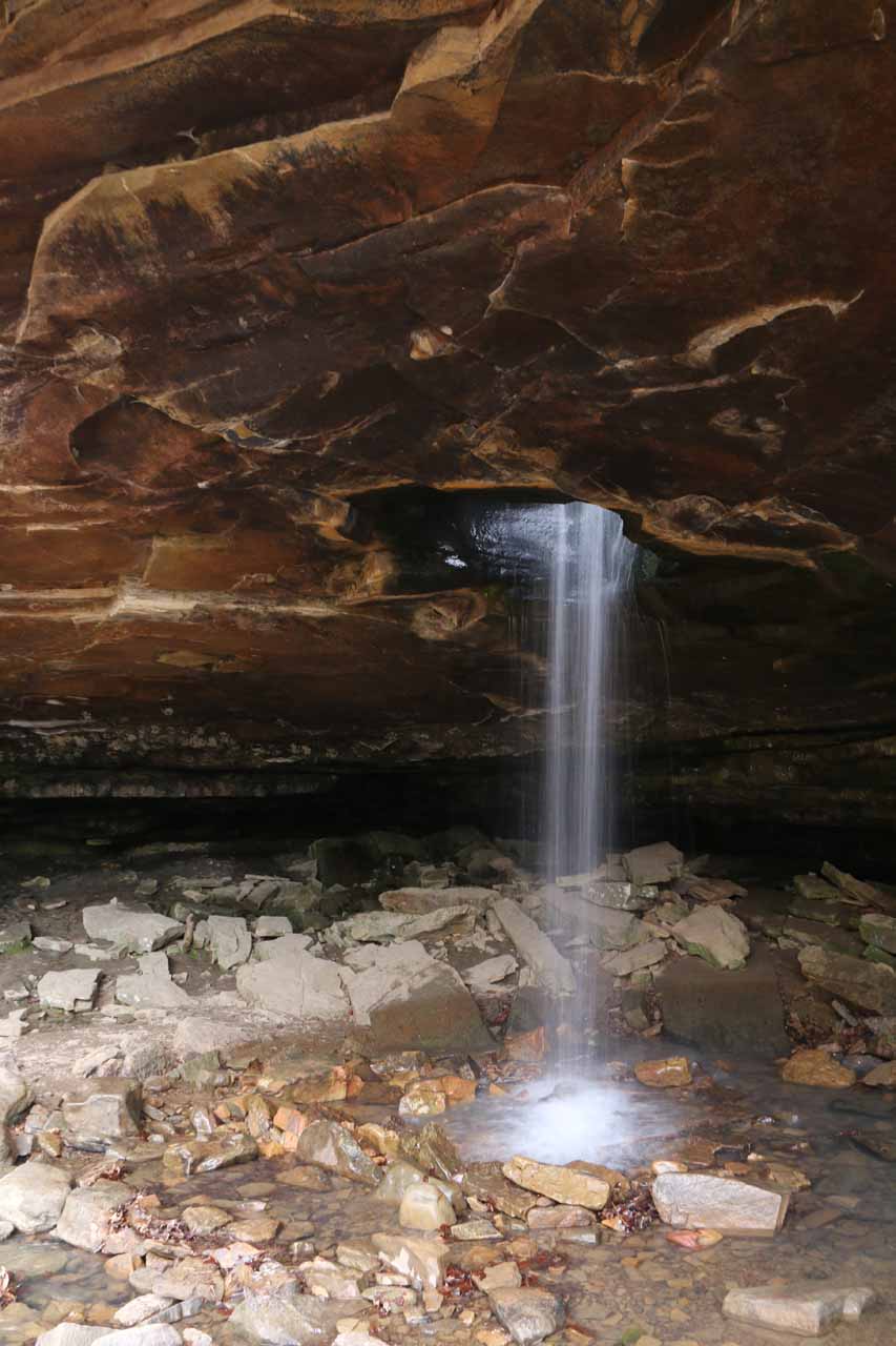
The Glory Hole Falls was definitely was one of the more unique waterfalling experiences that we’ve ever had. As you can see from the photo at the top of this page, it was a rare waterfall where the water fell through a hole into a deep grotto. It had always been on our bucket list ever since we were first made aware of it a few years ago (though in the internet literature, photos tended to be Photoshopped or under ideal conditions to make it appear far ideal than the reality would be). In addition to experiencing this waterfall from the base of this hole, we also got to see the very top of the hole where the stream fell through. Indeed, it was because of the uniqueness of this waterfall that we gave this waterfall the high scenic rating score despite its modest size of around 30ft.
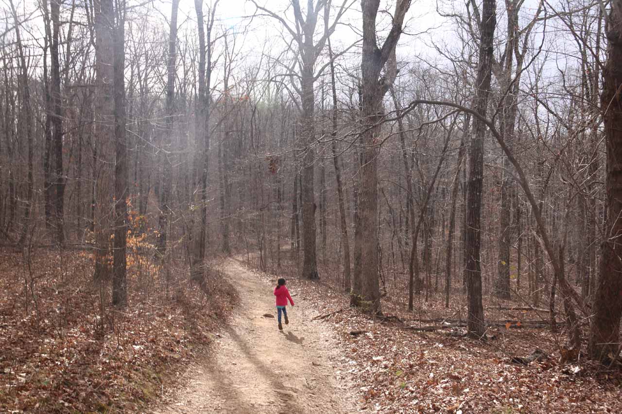
We started our hike from its relatively obscure trailhead right off the Hwy 21/16 (see directions below). There happened to be a sign at the start of the trail that said “Glory Hole” with an arrow pointing left, which gave us the confidence that we were in the right place. From the highway, we followed what appeared to be a wide jeep trail or 4wd road flanked by tall thin trees. Since our visit had followed around a week of rain, there were still some deep puddles flooding sections of the trail. Fortunately for us, we were able to go around these wet and muddy spots as there were established trails of use to dodge them.
As the descending part of the trail veered to the left, it crossed a creek, which turned out to be the very creek that would ultimately feed the Glory Hole Falls further downstream. However, we heard the sounds of falling water, and it turned out that we started to notice some trails of use branching to our left away from the main trail to get closer to the creek. The first of these branches led to an attractive cascade and smaller grotto that was kind of a precursor to the Glory Hole Falls that we’d see later. It was easy to linger around here for a bit (especially since we were alone here), but we knew there was more to see later on so we quickly backtracked to the main trail and kept going.
After having our fill of the top of the Glory Hole, we then continued along the main trail, which went away from the falls towards another small creek crossing before descending back towards the main creek. At the creek level, we then followed the trail briefly upstream towards the large grotto through which the Glory Hole Falls fell through. And this was where the majority of the hikers spent most of their time (so it was difficult to take photos without other people in them despite the amount of space beneath the ledge causing the grotto). While around the waterfall and hole, we were able to walk completely around the falls. When we had our fill of the falls, we returned back the way we came for a grand total of 2 miles round trip of hiking and about 2.5 hours away from the car (indeed we had spent a lot of time at the falls).
During our visit, even though the falls was clearly very popular, we did have a few moments of having the waterfall to ourselves before the next wave of visitors showed up. So we just had to be patient or opportunistic (whichever came first). As for photographing the falls, we’ve heard conflicting advise about it. On the one hand, it would be nice to show up in the late afternoon where the rays of the sun should more or less reflect and light up the grotto and create that warm effect in those internet photos that drew us to the falls in the first place. On the other hand, if it was cloudy (like it was during our visit), we were able to get even lighting so the contrast between the shady grotto and the area outside the grotto wasn’t so great that it would result in photos that were overly dark or blown out. And with the waterflow, it gave the appearance that there was a ray of light shining piercing through the darkness of the grotto (perhaps having something to do with its monicker “Glory Hole”). That said, we were also well aware of a more devious meaning or connotation behind the name of the falls. We’ll leave it up to you to figure out what we’re talking about. In any case, it was probably wise to bring a tripod to get creative with taking photos of this waterfall, but I regrettably didn’t bother to do it and I’m kicking myself for it.
By the way, this wasn’t the only waterfall we’ve seen where a waterfall fell into a hole before re-emerging from a cave or grotto. We’ve also seen an example of this at Running Eagle Falls (where a waterfall fell onto another waterfall) in Glacier National Park and Natural Bridge in Springbrook National Park in Australia among others.
Related Trip Reports

Related Top 10 Lists
No Posts Found
Related Itineraries

Trip Planning Resources

Nearby Accommodations
This content is for members only. See Membership Options.Featured Images and Nearby Attractions
This content is for members only. See Membership Options.Visitor Comments:
Got something you'd like to share or say to keep the conversation going? Feel free to leave a comment below...No users have replied to the content on this page
Visitor Reviews of this Waterfall:
If you have a waterfall story or write-up that you'd like to share, feel free to click the button below and fill out the form...No users have submitted a write-up/review of this waterfall
Only logged in users can post a comment Please login or sign up to comment