About Falls Creek Falls

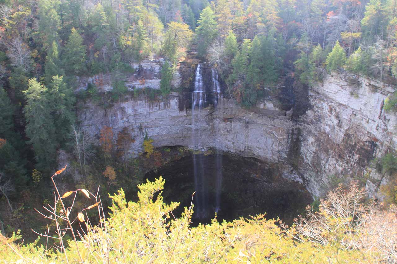
Falls Creek Falls is said to be the highest free-leaping waterfall east of the Mississippi River at about 256ft (according to the signs here).
If there happens to be enough water, then a second companion waterfall on Coon Creek drops alongside the main waterfall. Clearly, this was not the case during our visit as Coon Creek was trickling while Falls Creek had more of a wispy appearance. Apparently, high flow on Falls Creek would only be possible if the dam holding up Falls Creek Falls Lake released water due to high volume (from high precipitation perhaps?) to allow Falls Creek to grow.
We got to see this waterfall from a very easy stroll to an overlook platform that always seemed to be busy. I guess that shouldn’t be surprising considering how accessible it was to everyone from the car park. Even though the falls could be seen from much of this overlook, there was only room for one or two people for the best viewing spot in the middle of the facing side where the foliage beneath didn’t get in the way of the view. Thus, photo buffs would probably have to wait their turn (and be considerate of others waiting for their turn).
I also managed to take a 0.4-mile descent (0.8-mile round trip) to the base of the falls for a quieter and more neck-cranking experience (along with some exercise to boot). This trail left the overlook area to the left and followed the cliffs towards another overlook of the gorge before making its steep descent down a combination of stairs and rocky trail with uneven footing.
Towards the bottom of the descent there was one section of rock steps where I felt cold air blow upwards into my face. I suspected that there must be a cave somewhere off trail near that spot, but I didn’t investigate that further.

Visiting just Falls Creek Falls along with the descent to the base and back took me about an hour and 15 minutes, and this included all the photo-taking as well. It was also possible to extend this excursion and hike in the other direction from the overlook (to its right) towards the Nature Center where I could’ve also visited three more waterfalls (which I’ll describe on a separate page). I believe it was at least a mile or so to get to the Betty Dunn Nature Center from the overlook.
Related Trip Reports
Related Top 10 Lists

Related Itineraries
Trip Planning Resources

Nearby Accommodations
This content is for members only. See Membership Options.Featured Images and Nearby Attractions
This content is for members only. See Membership Options.Visitor Comments:
Got something you'd like to share or say to keep the conversation going? Feel free to leave a comment below...No users have replied to the content on this page
Visitor Reviews of this Waterfall:
If you have a waterfall story or write-up that you'd like to share, feel free to click the button below and fill out the form...No users have submitted a write-up/review of this waterfall
Only logged in users can post a comment Please login or sign up to comment