About Eagle Falls

Eagle Falls is a light-flowing and short 44ft waterfall adding its output to the Cumberland River from its west bank just downstream of Cumberland Falls.
It’s certainly an easily overlooked waterfall thanks to its tendency to be a follow-up act to its larger neighbor. Thus, to appreciate this falls, one really has to be able to manage expectations and take it for what it is. After all, you can’t really compare the two falls so why bother with comparisons?
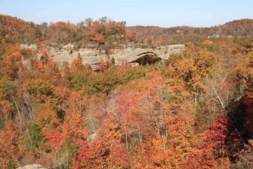
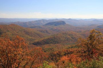
Nonetheless, what motivated us to hike Trail 9 (i.e. this trail to this waterfall) was the opportunity to get different views of Cumberland Falls that we couldn’t get from its more touristed east bank. As we did the trail, we also realized that it was meandering beneath overhanging rocks, hugging ledges, and affording us panoramic views of the scenery across the gorge
Perhaps that was why we saw a large sign at the trailhead proclaiming this trail to be voted the best trail in the state of Kentucky. We’re not so sure about that bold assertion, but we were certainly glad we did it.
The trail to the Eagle Falls and back was said to be 3 miles round trip (1.5 miles each way). It wasn’t the easiest trail because of its tendency to undulate in addition to being an upside down hike (i.e. going downhill to get to the falls then going back uphill to get back to the car park). And although there was also the option of extending this hike into a longer loop, but we didn’t do that option.
Most of the scenic overlooks revealing the gorge as well as the Cumberland Falls was past the loop trail connectors (always staying right to remain on the main waterfall trail). When we got to river level, at which point we were very close to the falls, it was said that during flood, this section of trail could be flooded. That probably explained why the trail degenerated into almost a boulder scramble with some boulders containing colored paint as trail indicators.
The overall time we took to do this hike plus take pictures was about 1 hour 20 minutes.
Related Trip Reports
Related Top 10 Lists
No Posts Found
Related Itineraries
Trip Planning Resources

Nearby Accommodations
This content is for members only. See Membership Options.Featured Images and Nearby Attractions
This content is for members only. See Membership Options.Visitor Comments:
Got something you'd like to share or say to keep the conversation going? Feel free to leave a comment below...No users have replied to the content on this page
Visitor Reviews of this Waterfall:
If you have a waterfall story or write-up that you'd like to share, feel free to click the button below and fill out the form...No users have submitted a write-up/review of this waterfall
Only logged in users can post a comment Please login or sign up to comment