About Copper Falls and Brownstone Falls

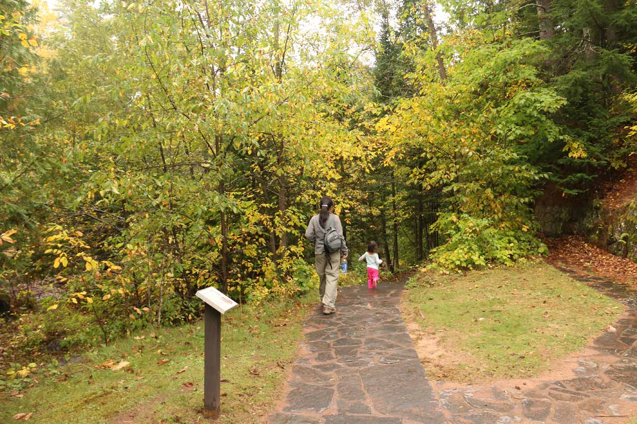
Copper Falls and Brownstone Falls were a pair of the featured waterfalls of the Copper Falls State Park. Julie and I were actually turned onto this falls by a pair of locals that we encountered while visiting the Potato River Falls. It was they who suggested that we give this state park a try. And contrasting the more rugged and potentially riskier scrambling paths to fully appreciate Potato River Falls, the state park was far more family-friendly as we were able to experience both the Copper and Brownstone Falls on developed trails with established and signposted lookouts for a much safer and more satisfying experience without risking life and limb to do it.
Copper Falls was a segmented and multi-tiered series of drops on the Bad River dropping some 30ft or so. Given the twisting nature of the falls, it wasn’t possible to get an all-inclusive look from any one position. Instead, we had to experience it from a couple of different vantage points to get the full experience. On the other hand, Brownstone Falls could very well be the show stealer of the state park as this 40ft falls had a more vertical and singular drop. There were also the Tyler Cascades (on the same looping trail taking in both Copper and Brownstone Falls) as well as the Red Granite Falls (which was on a different and longer trail at a different car park), but we visited neither of these given the limited amount of time we had.
Another 1/4-mile beyond the bridge was the signposted lookout for Brownstone Falls and the Bad River Gorge. Unfortunately, the view of the falls from here was obstructed, but I was able to appreciate the depth and ruggedness of the gorge. This marked my turnaround point though I very well could have kept going towards the Tyler Cascades.
Back at the concession buildings, I then took the other side of the loop by crossing the bridge then following the trail for a few minutes before I reached a railed lookout providing me with a direct view of Copper Falls (pictured at the top of this page). Once I had my fill of the falls from this vantage point, I then continued further downstream for about another 0.3 miles before reaching the more frontal view of Brownstone Falls. This was my turnaround point of the hike, but in hindsight, it wasn’t that much additional hiking to complete the loop to cover the parts that I wasn’t able to in doing the two short out-and-back hikes.
So given what we were able to do, it took us just under an hour. However, I’d imagine that it would take just as much time if we would have done the entire 1.7-mile loop hike in the first place. And in the end, we definitely enjoyed our experiences at both these falls more so than the Potato River Falls so we were glad that the Wisconsin couple that we had met earlier in the day made the recommendation to us. We owe them for this one!
Related Trip Reports
Related Top 10 Lists
No Posts Found
Related Itineraries
Trip Planning Resources

Nearby Accommodations
This content is for members only. See Membership Options.Featured Images and Nearby Attractions
This content is for members only. See Membership Options.Visitor Comments:
Got something you'd like to share or say to keep the conversation going? Feel free to leave a comment below...No users have replied to the content on this page
Visitor Reviews of this Waterfall:
If you have a waterfall story or write-up that you'd like to share, feel free to click the button below and fill out the form...No users have submitted a write-up/review of this waterfall
Nearest Waterfalls
