Clark Creek Waterfalls (Tunica Falls)

Woodville / Natchez / Clark Creek Natural Area / Baton Rouge, Mississippi / Louisiana, USA

About Clark Creek Waterfalls (Tunica Falls)


Hiking Distance: 4 miles round trip (to 5 waterfalls); scramble
Suggested Time: 2.5 hours

Date first visited: 2016-03-15
Date last visited: 2016-03-15

Waterfall Latitude: 31.06695
Waterfall Longitude: -91.51782

Waterfall Safety and Common Sense

The Clark Creek Waterfalls (also referred to as Tunica Falls in Google Maps) were a series of several waterfalls residing within the Clark Creek Natural Area within Mississippi near its border with Louisiana. Now while none of these waterfalls exceeded 15-20ft or so, the fact that waterfalls even existed in the low-lying swamp lands of bayou country was quite a miracle in and of itself! And it was for this reason that we made the detour to visit this place when we made the long drive between New Orleans and Shreveport. The result of the time and effort taken to go on this excursion was about five waterfall sightings, but if we had more time to do more hiking in the preserve, there were other trail branches that led to even more waterfalls!

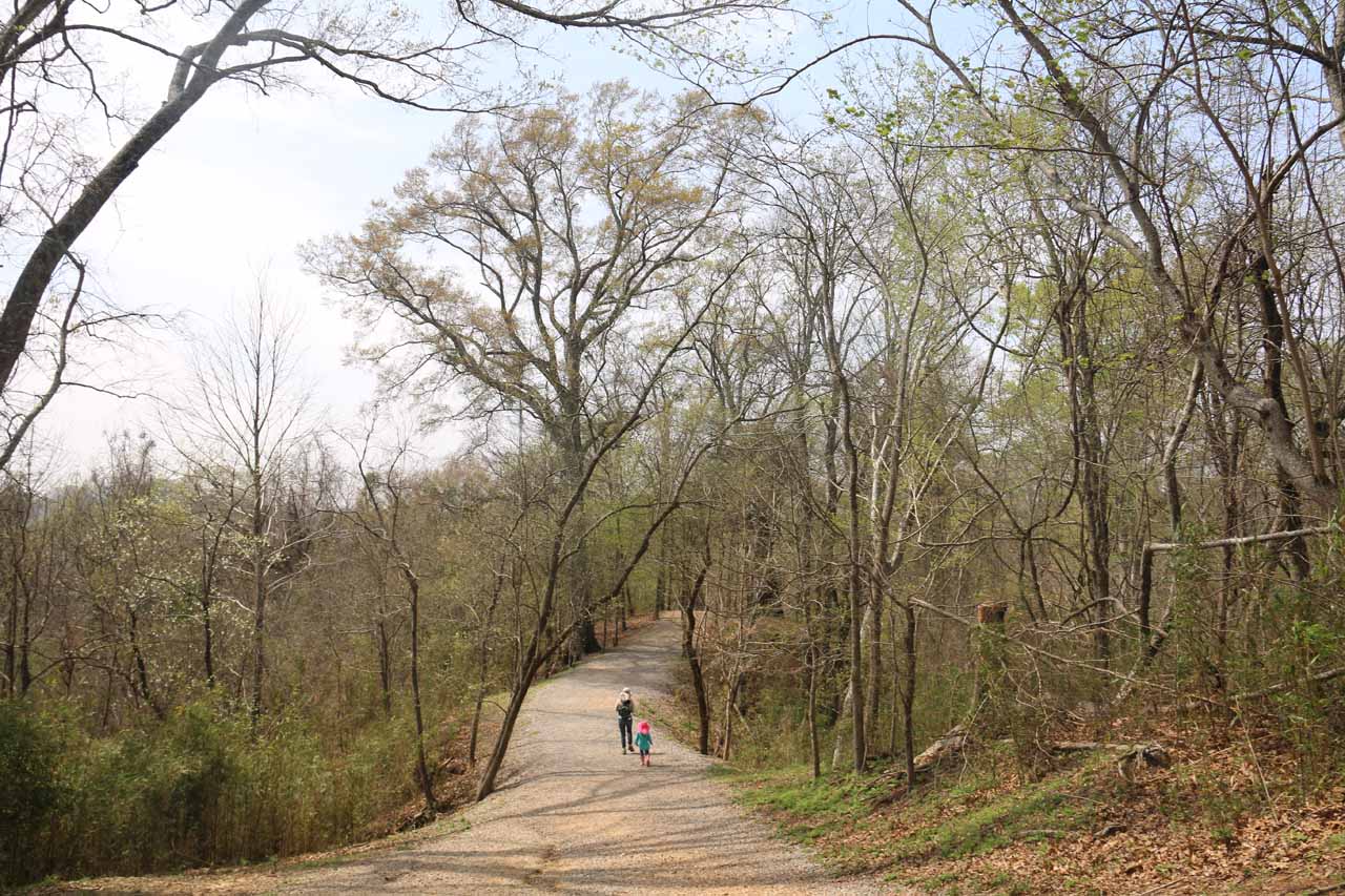
Our hike began from a pretty busy trailhead (see directions below), which was decked out with a restroom facility as well as some picnic tables atop an adjacent hill. There was also a self-help kiosk to pick up a payment envelope that we’d put money in, then detach the payment slip so we could put it on the dash of our car as proof of payment. As of our visit in mid-March 2016, the cost was $4 per vehicle then 50 cents per person if there were more than 6 people in the vehicle. I didn’t have exact change on me at the time so I paid $5, and I’d imagine this was pretty common as not everybody has that many singles on hand.

Clark_Creek_NA_015_03152016
The wide trail near the trailhead following a ridge as it descended deeper into the Clark Creek Natural Area
Once we got past the self-payment formalities, we then went on a pretty wide trail that went past a gate then descended on a ridge flanked by tall thin trees. There were a couple of sections during this descent where there were steps alongside the wide trail. At first, we wondered why they built this infrastructure besides an already present trail, but then when we saw the ruts and gullies on the wide trail, we realized that the trail could easily become muddy and difficult to climb back up after heavy rains (which is not uncommon in this part of the country). And speaking of uphill climbs, we knew that all this downhill hiking meant that we would have to get all this elevation loss back at the very end of our return hike along this stretch. Towards the bottom of this descent, there was a bridge traversing a seasonal creek before climbing up a hill then reaching a trail junction with a sign containing a topographic map of the area, which helped to orient us.

That junction with the topographic map sign was at about a half-mile from the trailhead. We took the spur trail to our left for roughly 400ft, which descended towards what turned out to be the first of the Clark Creek Waterfalls (shown in the photo at the top of this page). We were able to view this 15-20ft waterfall from around the rim of the small dropoff before taking the wooden platform and stairs further downstream to access the base of the falls. There was a small rope that we were able to use at the very bottom of the descent, which was slippery, but it was very doable (even without the rope). Anyways, this first waterfall was a satisfying drop, and we wound up spending quite a bit of time here.

Clark_Creek_NA_073_03152016
Julie and Tahia headed back to the car park after having seen the first Clark Creek Waterfall
Once we had our fill of this waterfall, we returned back uphill to the trail junction. It was at this point that Julie and Tahia returned to the car (making their out-and-back hike about a mile in total) while I pursued the remaining waterfalls solo. In another 500ft of continuing on the main Waterfall Trail, I reached a second signposted trail junction with another topographic map. I then went left at this junction, which again descended as I hiked another 0.1-mile towards the second waterfall. There was a set of stairs that brought me closer to the base of this waterfall, but any further progress beyond the stairs meant some pretty rough scrambling with dropoff exposure. And given how this second waterfall wasn’t as scenic as the first (its direct view was also somewhat obstructed by foliage), I opted not to spend more time than I needed to here and returned to the trail junction.

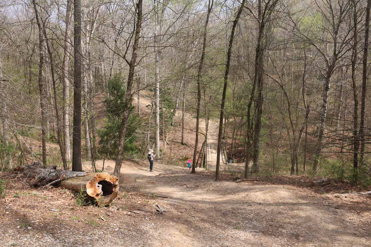
As I continued on the main Waterfall Trail, it undulated for the next half-mile (around 20 minutes) as I went past a trail junction leading to some overlook, and then I encountered a shed or shelter with some graffiti on it. Continuing past the shed for the next five minutes, the trail followed a ridge before it ultimately descended a fairly long series of wooden steps that ultimately returned to Clark Creek at its bottom. This marked the end of the official Waterfalls Trail, but I knew there were more waterfalls to be found here.

Clark_Creek_NA_111_03152016
Approaching the attractive ‘third’ Clark Creek Waterfall after a little bit of a stream scramble beyond the official end of the Waterfalls Trail
While I had the option of continuing to hike to my left (going downstream) to potentially encounter more waterfalls in that direction, I decided to go right (upstream). The hiking at this point was pretty much a stream scramble, but the stream was mostly shallow, and there were enough dry spots to avoid wading in most places. At about 400ft from the end of the Waterfall Trail, there was a confluence of creeks. I started off by going right, which quickly degenerated into an even rougher stream scramble over rocks and around a fallen tree. But after roughly 500ft of this stream scramble (taking me around 15 minutes), I finally reached what I dubbed the third Clark Creek Waterfall, which fell within a V-shaped cliff. This particular falls was probably between 20-30ft, and the surrounding cliffs really made this particular spot tranquil, especially given the adventure it took to get here.

Scrambling back to the confluence of the streams, I then took the other fork, which actually turned out to be quite a bit muddier than the stream scramble to the third waterfall. After only about 100ft or so from the confluence, there was a thin-flowing waterfall to the right. I dubbed that one the fifth Clark Creek Waterfall because I punted on it until after I had visited the fourth waterfall. In any case, there was a steep stream scramble leading up to the base of this fifth waterfall, which was very thin flowing despite all the rains that had hit the states of Louisiana and Mississippi prior to our arrival. So I suspected that this “fifth” waterfall was probably more ephemeral than the rest of the falls seen so far.

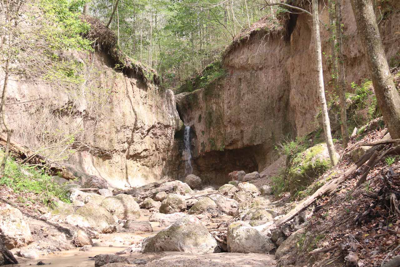
Finally at roughly 500ft beyond the fork to the so-called “fifth” waterfall, I had reached the fourth Clark Creek Waterfall. That final stretch of stream scrambling was a bit on the rough and muddy side as I had found myself scrambling both in the stream as well as over and around some fairly large rocks. Anyways, that fourth waterfall had a bit of a freefall as there was a short alcove behind it. Meanwhile, there were large rocks surrounding the plunge pool area of this waterfall, suggesting that every now and then, parts of the neighboring cliff would chunk off. After having my fill of this waterfall and that “fifth” waterfall that I had punted on earlier, I then returned back the way I came.

Overall, I had spent about 2.5 hours away from the car. The difficulty rating you see at the top of this page reflected my physical exertion to take in the five waterfalls that I would up encountering. However, it could be argued that the first waterfall was the most scenic of the bunch, and so the out-and-back hike just to do that first waterfall would probably take around an hour round trip (warranting more of a “2” difficulty rating).

Clark_Creek_NA_167_03152016
Clark_Creek_NA_002_03152016
Clark_Creek_NA_003_03152016
Clark_Creek_NA_007_03152016
Clark_Creek_NA_008_03152016
Clark_Creek_NA_011_03152016
Clark_Creek_NA_014_03152016
Clark_Creek_NA_017_03152016
Clark_Creek_NA_022_03152016
Clark_Creek_NA_023_03152016
Clark_Creek_NA_026_03152016
Clark_Creek_NA_027_03152016
Clark_Creek_NA_031_03152016
Clark_Creek_NA_032_03152016
Clark_Creek_NA_034_03152016
Clark_Creek_NA_068_03152016
Clark_Creek_NA_075_03152016
Clark_Creek_NA_078_03152016
Clark_Creek_NA_084_03152016
Clark_Creek_NA_088_03152016
Clark_Creek_NA_091_03152016
Clark_Creek_NA_094_03152016
Clark_Creek_NA_096_03152016
Clark_Creek_NA_098_03152016
Clark_Creek_NA_101_03152016
Clark_Creek_NA_159_03152016
Clark_Creek_NA_105_03152016
Clark_Creek_NA_106_03152016
Clark_Creek_NA_107_03152016
Clark_Creek_NA_108_03152016
Clark_Creek_NA_114_03152016
Clark_Creek_NA_132_03152016
Clark_Creek_NA_135_03152016
Clark_Creek_NA_139_03152016
Clark_Creek_NA_142_03152016
Clark_Creek_NA_152_03152016
Clark_Creek_NA_165_03152016


The Clark Creek Natural Area was about 90 minutes drive north of Baton Rouge, which itself was another hour’s drive northwest of New Orleans (where we based ourselves) along the I-10. We’ll describe the specifics of the driving directions from the 10-110 junction in Baton Rouge.

So from the I-10/I-110 junction in downtown Baton Rouge, we headed north on the I-110. The freeway eventually ended towards the north end of Baton Rouge and became the Scenic Highway 61. We stayed on the Hwy 61 for about 25 miles until we turned left onto Hwy 66 (around 2.5 miles north of the town of St Francisville). We then followed Hwy 66 for nearly 12.5 miles before we left the highway and veered right onto the Route 969.

Next, we followed the Route 969 for a little over 7 miles (crossing the state border between Louisiana and Mississippi) before we obeyed the brown sign for the Clark Creek Natural Area, which directed us to turn left onto the Fort Adams Pond Road towards the Pond Store (a white building just off to the side of the Fort Adams Pond Road). We had to be careful while driving the Route 969 because it contained some water-damaged sections to the road as well as a few potholes. Thankfully, most of the potholes were filled in.

In just under a half-mile on the Fort Adams Pond Road, we reached the Clark Creek Waterfalls Trailhead, where we saw plenty of cars already parked here during our early afternoon visit on a Tuesday in March 2016.

This drive from Baton Rouge took us around 2.5 hours. When we were done doing this hike, we backtracked towards Baton Rouge before continuing our long drive to Shreveport. That drive took us about around 4 hours.

To give you a sense of geographical context, Baton Rouge was 272 miles (4 hours drive) east of Houston, Texas, 81 miles (90 minutes drive) northwest of New Orleans, and 251 miles (under 4 hours drive) southeast from Shreveport.

Find A Place To Stay

Long movie checking out the base of the first Clark Creek Waterfall before walking back up the trail for other views of the falls


Checking out the second Clark Creek Waterfall from the end of the wooden steps before going up the steps and checking out different views of this falls, then finally ending up at the top of the falls


360 degree sweep showing the third Clark Creek Waterfall and the surrounding cliffs and overhangs


360 degree sweep showing the fourth Clark Creek Waterfall and the cliffs and rocks around and in front of it


360 degree sweep showing the fifth Clark Creek Waterfall which was trickling

Related Top 10 Lists

No Posts Found

Trip Planning Resources


Nearby Accommodations


Tagged with: clark creek, natural area, baton rouge, louisiana, natchez, waterfall, mississippi, tunica falls, wilkinson county


Visitor Comments:

Got something you'd like to share or say to keep the conversation going? Feel free to leave a comment below...

No users have replied to the content on this page


Share your thoughts about what you've read on this page

You must be logged in to submit content. Refresh this page after you have logged in.

Visitor Reviews of this Waterfall:

If you have a waterfall story or write-up that you'd like to share, feel free to click the button below and fill out the form...

No users have submitted a write-up/review of this waterfall


Have you been to a waterfall? Submit a write-up/review and share your experiences or impressions

Review A Waterfall

Nearest Waterfalls

The Waterfaller Newsletter

The Waterfaller Newsletter is where we curate the wealth of information on the World of Waterfalls website and deliver it to you in bite-sized chunks in your email inbox. You'll also get exclusive content like...

  • Waterfall Wednesdays
  • Insider Tips
  • User-submitted Waterfall Write-up of the Month
  • and the latest news and updates both within the website as well as around the wonderful world of waterfalls


How To Build A Profitable Travel Blog In 4 Steps