About Bond Falls

Bond Falls was a waterfall in the western side of the UP (short for Upper Peninsula of Michigan) that seemed to be a sentimental favorite amongst those “Yoopers” (folks who live in or frequent the UP) from this local region of the state. Just about every “Yooper” we spoke to in the area considered this to be the prettiest waterfall in Michigan, even trumping the more famous Upper Tahquamenon Falls. And after seeing this waterfall for ourselves, we can see where they were coming from. After all, Bond Falls featured a wide but graceful characteristic (the kind that Julie says has “character”) that seemed to be very photogenic so I was definitely glad that I had brought my tripod along for this excursion. Moreover, we were able to experience the falls from a variety of positions given the nice infrastructure here in the form of boardwalks and trails surrounding this part of the Middle Branch of the Ontonagon River. Indeed, given its ease of access, scenic allure, size, and even some of the fall colors nearby, we were getting as sentimentally caught up with this falls as the locals!
The walk from the dedicated car park to our first views of the falls took less than five minutes. Most of our time spent on this excursion was pretty much checking out the falls from the entirety of the 600ft boardwalk and developed trails right around the impressively wide curtain of water. At least that was what I was busy doing when not using the tripod to take family photos. Apparently, this boardwalk was the result of a recent improvement effort that made this waterfall even more accessible to a wider pool of visitors than before. In any case, Julie was busy watching Tahia drop leaves into the river and watch them flow away much to their amusement. Indeed, this was one of those places that was perfect for the enjoyment by families as well as for channeling our inner Ansel Adams to make our attempts at capturing this magical place in photographs.
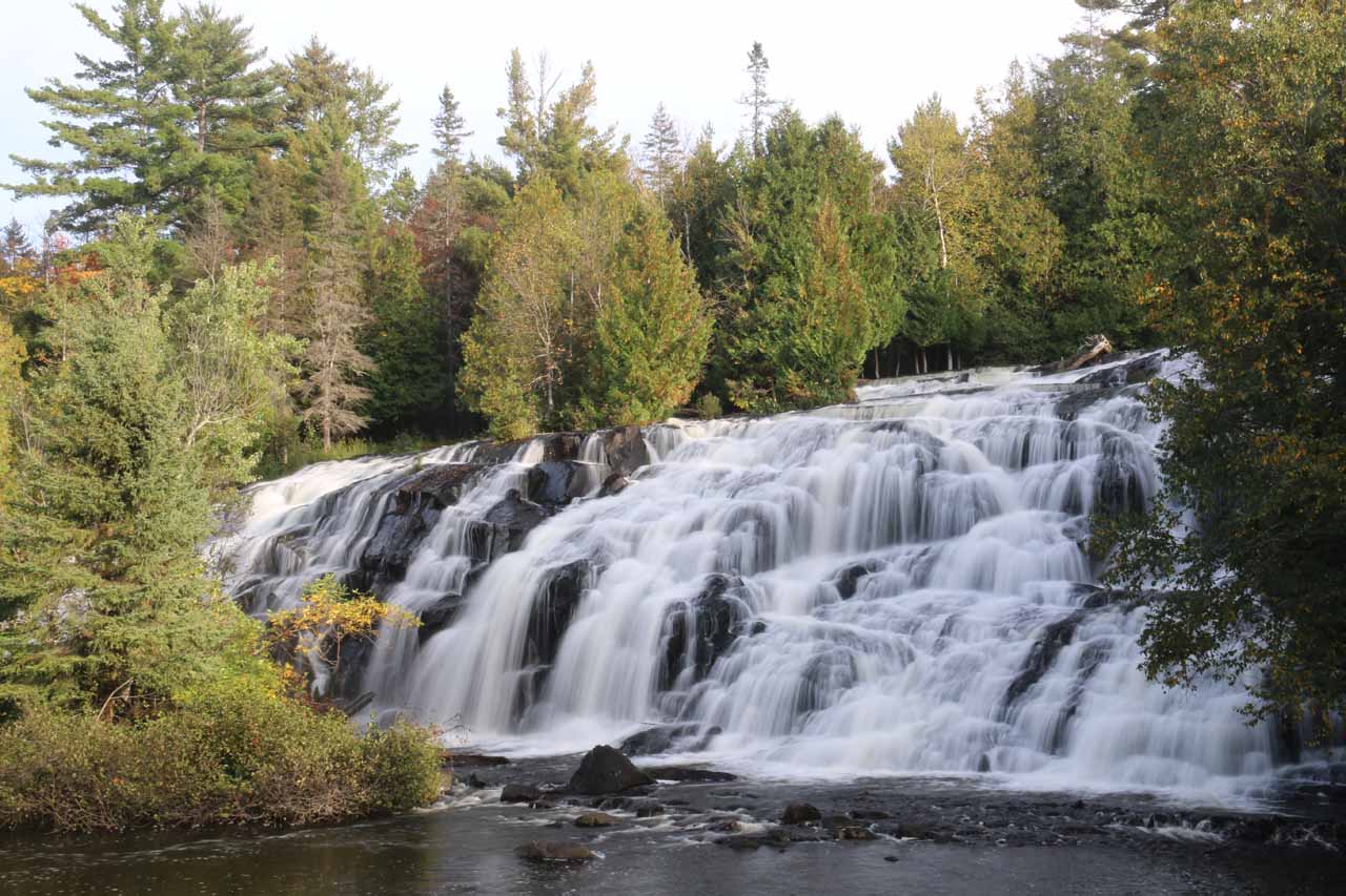
Once I had my fill of the front of the falls from the various angles from the boardwalk, I then swung all the way to the right side of the falls where the trail ascended some steps alongside the slope of the falling water. Once I got up to the top, I was treated to a handful of tiny cascades tumbling their way down to the main drop of Bond Falls. As I peered over the brink of the falls, I was treated to a nice overlook of the immediate area beneath the falls as well as the opportunity to photograph part of the falls with some fall colors down below.
Another thing I noticed up here was that there were concrete barricades that seemed to channel that Middle Branch of the Ontonagon River towards the main drop of the Bond Falls. I thought it was unusual to see such a structure actually “help” the river flow over the waterfall (I’ve seen too many examples of structures robbing the flow of water from a waterfall), but perhaps it was to prevent potentially excess overflow of the river onto the trails and infrastructure here (thereby causing damage).
Finally, speaking of infrastructure, while driving the Bond Falls Road further upstream of the waterfall itself, we noticed the Bond Falls Hydroelectric Project. That meant that this branch of the river was being held up, and I’d have to believe that this would constrain the average flow of the falls itself. We don’t know if the hydro scheme was required to discharge a minimum amount of water like at Superior Falls, but it seemed like this waterfall held its own in terms of year-round flow even with the man-made interventions. That said, just imagine what a crazy scene Bond Falls would be had it been allowed to flow naturally.
Related Trip Reports

Related Top 10 Lists
No Posts Found
Related Itineraries
Trip Planning Resources

Nearby Accommodations
This content is for members only. See Membership Options.Featured Images and Nearby Attractions
This content is for members only. See Membership Options.Visitor Comments:
Got something you'd like to share or say to keep the conversation going? Feel free to leave a comment below...No users have replied to the content on this page
Visitor Reviews of this Waterfall:
If you have a waterfall story or write-up that you'd like to share, feel free to click the button below and fill out the form...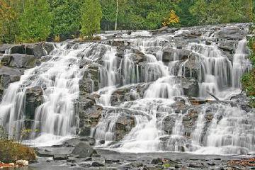 Bond Falls, Western Upper Peninsula, Michigan April 15, 2015 12:40 am - Bond Falls is considered the best waterfall in the Upper Peninsula. That's a pretty big claim, but when you have a cascade over 100 feet wide, you pretty much dwarf the competition. On the middle branch of the Ontonagon River, a few miles east of Paulding in Haight Township in southern Ontonagon County, Michigan. ...Read More
Only logged in users can post a comment Please login or sign up to comment