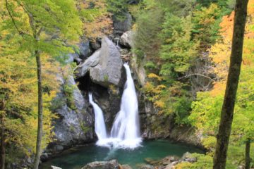
About Bash Bish Falls

Bash Bish Falls (sometimes written out as a single word like Bashbish Falls) was one of the more memorably-named waterfalls that we could remember. For some reason, I was always tempted to incorrectly call it Bish Bash Falls (like it would rhyme with “splish splash”). All kidding aside, the name was said to be of Mohican origin about a woman by the name of Bash Bish who was accused by her tribe of committing adultery, which was punishable by death over the falls while tied up in a canoe. It had also been said that the shape of the falls would resemble a woman falling to her death. Meanwhile, others contended that the segmented characteristic of the falls resembled the reuniting of Bash Bish and her daughter White Swan who had also disappeared over the falls according to the Mohican legend.
Speaking of tragedies, we had read in the literature that Bash Bish Falls was claimed to be one of the most dangerous tourist attractions in the United States. We’re not sure why they would single out this waterfall when we could easily envision any other waterfall to be just as dangerous. But I guess the combination of the temptation to rock climb here as well as the inviting plunge pool concealing strong undercurrents might be the deadly combination that would give this place its notoriety. So the moral of the story here would be to respect the dangers and just be content to bask in its beauty without pushing your luck.

We learned during our visit that there were actually two ways to hike to Bash Bish Falls – the Massachusetts way and the New York way. We ended up hiking on the Massachusetts trail (see directions below), which we believed to be the harder trail even though it was shorter from a distance standpoint at about a mile round trip. It was harder because there was a 300ft elevation loss which was fairly steep, muddy in spots, and full of roots and rocks.
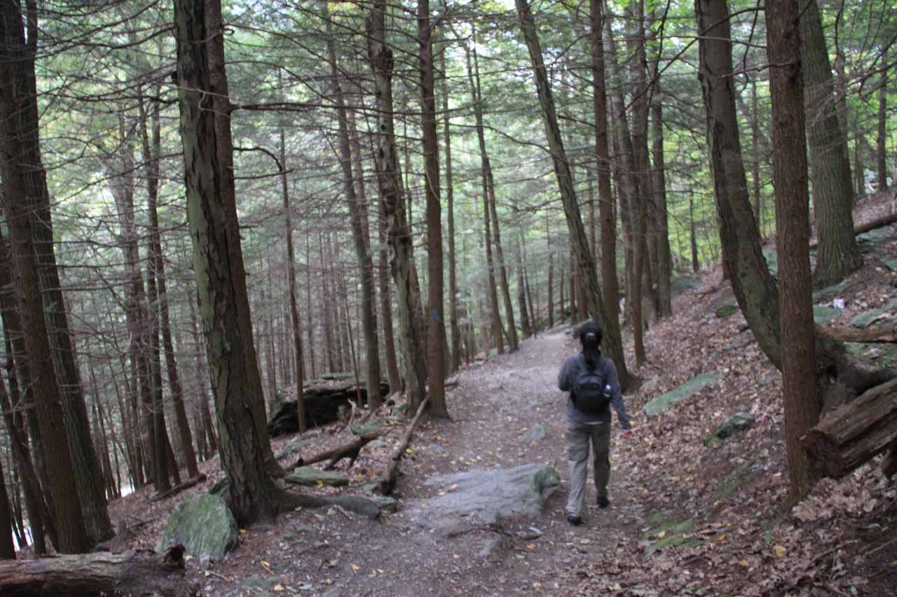
That said, the trail was pretty straightforward as we followed blue triangles strategically placed on trees and rocks so we wouldn’t lose the trail. We just had to watch our footing given its rough nature. We even saw a fairly large family with three kids start on the hike only to turn back upon realizing that it wasn’t the best trail for kids and that there was an alternate trail that was flatter and much easter.
Towards the bottom of the descent, there were steps that ultimately joined up with a much wider trail that turned out to be the alternate New York trail. Upon seeing this, that was when we figured out that perhaps we should’ve taken that trail instead since we were bringing our daughter along. Of course, if we had done that, the hike would’ve been a little longer at 1.5 miles round trip, but I’d imagine that it would still be easier despite the increased distance. Plus, the trail followed along Bash Bish Brook so it would’ve been a more pleasant riverside stroll as it would’ve crossed from New York into Massachusetts.
From the trail junction, we followed the trail to the left (upstream) where we then encountered a wide area with a nice overlook of the Bash Bish Falls and the rocky cove it was situated in. The people who were already here enjoying the falls provided a nice sense of perspective of how big this waterfall really was. This clearing area also had an interpretive sign discussing the vicinity as well as the Mohican legend concerning this falls in more detail.
A few paces from the interpretive sign, there was another set of steps leading right down to the rocky area fringing the waterfall’s misty plunge pool. We were content to enjoy the views from here and did not tempt fate by getting any closer to the falls nor the rushing Brook. We kept a real close watch on our daughter since the large rocks created many mini-drop offs that were significant to her given her diminutive size.
We happened to show up around the late morning just when the sun was starting to show itself. That was when we realized that the lighting was somewhat against us that time of the day so we had to be patient in waiting for some clouds to block the sun to let it be a little more photographable. Thus, I’d imagine on a sunny day, perhaps it would be more of an afternoon waterfall. Anyways, we spent about 90 minutes on the whole excursion, including the hiking, the resting, and all the photo taking – all at a pretty relaxed pace.
Related Trip Reports

Related Top 10 Lists
Related Itineraries

Trip Planning Resources


Nearby Accommodations
This content is for members only. See Membership Options.Featured Images and Nearby Attractions
This content is for members only. See Membership Options.Visitor Comments:
Got something you'd like to share or say to keep the conversation going? Feel free to leave a comment below...No users have replied to the content on this page
Visitor Reviews of this Waterfall:
If you have a waterfall story or write-up that you'd like to share, feel free to click the button below and fill out the form...No users have submitted a write-up/review of this waterfall
Only logged in users can post a comment Please login or sign up to comment