About Chutes de la Chaudiere
The Chutes de la Chaudiere were an impressive set of segmented waterfalls about 35m tall falling side by side to each other. One thing that made our waterfalling experience here quite different from the other waterfalls that we visited near the charming city of Quebec was that admission and parking for the falls were free. In fact, it felt like a true park where we were able to walk about at our own leisure without the monetization and/or exploitation to help us part with more of our money.
According to the literature, the word chaudiere meant “boiler”, and apparently this was due to the mist that the falls would generate at its base. The first evidence of the usage of this name was said to be from early explorers who had labeled this falls on their maps as “Sault de la Chaudiere”. The turbulent mist action was understandable as the falls was said to average about 130 cubic meters per second with a peak of about 1240 cubic meters during times of high water (most likely in the Spring). The falls was said to represent the last major drop of the 185km Chaudiere River just before emptying into the St Lawrence River, which was quite close to the Parc des Chutes-de-la-Chaudiere.
Being so close to the urban developments, we felt this was pretty much an urban waterfall. There was a 24MW dam and hydro faciility upstream of the main drop of the falls that dated back to 1901 (though it had to be rebuilt due to major flooding in 1970). Power lines were everpresent all around us, and the river itself had a smell that would make us quite touch it, though the currents and sudden release of water from the hydro facility would make lingering in the water a bad idea anyway.
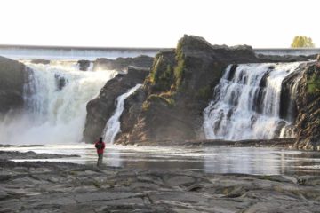
Our visit began from car park near Entrance A (see directions) according to our map. From there, we got our first glimpse of Chutes de la Chaudiere though in hindsight, we should’ve walked upstream a little more to see some of the closer overlooks of the wide falls in profile (a 630m footpath labeled Les Belvederes on our map). In any case, we then went down some stairs and followed the 360m path labeled La Passerelle, which headed towards a suspension bridge crossing the Chaudiere River.
We took a brief detour down some steep stairs down onto a rough riverbed allowing us to scramble closer to the impressive Chutes de la Chaudiere. We were careful not to get too close to the fast current in the river (and making sure our daughter didn’t linger out there either) as well as cognizant of the large potholes and mini-dropoffs conspiring to turn an ankle or tweak a knee as we were doing our riverbed scramble to get closer.
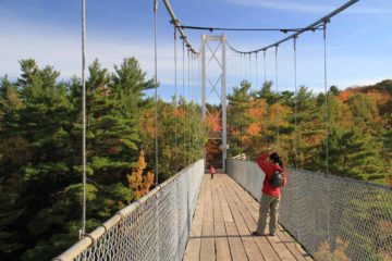
On the other side of the bridge, we took a trail that was closest to the opposite side of the river, which was an 830m path labeled La Presqu’ile on our map. This path followed a side channel towards the outflow of the hydroelectric facility before curving back around on the opposite side of the outflow channel, then curving once again alongside the Chaudiere River. There were more scrambling paths leading down to the riverbed along this path, though it seemed like we had to be careful about brushing up against poison ivy.
Eventually, this path climbed up alongside the falls where we were able to get the views you see at the top of this page. Those were probably our most satisfying photos of the falls though I still regret not taking the time to see the other overlooks near the Entrance A car park. In any case, we eventually went up to the dam above the falls, checked out some more interpretive signs there, and then followed the 440m path labeled La Boise back to la passerelle (suspension bridge), where we then took the remaining 360m back up to the car park.
Overall, the way we did the visit took us just under 2 hours. It was a leisurely stroll where we encountered numerous other Quebecois families (with young ones of similar age to our daughter) taking a morning Sunday stroll. However, experiencing the falls need not require as much hiking nor as much time as we took. Thus, I bumped down the difficulty rating to 2 even though the time commitment might have suggested otherwise.
Related Top 10 Lists
No Posts Found
Trip Planning Resources
Nearby Accommodations
This content is for members only. See Membership Options.Featured Images and Nearby Attractions
This content is for members only. See Membership Options.Visitor Comments:
Got something you'd like to share or say to keep the conversation going? Feel free to leave a comment below...No users have replied to the content on this page
Visitor Reviews of this Waterfall:
If you have a waterfall story or write-up that you'd like to share, feel free to click the button below and fill out the form...No users have submitted a write-up/review of this waterfall



Only logged in users can post a comment Please login or sign up to comment