About Rush Creek Falls
Rush Creek Falls was one of the more unique waterfalling excursions that we’ve been on. Something very unique about the trail reaching the falls was that it was said to be wheelchair accessible, and that it was the only such wilderness trail in the United States. In addition to scenery that reminded us a lot of the lush kind of scenery we’d typically find in Oregon, there appeared to be a lot of heritage concerning this hike as remnants of the bygone era of the California Gold Rush was still evident here. In fact, keeping the level enough grade to enable wheelchair access would typically involve quite a bit of work and infrastructure to support, but it was because infrastructure was already in place to support the transportation of water for hydraulic mining, efforts (especially by trail founder John Olmstead and later aided by the Civilian Conservation Corps) were made to repurpose the mining infrastructure for all-access outdoor recreational use. We suspect that the name of this trail (the South Yuba Independence Trail) gained the name “independence” as a way to acknowledge the freedom of wheelchair users to enjoy the wilderness that would previously be difficult for them in most other places.
From the well-signed pullout parking (see directions below), we immediately had choices to make. It turned out that there was an Independence Trail West and an Independence Trail East. The West Trail to the right was the one that ultimately reached the desired Rush Creek Falls as well as plenty of mining relics (including a beautiful section known as Flume 28), but we also managed to fit in a brief visit to the East Trail, which featured sweeping views of the South Yuba River as well as an impressive Rock Arch. For the purposes of this write-up, we’ll focus on the Independence West Trail.
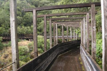
After about a quarter-mile from the underpass, there was a trail junction where the descending path on the right was signposted for the Jones Bar Road. Since we knew this was a flat trail, we kept going straight. At about 0.4 miles from the underpass, we reached a sheltered lookout for the South Yuba River Overook. Here, we were able to get an obstructed view towards part of the South Yuba River. Continuing beyond this mostly overgrown overlook, the trail then meandered for another 0.6 miles through more lush scenery with the odd bridge or shack, which were probably remnants from this place’s past life as a water channel for mining purposes. But at roughly a mile beyond the underpass (though I swore it took us an hour to get here suggesting it was longer than a mile), that was when things got real interesting.
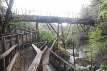
It turned out that the best part of this Flume 28 section was on a spur wooden path continuing further upstream along Rush Creek where we were able to get a view of the cascade you see pictured at the top of this page, while descending towards the banks of Rush Creek where we could look out through the taller sections of the flume and the brink of some of Rush Creek’s cascades further downstream. The part that I’m dubbing the Rush Creek Falls was best viewed from a sheltered lookout at the dead-end of the top end of this upstream extension of Flume 28, and it was probably on the order of 20-30ft tall with more smaller cascades both upstream and downstream from the main drop.
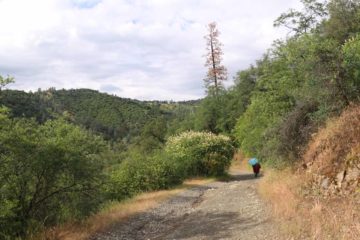
Back at the trailhead, we then made a brief out-and-back hike on the Independence Trail East to check out what Arch Rock was all about. Like the Independence Trail West, the East Trail also featured parallel sections of track. The scenery really made a turn for the dramatic at about a half-mile from the trailhead where we traversed a bridge that revealed rapids and cascades on the South Yuba River down below as well as the Hwy 49 and the canyon’s contours surrounding this scene. About 0.1-mile beyond this scenic stretch was when we finally reached the Arch Rock, whose span was big enough to allow us to walk through without ducking. We wound up spending about 35 minutes on the East Trail before regaining the car.
While it took my mother and I over 3 hours to hike the entire loop on the West Trail as well as the brief out-and-back East Trail to Arch Rock, we suspect that the trail to Rush Creek Falls could easily be done in less than 90 minutes. This longevity and time commitment was why we gave this trail a 2.5 in the difficulty rating even though it wasn’t that strenuous physically given how flat the trail was. Since my Mom and I did this hike just when a rain storm had stopped, the trail was indeed muddy and the wheelchair sections tended to have lots of puddles (which seemed to bring out these interesting little red lizards or salamanders or something). I’d imagine that wheelchair users would have to wait for the trail to be dry before it would be possible for them to go on this trail without getting stuck-in-the-mud so to speak.
And even if you’re not a wheelchair user, we recognized that this would also be a pretty family-friendly trail. Indeed, you can spend as little or as much time as you’d like on this most memorable of waterfall experiences to be had.
Related Top 10 Lists
No Posts Found
Trip Planning Resources
Nearby Accommodations
This content is for members only. See Membership Options.Featured Images and Nearby Attractions
This content is for members only. See Membership Options.Visitor Comments:
Got something you'd like to share or say to keep the conversation going? Feel free to leave a comment below...No users have replied to the content on this page
Visitor Reviews of this Waterfall:
If you have a waterfall story or write-up that you'd like to share, feel free to click the button below and fill out the form...No users have submitted a write-up/review of this waterfall

Only logged in users can post a comment Please login or sign up to comment